


Quick Research
Generate reliable direction feasibility study reports for your R&D in just a few steps.

Technical Q&A
Discover and master advanced knowledge NOW. Basics, ideas, possibilities, all at once.

Find Solutions
As an expert in R&D theories, this can generate solutions to your technical problems instantly.

Evaluate Feasibility
Analyze your overall solution with one click, know your potential R&D risks in advance.

Monitor Landscape
Get weekly tech updates, stay abreast of the latest tech innovations and key insights.
A method for automatic identification of potential landslides based on optical remote sensing considering insar deformation factor
An optical remote sensing, potential technology, applied in the direction of material analysis by optical means, scientific instruments, re-radiation of electromagnetic waves, etc., can solve the problems of strong subjectivity and low degree of automation
- Summary
- Abstract
- Description
- Claims
- Application Information
AI Technical Summary
Problems solved by technology
Method used
Image

Examples
Embodiment
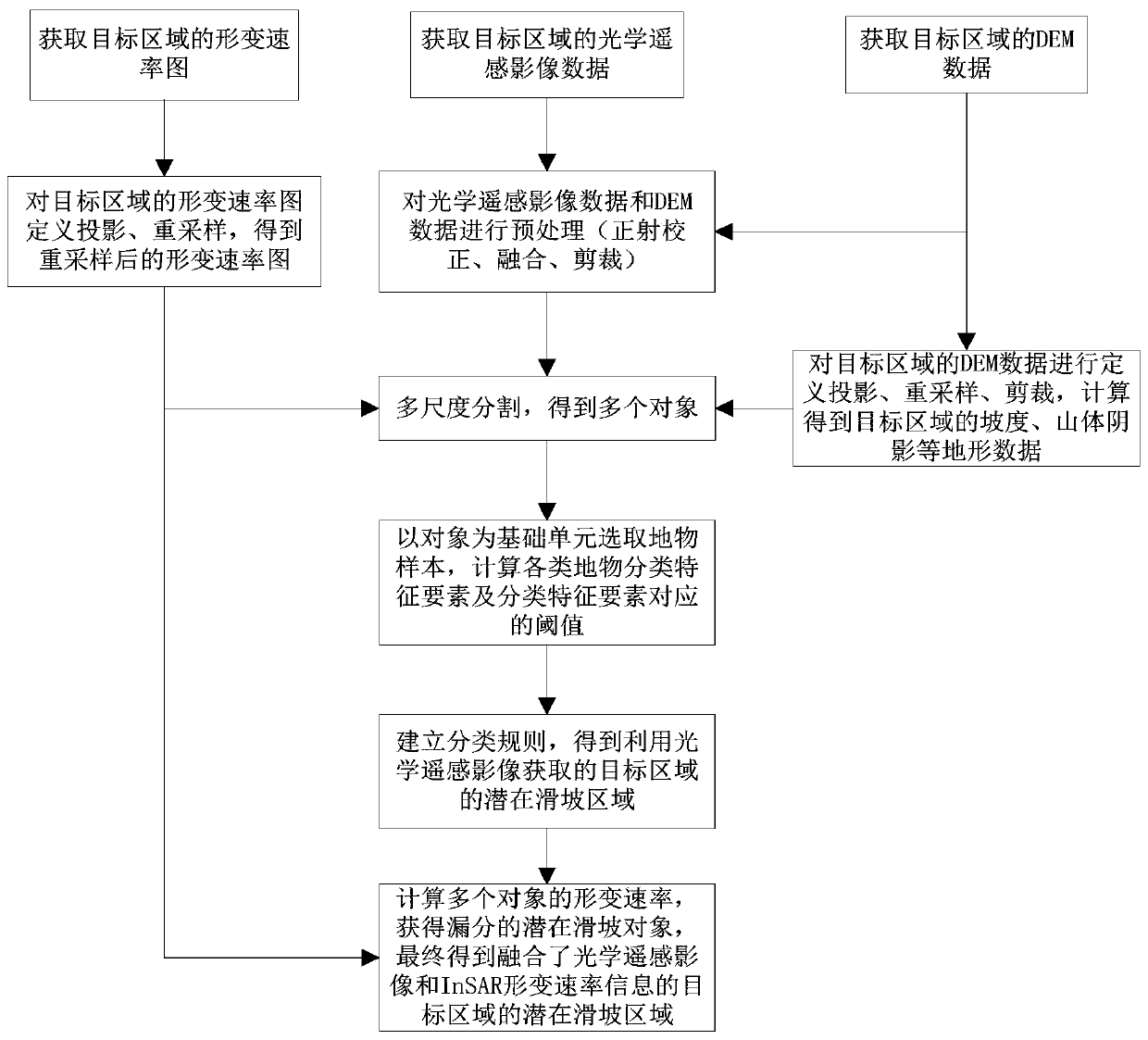
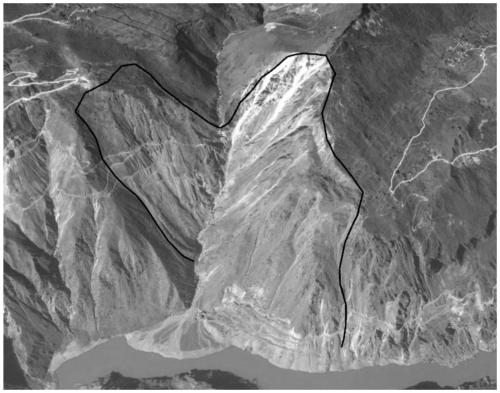
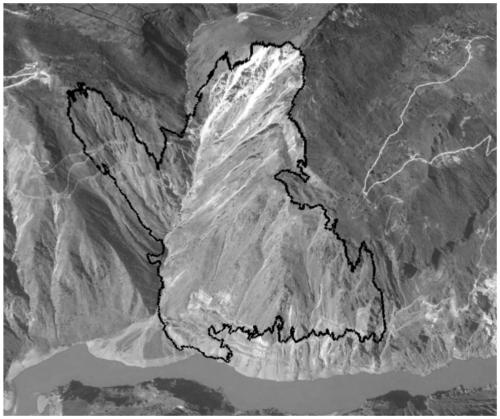
[0103] The present invention collects the ALOS / PALSAR orbit ascending data covering the Wudongde reservoir area in the Jinsha River Basin and the QuickBird-02 data covering the Shuanglongtan potential landslide area. Among them, there are 20 scenes of ALOS / PALSAR ascending orbit data obtained, and the image date range is from January 2007 to March 2011; the QuickBird-02 data obtained has 1 scene, including panchromatic data of 0.61m resolution and 2.44m High-resolution multispectral data, the acquisition date is November 15, 2009, the solar altitude angle is 43.6°, the solar azimuth angle is 162.7°, and the cloud coverage is 0.00%.
PUM
 Abstract
Description
Claims
Application Information
 - R&D Engineer
- R&D Manager
- IP Professional
- Industry Leading Data Capabilities
- Powerful AI technology
- Patent DNA Extraction
Browse by: Latest US Patents, China's latest patents, Technical Efficacy Thesaurus, Application Domain, Technology Topic, Popular Technical Reports.
© 2024 PatSnap. All rights reserved.Legal|Privacy policy|Modern Slavery Act Transparency Statement|Sitemap|About US| Contact US: help@patsnap.com