
A mobile robot navigation method based on two-dimensional code

A mobile robot and navigation method technology, applied in the field of mobile robot navigation, can solve problems such as time-consuming, and achieve the effects of strong environmental applicability, low cost, accurate and fast autonomous navigation

Active Publication Date: 2018-12-25
SHANTOU UNIV
View PDF8 Cites 1 Cited by
  • Summary
  • Abstract
  • Description
  • Claims
  • Application Information

AI Technical Summary

Problems solved by technology

It can solve the navigation problem of mobile robots in indoor and outdoor environments, and solve the time-consuming problem

Method used


Image

  • A mobile robot navigation method based on two-dimensional code
  • A mobile robot navigation method based on two-dimensional code
  • A mobile robot navigation method based on two-dimensional code

Examples


Embodiment Construction

[0025] In order to make the object, technical solution and advantages of the present invention clearer, the present invention will be further described in detail below in conjunction with the accompanying drawings.

[0026] The experimental environment of the embodiment of the present invention is the indoor environment of a laboratory hall and various small rooms. In an implementation, a mobile robot explores open areas of a laboratory.

[0027] Use TurtleBot mobile robot in the present embodiment, wheel encoder, laser range finder, Kinect sensor and airborne server are installed on described mobile robot, in the present embodiment, described laser range finder is Rplidar lidar, The scanning range of the Rplidar lidar is 360°, and the maximum measuring distance is 6 meters. Described airborne server is a notebook computer, adopts system to be Ubuntu system in described notebook computer, and builds ROS system platform, for realizing the embodiment of the present invention sm...


PUM


Abstract

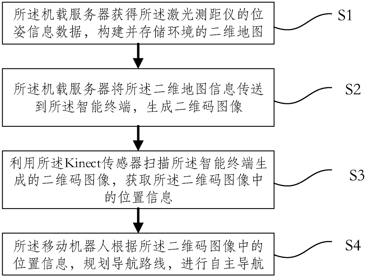
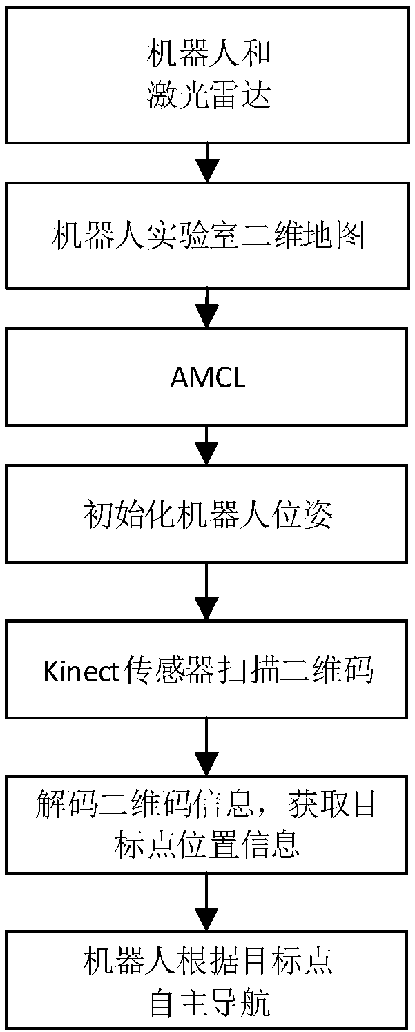
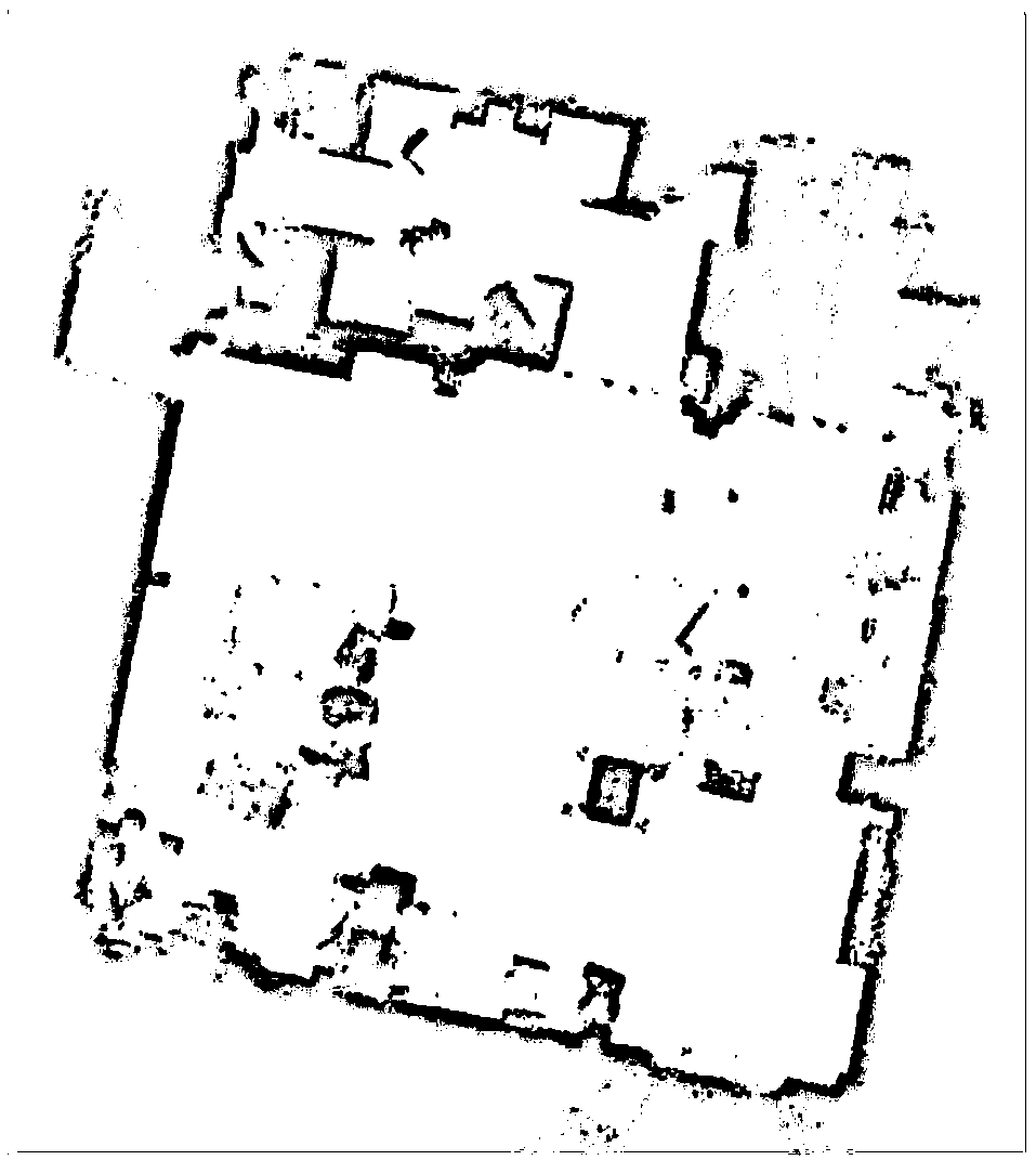
The invention provides a mobile robot navigation method based on a two-dimensional code. The method is implemented by a mobile robot equipped with a wheel encoder, a laser rangefinder, a Kinect sensor, an airborne server and an intelligent terminal capable of generating a two-dimensional code. The method comprises the following steps: the airborne server obtains position and posture information data of the laser rangefinder, and constructs and stores a two-dimensional map of the environment; the airborne server transmits the two-dimensional map information to the intelligent terminal to generate a two-dimensional code image; a two-dimensional code image generated by the intelligent terminal is scanned by the kinect sensor to obtain position information in the two-dimensional code image; the mobile robot plans a navigation route according to the position information in the two-dimensional code image and performs autonomous navigation. The invention can simplify and visualize the input mode of the autonomous navigation system, reduce the operation difficulty of the user, be more suitable for the user, and realize the two-dimensional code navigation quickly.

Description

technical field [0001] The invention relates to a mobile robot navigation method, in particular to a mobile robot navigation method based on a two-dimensional code. Background technique [0002] With the rapid development of computer technology, satellite positioning system and Internet technology, composition and positioning technology based on indoor and outdoor environments have been widely used in real life. At present, the problem of map construction and navigation in indoor and outdoor environments has become a hot field. Although the method of building two-dimensional map navigation based on lidar is relatively mature and complete, the method is cumbersome and requires multiple inputs and operations. The position of the target point, and more sensors may be needed for fusion, so the method based on the two-dimensional code navigation under the two-dimensional map has also become popular. [0003] At present, two-dimensional code navigation is popular in indoor and ou...

Claims


Application Information

Patent Timeline
IPC IPC(8): G06K17/00G06Q10/04
CPCG06K17/0025G06Q10/047
Inventor 范衠李冲朱贵杰姚利卞新超邱本章陈文钊游煜根胡星晨
Owner SHANTOU UNIV
Learn More