Track calculation method and system based on cloud side

A calculation method and trajectory technology, applied in the field of system, cloud-based trajectory calculation method, can solve problems such as large deviation, failure of recording function, large power consumption, etc., to save power consumption, accurate movement trajectory, and reduce positioning deviation. Effect

Inactive Publication Date: 2018-05-01
SHENZHEN YUEDONG TIANXIA TECH CO LTD
View PDF8 Cites 5 Cited by
  • Summary
  • Abstract
  • Description
  • Claims
  • Application Information

AI Technical Summary

Problems solved by technology

[0004] 1) The existing GPS track map positioning is prone to large deviations, drift, and step counting. In daily life, track maps are widely used, such as driving tracks, walking tracks, running tracks, etc., which are all based on GPS by satellite positioning
However, due to factors such as bad weather, high-rise buildings, mobile phone models, etc., GPS satellite positioning will inevitably be interfered to varying degrees by the outside world, which will eventually lead to large positioning deviation, drift, and no step counting on the GPS trajectory map.
[0005] 2) The existing GPS track map positioning consumes a lot of power. When the GPS is in a continuous working state, the power will be lost very quickly. This is because the device is constantly receiving and transmitting data, and this process consumes a lot of power.
Especially when the battery of the mobile phone is low, the recording function of the GPS track map positioning will be invalid

Method used


Image

  • Track calculation method and system based on cloud side
  • Track calculation method and system based on cloud side
  • Track calculation method and system based on cloud side

Examples


Embodiment Construction

[0036] The principles of the disclosure will now be described with reference to some example embodiments. It can be understood that these embodiments are described only for the purpose of illustrating and helping those skilled in the art to understand and implement the present disclosure, rather than suggesting any limitation to the scope of the present disclosure. The disclosure described herein may be implemented in various ways other than those described below.

[0037] As used herein, the term "comprising" and its variations may be understood as open-ended terms meaning "including but not limited to". The term "based on" may be understood as "based at least in part on". The term "one embodiment" can be read as "at least one embodiment". The term "another embodiment" may be understood as "at least one other embodiment".

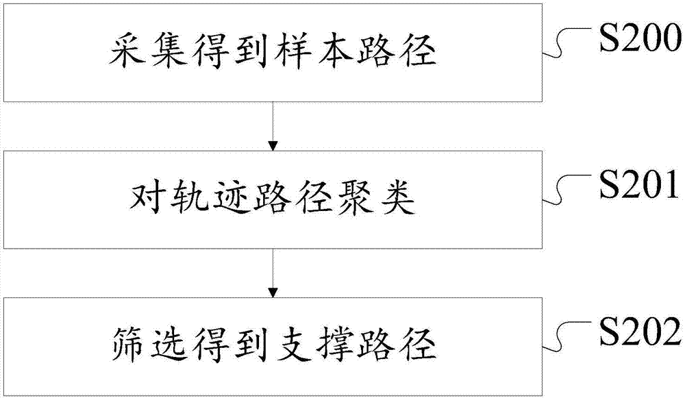
[0038] In a group of paths, when the access frequency (Em,n.f) of Em,n is greater than a given threshold α, it is called a frequent directed edge (FDE)...


PUM


Abstract

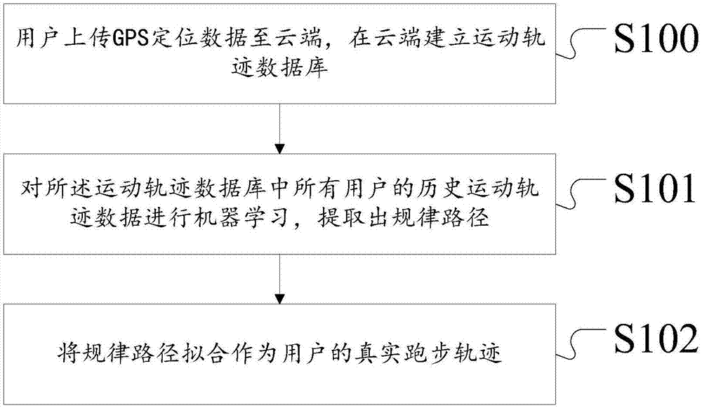
The invention discloses a track calculation method and system based on a cloud side, and the method comprises the steps: enabling a user to upload GPS positioning data to the cloud side, building a movement track database at the cloud side, carrying out the machine learning of the historical movement rack data of all users in the movement track database, extracting a regular path, and carrying outthe fitting of the regular path as a real running track of the user. The method achieves the fitting of a prediction path through the analysis via a big data algorithm, cannot be limited by the space, region and time, and greatly reduces the problems of track map positioning deviation, drift and no step-down operation to maximum degree. In addition, the method also can greatly save the electricity consumption of positioning.

Description

technical field [0001] The present invention relates to the field of computer software and cloud computing, and in particular to a cloud-based trajectory calculation method and system. Background technique [0002] GPS track is a series of location points of outdoor activities collected by GPS track recorder. Each point includes at least date, time, longitude, latitude, altitude information, and some track recorders also include speed and other information. With the GPS trajectory coupled with the communication part, the trajectory of the moving body can be transmitted to the network in real time for relevant users to share at the first time. In this regard, smart phones with GPS chips will be the main carrier. Most mobile phone software can record, upload and share tracks in multiple ways. [0003] Most of the current motion trajectory calculation methods use GPS trajectory map positioning, which mainly has the following defects: [0004] 1) The existing GPS track map pos...

Claims


Application Information

Patent Timeline
IPC IPC(8): G01S19/50G06F17/30
CPCG01S19/50G06F16/2465Y02D10/00
Inventor 胡茂伟
Owner SHENZHEN YUEDONG TIANXIA TECH CO LTD
Why Eureka
Try Eureka