Unmanned plane-based large-scale parabolic antenna surface precision test system
A technology of parabolic antenna and surface accuracy, which is applied in antenna radiation pattern, external dimension measurement, etc., can solve problems such as light pollution, and achieve the effect of improving the quality of observation data
- Summary
- Abstract
- Description
- Claims
- Application Information
AI Technical Summary
Problems solved by technology
Method used
Image
Examples
Embodiment Construction
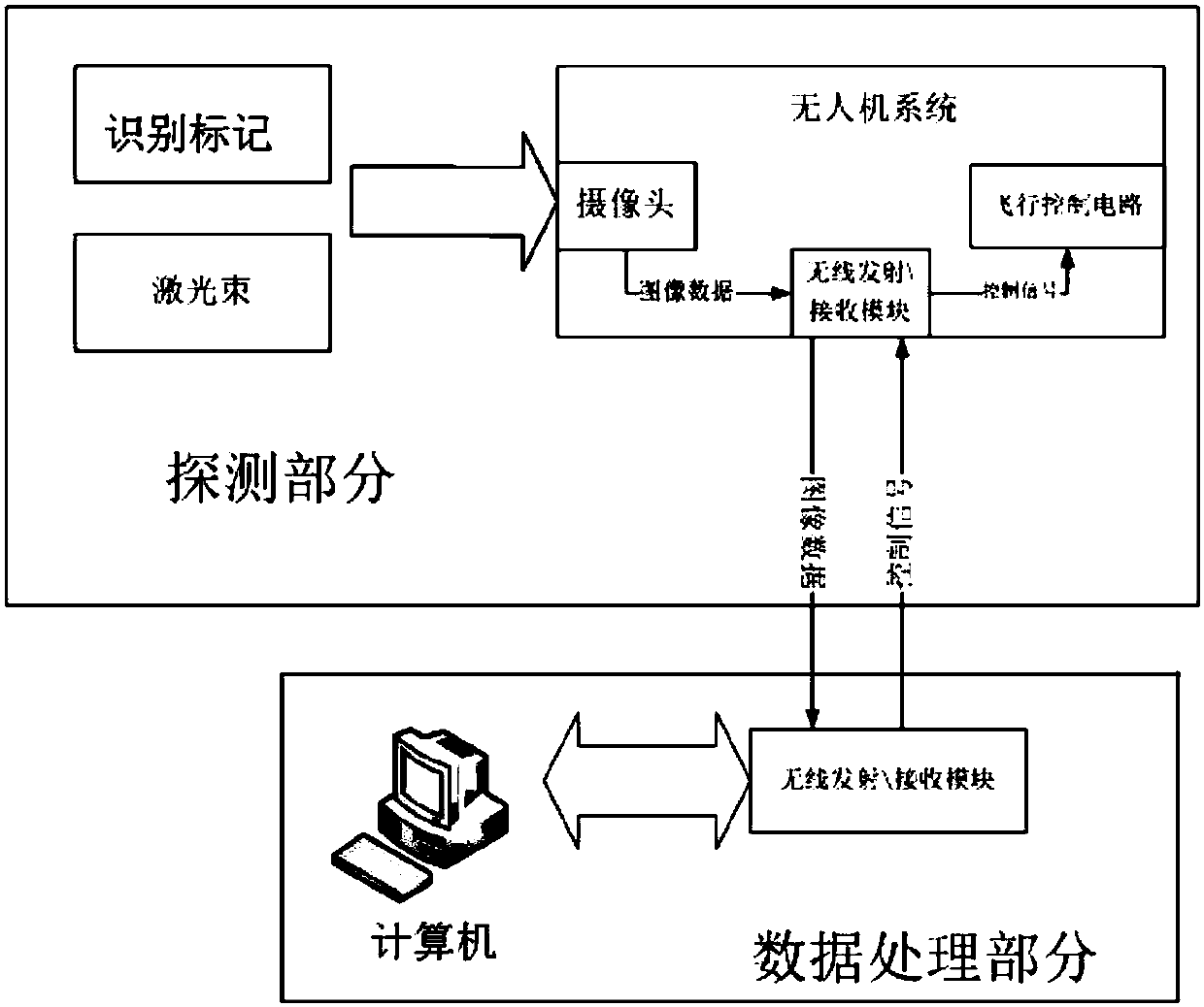
[0052] Such as Figure 1-5 As shown, the UAV-based large-scale parabolic antenna surface accuracy test system consists of two parts: the detection part and the data processing part, which are connected in sequence:
[0053] The detection part consists of a multi-axis drone equipped with a camera, identification marks pasted on the surface of the antenna, a laser calibration reference subsystem, and a signal receiving and transmitting module I;
[0054] A. The multi-axis drone aircraft and its equipped camera constitute the shooting subsystem. The multi-axis aircraft is a six-axis aircraft, and then the camera is hung. The camera integrates a memory card to back up and store the captured pictures;
[0055] At the same time, the UAV carries the signal receiving and transmitting module Ⅰ, which is connected to the camera and the flight control circuit of the UAV. This module uses wireless frequencies such as wifi, 3G or 4G to transmit and receive; it is used to modulate the image...
PUM
 Abstract
Description
Claims
Application Information
 - R&D
- Intellectual Property
- Life Sciences
- Materials
- Tech Scout
- Unparalleled Data Quality
- Higher Quality Content
- 60% Fewer Hallucinations
Browse by: Latest US Patents, China's latest patents, Technical Efficacy Thesaurus, Application Domain, Technology Topic, Popular Technical Reports.
© 2025 PatSnap. All rights reserved.Legal|Privacy policy|Modern Slavery Act Transparency Statement|Sitemap|About US| Contact US: help@patsnap.com


