
Method and system for transforming geodetic coordinates into independent plane coordinates in railway survey

A technology of geodetic coordinates and plane coordinates, applied in radio wave measurement systems, satellite radio beacon positioning systems, measurement devices, etc., can solve problems such as increasing complexity, achieve the effect of reducing complexity and ensuring absolute accuracy

Active Publication Date: 2019-08-20
WUHAN UNIV
View PDF3 Cites 2 Cited by
  • Summary
  • Abstract
  • Description
  • Claims
  • Application Information

AI Technical Summary

Problems solved by technology

On the other hand, even if the above six types of parameters are known, such as the scheme described in the invention patent with the notification number CN103343498A, the GNSS base station must be erected on known CPII points for long-term static surveying and mapping to obtain high-precision positioning result; this undoubtedly increases the complexity of the actual operation of the program

Method used


Image

  • Method and system for transforming geodetic coordinates into independent plane coordinates in railway survey
  • Method and system for transforming geodetic coordinates into independent plane coordinates in railway survey
  • Method and system for transforming geodetic coordinates into independent plane coordinates in railway survey

Examples


Embodiment Construction

[0045] The present invention will be further described below in conjunction with the accompanying drawings and specific embodiments. The embodiment is described by taking the measurement data of the INS / GNSS track inspection trolley described in the Chinese patent with the notification number CN103343498A as an example.

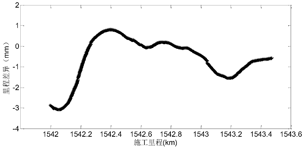
[0046] In this specific embodiment, the data comes from the long-track fine-tuning data collected by the INS / GNSS track inspection trolley described in the Chinese patent with the announcement number CN103343498A during the construction of the Lanzhou-Xinjiang high-speed railway, and the mileage range is SDK1541+996~SDK1543+500 .

[0047] In this specific embodiment, the GNSS is erected on the known CPII control points, and the following six types of parameters are accurately known: 1) the ellipsoid and basic parameters of the survey area; 2) the longitude value of the central meridian of the survey area; 3) the average elevation of the survey area is abnormal ...


PUM


Abstract

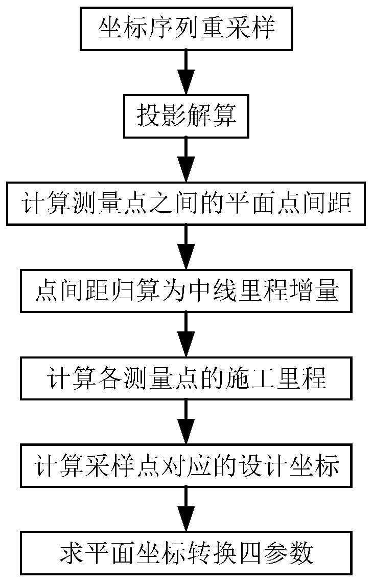
The invention discloses a method and system for converting geodetic coordinates into independent horizontal coordinates in railway measurement, and the method comprises the steps: S1, resampling is performed on geodetic coordinate series; S2, expansion ellipsoid Guass projection transformation is performed on geodetic coordinate series of a measurement point, and projection plane coordinate series of the measurement point are obtained; S3, distance of a line joining each adjacent two measurement points on a projection plane is obtained; S4, mileage increment of two adjacent measurement points is reduced; S5, rail construction mileage of each measurement point is calculated; S6, graphic design coordinate series of the measurement point under an independent engineering coordinate system are calculated; S7, according to the projection plane coordinate series and the graphic design coordinate series, and parameters of projection plane coordinates converting into the independent engineering coordinate system are calculated. According to the invention, a few priori knowledge is needed in the method, the geodetic coordinates outputted by GNSS / INS navigation system can be precisely converted into the horizontal coordinates under the independent engineering coordinate system, and the complexity of coordinate transformation is greatly reduced.

Description

technical field [0001] The invention relates to the technical field of railway track precision measurement, in particular to a method and system for converting geodetic coordinates into independent plane coordinates in railway measurement. Background technique [0002] Global Navigation Satellite System (GNSS) technology and its integrated navigation technology (GNSS / INS) with Inertial Navigation System (INS) are being more and more widely used in the field of railway surveying and mapping. Using GNSS or GNSS / INS integrated navigation system for orbit measurement, the directly obtained position coordinates are often geodetic coordinates or spatial rectangular coordinates under the earth-centered ground-fixed coordinate system, and the positions of ground points in the geodetic coordinates are represented by longitude, latitude and elevation . In the process of track construction and maintenance, the construction coordinate system or independent engineering coordinate system...

Claims


Application Information

Patent Timeline
Patent Type & Authority Patents(China)
IPC IPC(8): G01S19/42G01S19/49G01C21/16
Inventor 陈起金周禹昆李姗姗牛小骥陈小文刘经南
Owner WUHAN UNIV
Learn More