
An autonomous orbit determination method for Earth-lagrange joint constellation based on inter-satellite ranging

A technology for autonomous orbit determination and inter-satellite ranging, which is applied in integrated navigators, astronomical navigation, etc., can solve the problems of difficulty in obtaining noise statistical characteristics, filter divergence, and inappropriate real-time orbit determination, so as to improve the accuracy of long-term autonomous orbit determination. , Improve the accuracy and stability, and improve the effect of autonomous orbit determination

Active Publication Date: 2020-08-28
BEIHANG UNIV
View PDF6 Cites 0 Cited by
  • Summary
  • Abstract
  • Description
  • Claims
  • Application Information

AI Technical Summary

Problems solved by technology

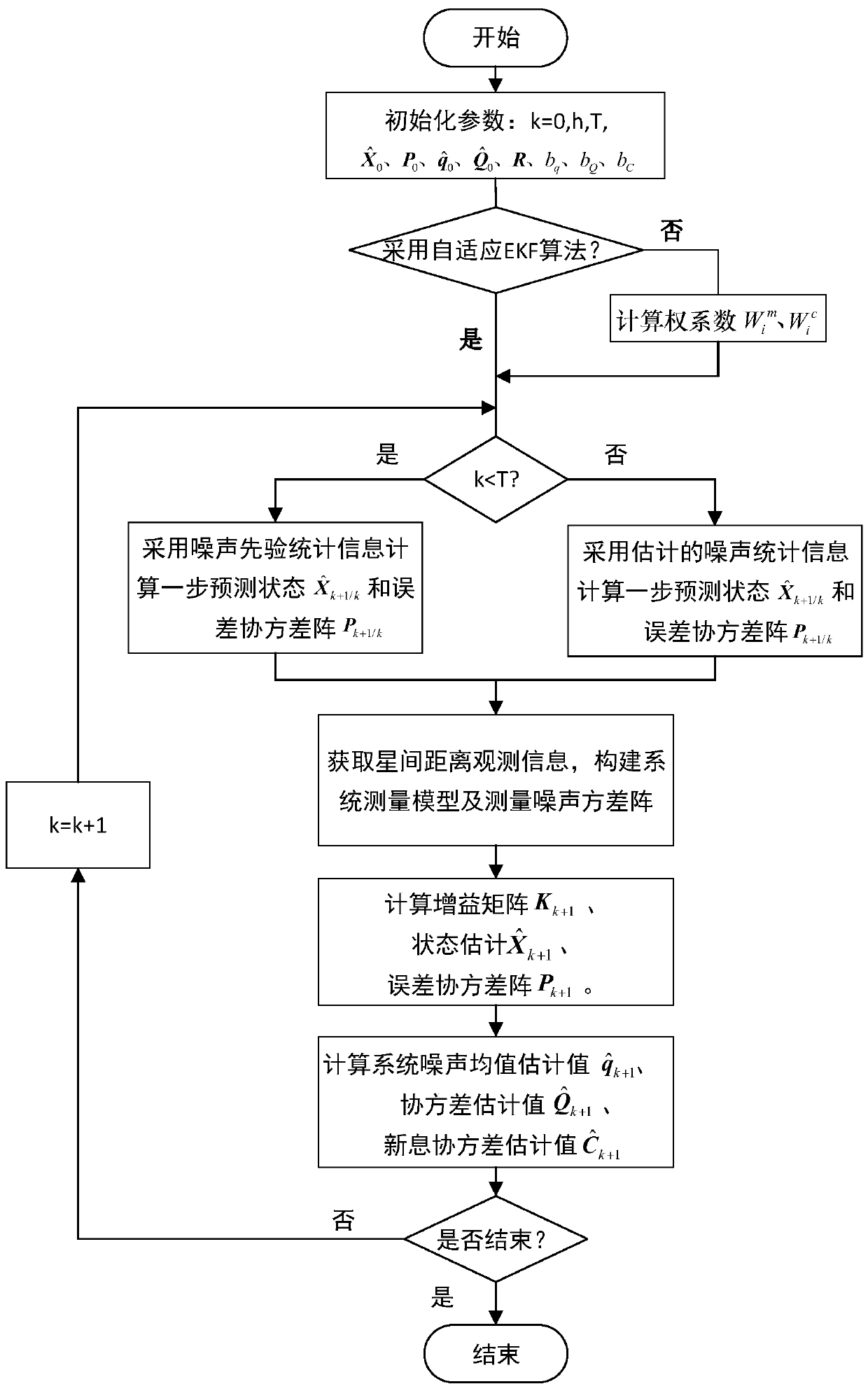
However, batch processing algorithms are often used for post-processing and are not suitable for real-time orbit determination; although the conventional EKF and UKF algorithms adopt a recursive form that is convenient for real-time calculation, they often require the prior information of system noise and measurement noise to be known. Otherwise, it will cause system performance degradation or even filter divergence
Due to the complexity of the actual stress on satellites in orbit, especially Lagrange satellites, it is difficult to obtain more accurate noise statistical characteristics, and irregular modeling errors caused by satellite orbit maintenance maneuvers will also cause changes in statistical characteristics, making the priori The information loses its meaning, so it is of great significance to study the autonomous navigation algorithm that can be adaptively adjusted according to the measurement information sequence to improve the robustness of the autonomous orbit determination system and ensure the accuracy of the autonomous orbit determination

Method used


Image

  • An autonomous orbit determination method for Earth-lagrange joint constellation based on inter-satellite ranging
  • An autonomous orbit determination method for Earth-lagrange joint constellation based on inter-satellite ranging
  • An autonomous orbit determination method for Earth-lagrange joint constellation based on inter-satellite ranging

Examples


Embodiment

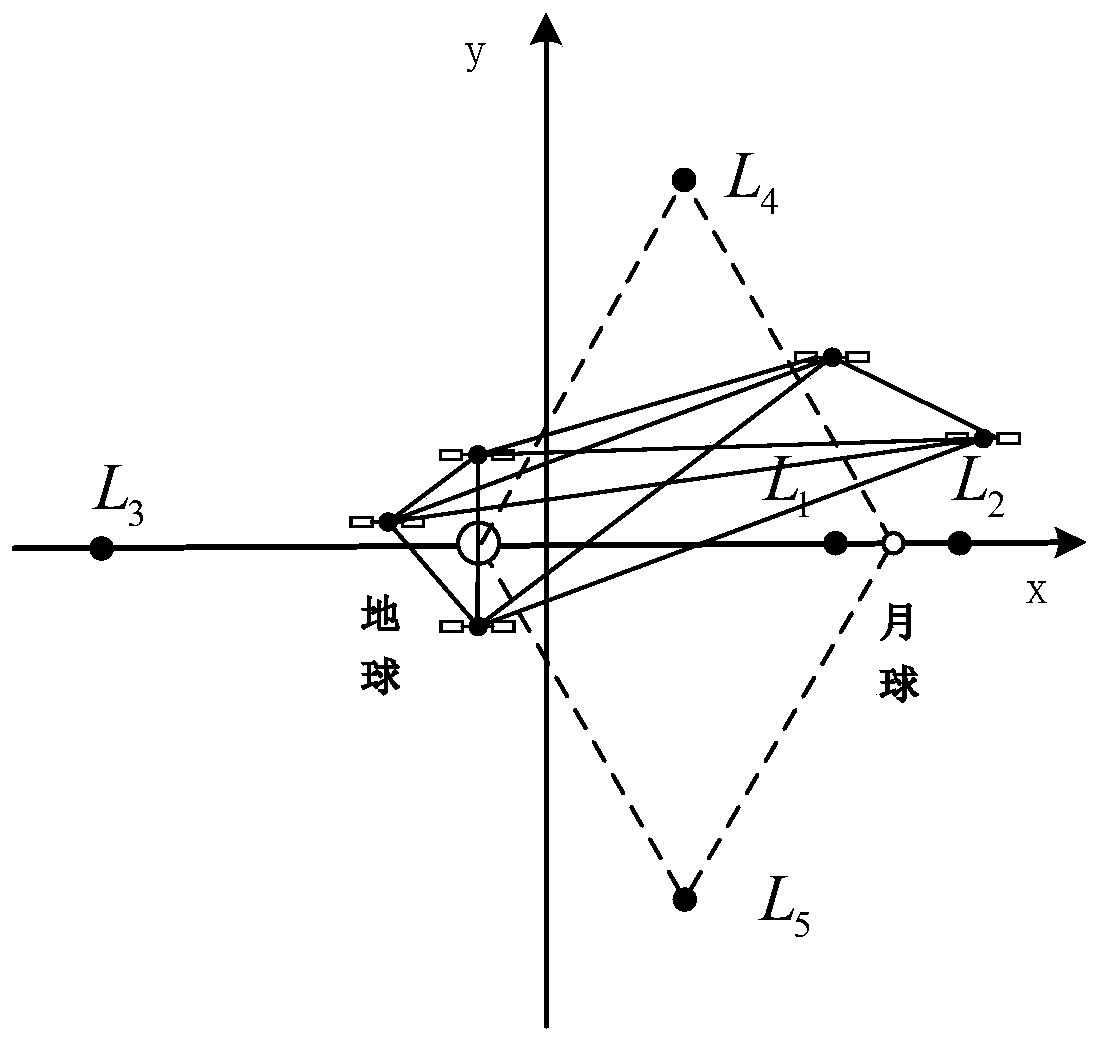
[0185] Taking an Earth-Lagrange constellation as an example, the constellation consists of 3 MEO satellites and 2 Lagrange satellites. The MEO satellite number is E 1 ~E 3 ; Lagrange satellite number is L 1 ~ L 2 . In the simulation, it is found that the orbit determination accuracy of each satellite in the MEO constellation is similar, and the orbit determination accuracy of each satellite in the Lagrange constellation is also similar, so only the number E is used in this paper. 1 The MEO satellite and numbered L 1 The Lagrange satellite is used as an example for illustration.

[0186] Simulation conditions:

[0187] STK is used to simulate the actual operation of the constellation, and the nominal orbit data during the operation of the constellation is generated.

[0188] (1) Nominal data generation parameter setting

[0189]The simulation time is from 12:00:00 on January 1, 2016 to 12:00:00 on June 28, 2016, with a duration of 180d and a step size of T=1s. The orbi...


PUM


Abstract

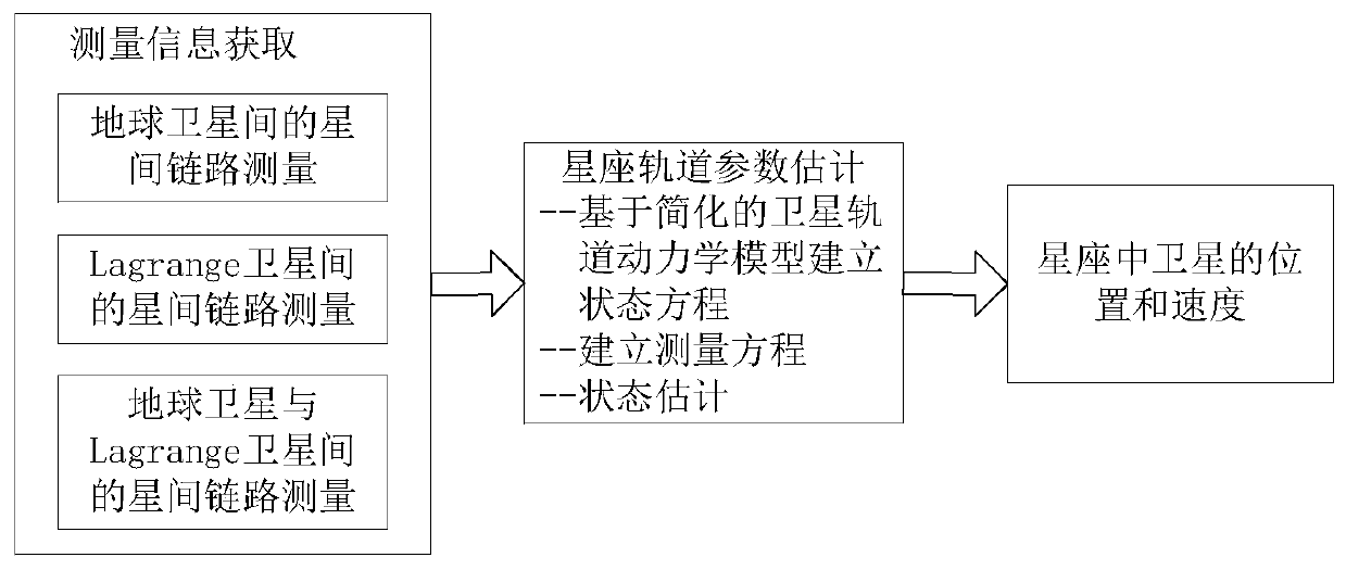
The invention discloses an earth-Lagrange combined constellation autonomous orbit determination method based on inter-satellite ranging. The method includes following steps: step 1, establishing a state equation of an earth-Lagrange combined constellation autonomous orbit determination system; step 2, establishing a measurement equation of the earth-Lagrange combined constellation autonomous orbit determination system; step 3, determining a filtering method for realizing orbit parameter estimation; step 4, specifically realizing the earth-Lagrange combined constellation autonomous orbit determination method based on a selected filtering algorithm. By introducing a Lagrange satellite, the problem of deficient range when only inter-satellite ranging information is utilized for autonomous orbit determination is solved effectively, and complexity of system equipment is lowered; statistical characteristics of system noise are estimated online in real time through a self-adaptive nonlinear filtering algorithm, so that requirements on noise prior information are low, stability of the autonomous orbit determination filtering algorithm is improved, and autonomous orbit determination accuracy is improved.

Description

technical field [0001] The invention belongs to the field of autonomous orbit determination of earth satellite constellations. Specifically, it is a method for realizing autonomous orbit determination of earth satellite constellations based on adaptive filtering by using only the inter-satellite ranging information in the Earth-Lagrange joint constellation. track method. Background technique [0002] In recent decades, satellite navigation has played an increasingly important role in the fields of national economy and military struggle. Improving the autonomous operation capability of satellites is crucial to reducing the burden of ground measurement and control, reducing satellite operating costs, improving satellite survivability and expanding the application of spacecraft. Potential and so on are of great significance. The satellite's autonomous orbit determination technology is the premise of realizing the satellite's autonomous control and plays a vital role in ensurin...

Claims


Application Information

Patent Timeline
Patent Type & Authority Patents(China)
IPC IPC(8): G01C21/24G01C21/02
CPCG01C21/02G01C21/24
Inventor 杨静卢帅
Owner BEIHANG UNIV
Learn More