
Cross-sea elevation measuring method and system

An elevation measurement and cross-sea technology, applied in the field of cross-sea elevation measurement, can solve problems such as large jumping range of measurement data, influence of unstable measurement, failure to meet specification requirements, etc., and achieve the effect of improving measurement efficiency and reducing time spent

Active Publication Date: 2017-06-13
CCCC FIRST HARBOR ENG +1
View PDF4 Cites 3 Cited by
  • Summary
  • Abstract
  • Description
  • Claims
  • Application Information

AI Technical Summary

Problems solved by technology

[0003] The purpose of the present invention is to overcome the influence of the instability of the offshore measurement platform on the cross-sea elevation measurement, resulting in large jumps in the measurement data, which cannot meet the requirements of the specifications, and the problem of low efficiency of manually pressing the instrument measurement key to record or manual recording

Method used


Image

  • Cross-sea elevation measuring method and system
  • Cross-sea elevation measuring method and system

Examples


Embodiment Construction

[0028] The present invention will be further described in detail below in conjunction with specific embodiments. However, it should not be understood that the scope of the above-mentioned subject of the present invention is limited to the following embodiments, and all technologies implemented based on the content of the present invention belong to the scope of the present invention.

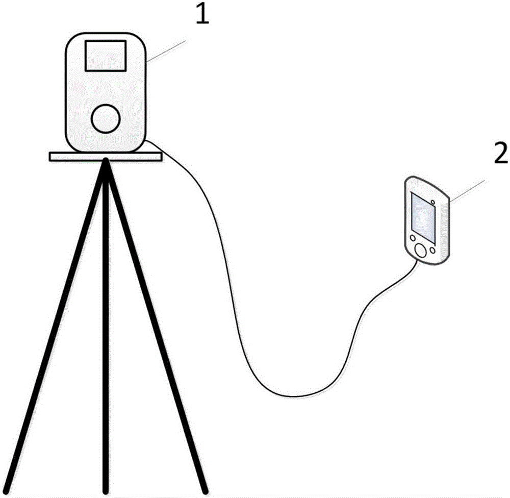
[0029] Such as figure 1 The schematic diagram of the connection between the total station and the electronic handbook in the present invention is shown; among them, the total station 1 is set on the measurement site and is connected to the electronic handbook 2 through a data connection line. During the cross-sea elevation measurement process, the total station 1 performs angle measurement according to the measurement parameters set by the electronic handbook 2, and the electronic handbook 2 receives the measurement results of the total station 1 and analyzes the measurement results.

[0030] Such as...


PUM


Abstract

The invention discloses a cross-sea elevation measuring method and system, wherein the method comprises: analyzing the measurement result of each measurement, judging whether it meets the measurement requirements or not, adding measurements, screening to obtain more accurate measurement results during measuring, repeating the steps aforementioned such that all final measurement results meet the measurement requirements. Therefore, the impact of the instability of an offshore measuring platform upon cross-sea elevation measurement can be overcome, time for cross-sea elevation measurement is shortened, and measurement efficiency is improved greatly.

Description

Technical field [0001] The invention relates to the technical field of cross-sea elevation measurement, in particular to a cross-sea elevation measurement method and system. Background technique [0002] The cross-river leveling method specified in "National First and Second Class Leveling Specifications" (GBT12897-2006) is only applicable to cross-sea elevation measurement where the stations at both ends of the cross-sea route are on stable structures. The vertical angle change value of the total station installed on a stable ground or other stable structure is less than 1 second, but in the cross-sea elevation transfer measurement, one or both ends of the cross-sea route are located on the unstable structure such as the sea measurement platform or bridge pier Above, due to the action and influence of ocean tides, waves and wind, these sea measurement platforms or bridge piers are in continuous slight shaking, which makes the total station installed on unstable structures in the...

Claims


Application Information

Patent Timeline
Patent Type & Authority Applications(China)
IPC IPC(8): G01C5/00
CPCG01C5/00
Inventor 宋江伟成益品曾旭平季浩华张秀振刘兆权孙阳阳陶振杰张超徐良
Owner CCCC FIRST HARBOR ENG
Learn More