
Region Adaptive Cultivated Land Extraction Method Based on High Resolution Image

A high-resolution, extraction method technology, applied in the field of remote sensing applications, can solve the problems of lack of universality and promotion, data source phase and quantity limitations, and low degree of automation, so as to facilitate promotion, reduce restriction requirements, The effect of increasing the degree of automation

Active Publication Date: 2019-07-09
TWENTY FIRST CENTURY AEROSPACE TECH CO LTD
View PDF5 Cites 0 Cited by
  • Summary
  • Abstract
  • Description
  • Claims
  • Application Information

AI Technical Summary

Problems solved by technology

[0004] 1) The general cultivated land extraction method is based on the growth characteristics of crops, using multi-phase images that match the growth cycle for analysis and research. This method is limited by the time phase and quantity of data sources in terms of promotion;
[0005] 2) The object-oriented cultivated land extraction method is widely used, but its application area is small, the classification process is complicated, the degree of automation is low, and it is not universal and popular

Method used


Image

  • Region Adaptive Cultivated Land Extraction Method Based on High Resolution Image
  • Region Adaptive Cultivated Land Extraction Method Based on High Resolution Image
  • Region Adaptive Cultivated Land Extraction Method Based on High Resolution Image

Examples


Embodiment 1

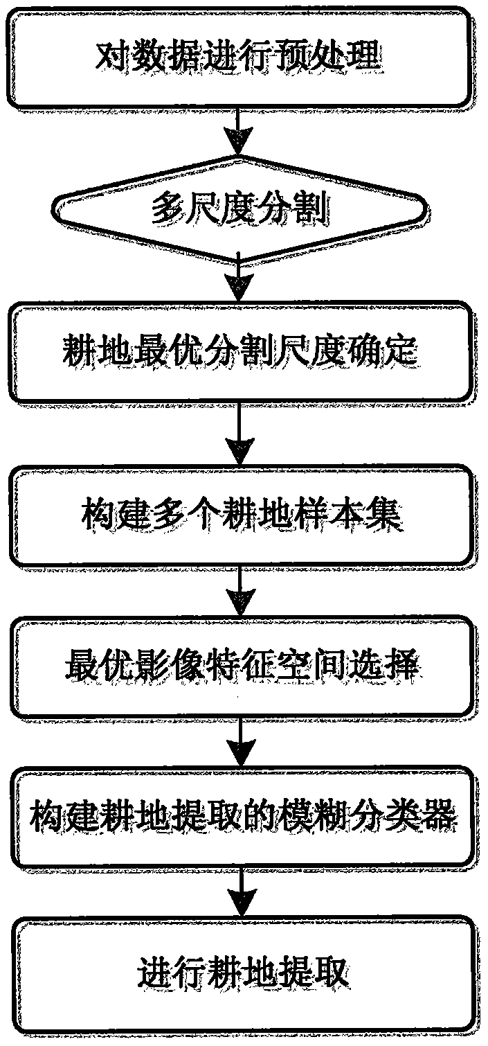
[0061] A region-adaptive cultivated land extraction method based on high-resolution images, such as figure 1 shown, including:

[0062] S1, preprocessing the data

[0063] The high-resolution images are selected as multiple SPOT6 multispectral and panchromatic remote sensing images in Hebei Province, the main time phase is October, and the multispectral images (including four bands of blue, green, red and near-red) have a spatial resolution of 6m. The spatial resolution of the panchromatic remote sensing image is 1.5m. The high-resolution image has undergone radiation, geometric correction and image fusion. If it is a single high-resolution image, image fusion is not required.

[0064] At the same time, the 30mDEM (Digital Elevation Model) of the research area is selected for auxiliary classification, and the digital elevation model is subjected to slope generation, projection transformation and cropping processing (not necessary processing) to ensure that its projection and ...


PUM


Abstract

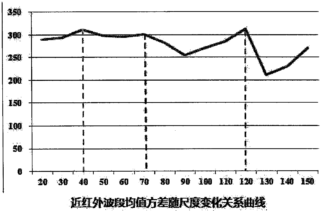
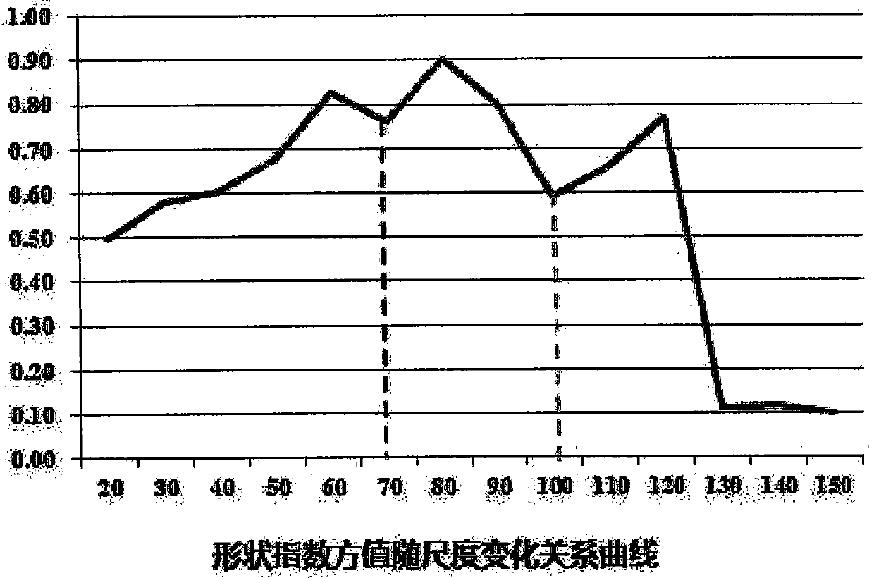
The invention belongs to the technical field of remote sensing applications, and relates to a region-adaptive cultivated land extraction method based on high-resolution images, including: preprocessing data; performing multi-scale segmentation on high-resolution images, and determining the optimal segmentation scale of cultivated land , to obtain the optimal segmentation layer of cultivated land classification; construct multiple cultivated land sample sets in the optimal segmentation layer to form the attribute feature space of each cultivated land sample set; select the optimal image feature space; construct the cultivated land according to the optimal image feature space The extracted fuzzy classifier; based on the cultivated land sample set and the fuzzy classifier, the cultivated land is extracted. The invention realizes the automatic recognition of the cultivated land object through the combination of the cultivated land sample set and the fuzzy classifier. By selecting the optimal segmentation scale and the attribute feature space of different farmland sample sets, the homogeneity of the segmentation objects of high-resolution images and the extraction accuracy of the fuzzy classifier are improved; Requirements for phase and quantity restrictions.

Description

technical field [0001] The invention belongs to the technical field of remote sensing applications, and in particular relates to a region-adaptive cultivated land extraction method based on high-resolution images. Background technique [0002] The rapid and accurate extraction of cultivated land information is of great significance to the dynamic monitoring of cultivated land, the investigation and evaluation of cultivated land fertility, the protection of cultivated land and the delineation of basic farmland, the analysis of the utilization degree of land resources, and precision agriculture. [0003] High-resolution images enhance the internal differences of cultivated land, making the spectral representation of cultivated land coverage more diverse, and increasing the difficulty of accurately extracting cultivated land. At present, there are many methods for extracting cultivated land from high-resolution images, which have the following problems: [0004] 1) The general...

Claims


Application Information

Patent Timeline
Patent Type & Authority Patents(China)
IPC IPC(8): G06K9/62G06T7/10
CPCG06F18/24
Inventor 文强丁媛李丽纪中奎周会珍沙漠泉周淑芳张强任昊冬
Owner TWENTY FIRST CENTURY AEROSPACE TECH CO LTD
Learn More