
Cooperative location sensor device and system for low-complexity geolocation

A sensor device and sensor technology, applied in satellite radio beacon positioning systems, radio wave measurement systems, instruments, etc., can solve problems such as spending a lot of time, unavailable position sensors, and power consumption

Active Publication Date: 2020-04-24
TEXAS INSTR INC
View PDF5 Cites 0 Cited by
  • Summary
  • Abstract
  • Description
  • Claims
  • Application Information

AI Technical Summary

Problems solved by technology

The initial operations to acquire satellites and decode ephemeris information take a significant amount of time and consume power from the microprocessor and receiver circuitry used to operate the position sensor
Also, in some applications, the amount of power required to start tracking from cold crank conditions is not available to the position sensor

Method used


Image

  • Cooperative location sensor device and system for low-complexity geolocation
  • Cooperative location sensor device and system for low-complexity geolocation
  • Cooperative location sensor device and system for low-complexity geolocation

Examples


Embodiment Construction

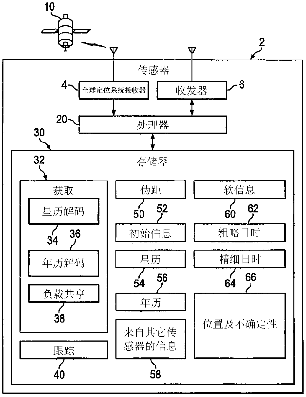
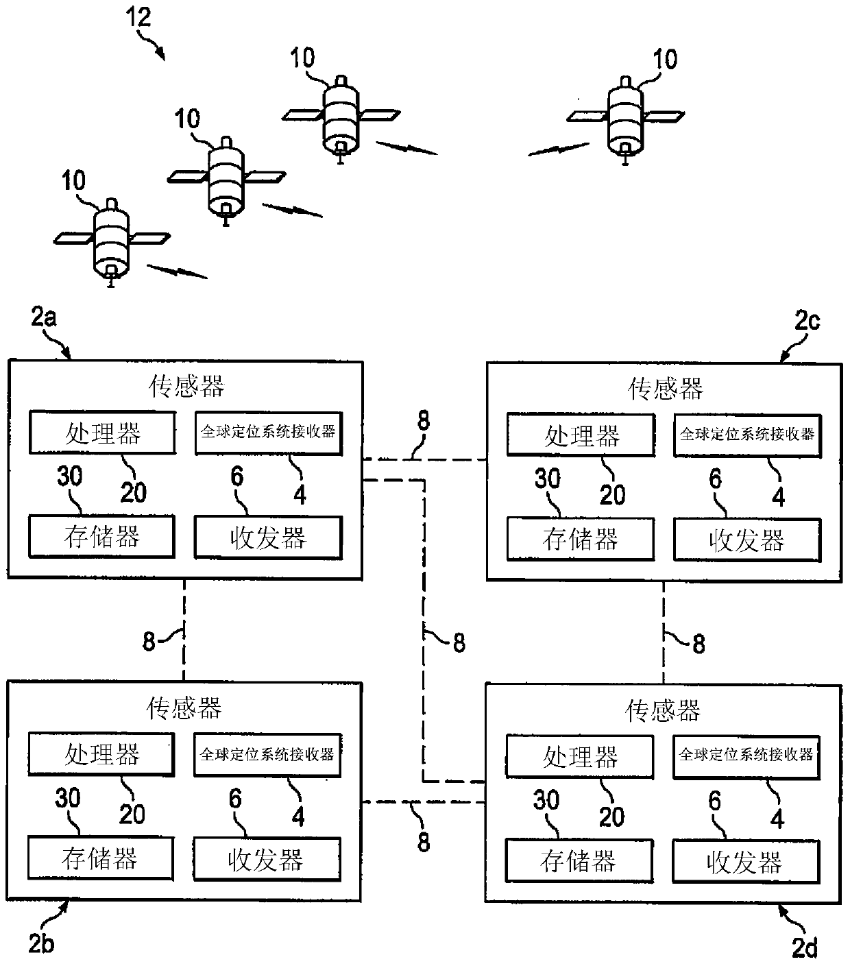
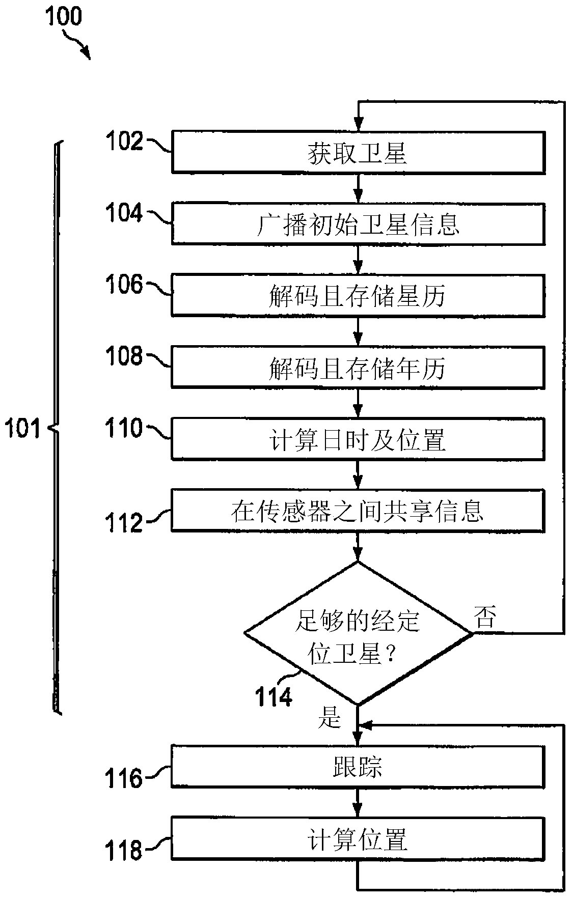
[0028] One or more embodiments or implementations are described below with reference to the drawings, wherein like reference numbers are used to refer to like elements throughout, and the various features are not necessarily drawn to scale. The present invention provides a position sensor device for use in a satellite-based navigation system that uses cooperation between multiple sensors for satellite acquisition and tracking. The various concepts of the present invention can be advantageously used in the deployment, use and maintenance of remote satellite-based navigation systems that must accurately track their position and report information in a power-reduced mode while facilitating a short time-to-first-fix, but the disclosed apparatus and The techniques have utility in other usage scenarios and are not limited to the applications mentioned above.

[0029] first reference figure 1 , 2 and 6, figure 1 an exemplary navigation or position sensor device 2 is illustrated, a...


PUM


Abstract

The present application relates to cooperative position sensor devices and systems for low-complexity geolocation. The invention presents a position sensor device (2) and a sensor system (12), wherein individual position sensors (2) store and wirelessly exchange orbit information, soft demodulation information, position and time of day information, and the sensors share Decoding and computing tasks pertain to acquiring and tracking navigation satellites (10) to save power and facilitate determination of sensor positions by triangulation.

Description

technical field [0001] The present invention generally relates to satellite-based navigation or position sensors for determining a current position through positioning and tracking of orbiting satellites. Background technique [0002] Satellite positioning receivers (SPRs) or position sensors are widely used in various applications such as portable or vehicle-based navigation systems, aircraft navigation systems, and more. Various satellite-based positioning systems exist, such as the Global Positioning System (GPS), in which position sensors determine the current geographic position by tracking and receiving signals from multiple orbiting satellites, using positioning algorithms to determine the current position or location and current time information. For example, in the GPS system, a group of orbiting satellites each broadcast navigation messages in the same frequency band using a different spreading sequence encoding information related to the satellite's position. GP...

Claims


Application Information

Patent Timeline
Patent Type & Authority Patents(China)
IPC IPC(8): G01C21/00G01S19/42
CPCG01S19/42G01S19/05G01S19/09G01S19/35G01S19/03
Inventor 德里克·韦恩·沃特斯干加达尔·伯拉斯里纳特·霍苏尔
Owner TEXAS INSTR INC
Learn More