
Vehicle positioning error correction method in vsyr blind area for gnss

A technology for positioning error and vehicle, which is applied in the field of correction of accumulated error parameters of vehicle positioning in the blind spot of VSYR, can solve the problems of vehicle sensor parameter error and error accumulation, and achieves the goal of improving accuracy, alleviating the problem of error accumulation and alleviating the problem of error accumulation. Effect

Active Publication Date: 2017-07-14
NANJING UNIV OF POSTS & TELECOMM
View PDF5 Cites 0 Cited by
  • Summary
  • Abstract
  • Description
  • Claims
  • Application Information

AI Technical Summary

Problems solved by technology

[0004] VSYR is an autonomous positioning method for blind spots based on vehicle sensors, but there is a problem of error accumulation, which is mainly caused by parameter errors of vehicle sensors.

Method used

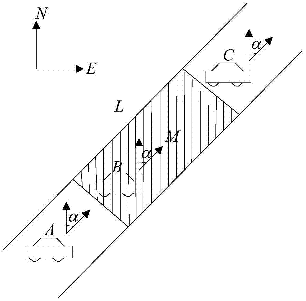
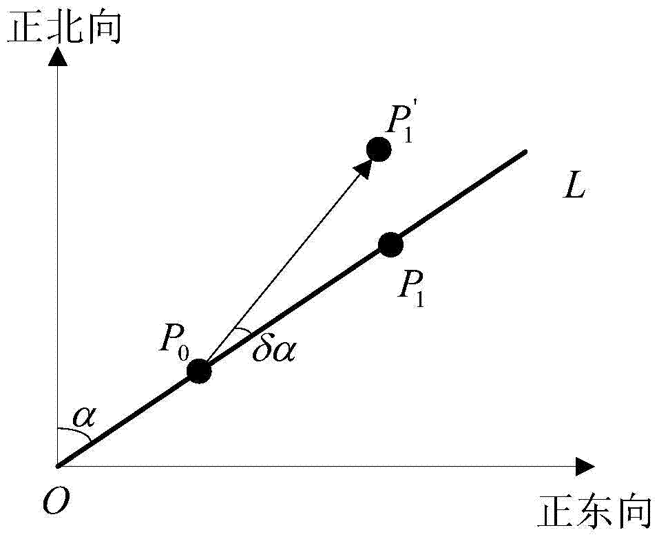
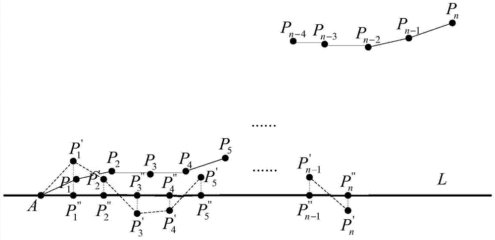

Image

  • Vehicle positioning error correction method in vsyr blind area for gnss
  • Vehicle positioning error correction method in vsyr blind area for gnss
  • Vehicle positioning error correction method in vsyr blind area for gnss

Examples


Embodiment Construction

[0029] In order to make the object, technical solution and advantages of the present invention clearer, the present invention will be further described in detail below in conjunction with the accompanying drawings and embodiments. It should be understood that the specific embodiments described here are only used to explain the present invention, not to limit the present invention.

[0030] VSYR uses the sensors installed in the vehicle to measure the vehicle speed and vehicle yaw rate at each sampling moment, and performs integral calculations from the initial position to obtain the complete vehicle trajectory. The initial position of the vehicle uses GNSS technology when the vehicle enters the blind zone Measured at the last moment before. However, because the parameter accuracy of the vehicle sensor is not high, the positioning error of VSYR will accumulate after a long time of operation, so the parameters of the vehicle sensor need to be corrected.

[0031] (1) Straight sc...


PUM


Abstract

The invention discloses a method for correcting a positioning error of a vehicle in a VSYR (vehicle speed and yaw rate) blind area by using a GNSS (global navigation satellite system). The methods comprises the following steps: step 1, GNSS positioning and VSYR blind area positioning are started simultaneously when the vehicle enters a visible area of the GNSS; step 2, a VSYR speed sensor error model and a yaw rate sensor error model are established according to the road condition of the VSYR blind area; step 3, the parameter KO of a vehicle speed sensor is corrected by using the vehicle locating point deviation, and the parameter Kg of a vehicle yaw rate sensor is corrected by using the vehicle heading angle deviation. According to the method, the parameters of the vehicle sensors are corrected by using the characteristic that the GNSS performs accurate positioning for long time, error accumulation of the vehicle sensors is relieved, and the blank of the error accumulation produced when vehicle self-positioning is used in the GNSS blind area is filled up.

Description

technical field [0001] The present invention relates to the technical field of vehicle positioning, in particular to the correction of accumulated error parameters in the blind spot positioning of vehicles using GNSS (Global Navigation Satellite System) in VSYR (Vehicle Speed ​​& Yaw Rate, vehicle speed-yaw rate sensor positioning method) method. Background technique [0002] Currently, there are various vehicle positioning technologies, including GNSS, INS (Inertial Navigation System, inertial navigation system) and the like. Among them, GNSS system is widely used in vehicle navigation and positioning system due to its advantages of wide coverage, high positioning accuracy and strong real-time performance. However, the GNSS system also has its own defects, resulting in inaccurate positioning, especially when the vehicle is driving in some areas covered by trees or tall buildings, because the GNSS system cannot capture and track signals from satellites through the vehicle r...

Claims


Application Information

Patent Timeline
Patent Type & Authority Patents(China)
IPC IPC(8): G01C21/16G01S19/47
CPCG01C21/165G01S19/47
Inventor 黄波李中海李大鹏赵海涛吴晓春
Owner NANJING UNIV OF POSTS & TELECOMM
Learn More