A Pyramid Layer Storage Method for Image Data and Spatial Database System

A technology of image data and spatial data, applied in geographic information database, still image data retrieval, still image data index, etc., can solve the problems of mass image data storage management, spatial information service response and network bandwidth cannot be effectively solved, etc.

Inactive Publication Date: 2019-12-03
霍亮
View PDF1 Cites 0 Cited by
  • Summary
  • Abstract
  • Description
  • Claims
  • Application Information

AI Technical Summary

Problems solved by technology

Although various geoscience information platforms are emerging, there are many bottlenecks in the traditional image data network service model, such as storage and management of massive image data, spatial information service response, and network bandwidth.

Method used


Image

  • A Pyramid Layer Storage Method for Image Data and Spatial Database System
  • A Pyramid Layer Storage Method for Image Data and Spatial Database System
  • A Pyramid Layer Storage Method for Image Data and Spatial Database System

Examples


Embodiment Construction

[0021] Below in conjunction with the accompanying drawings, the pyramid storage method for image data and the spatial database system proposed according to the present invention, its specific implementation, structure, features and effects, are described in detail as follows.

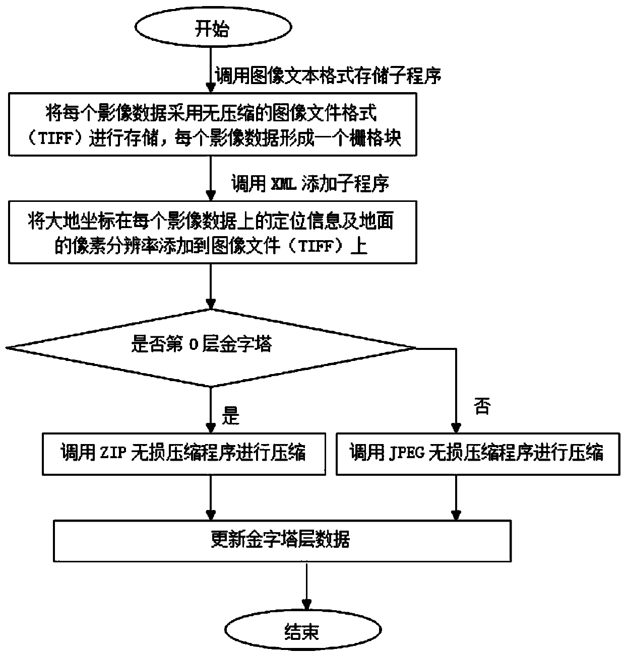
[0022] figure 1 It is a block flow diagram of the pyramid layer storage method of image data in the present invention.

[0023] Step 1: call the image text format storage subroutine, store each image data in image text format, each image data forms a grid block;

[0024] The second step is to call the XML subroutine to add the location information of the geodetic coordinates on each image data and the pixel resolution of the ground to the image file (TIFF);

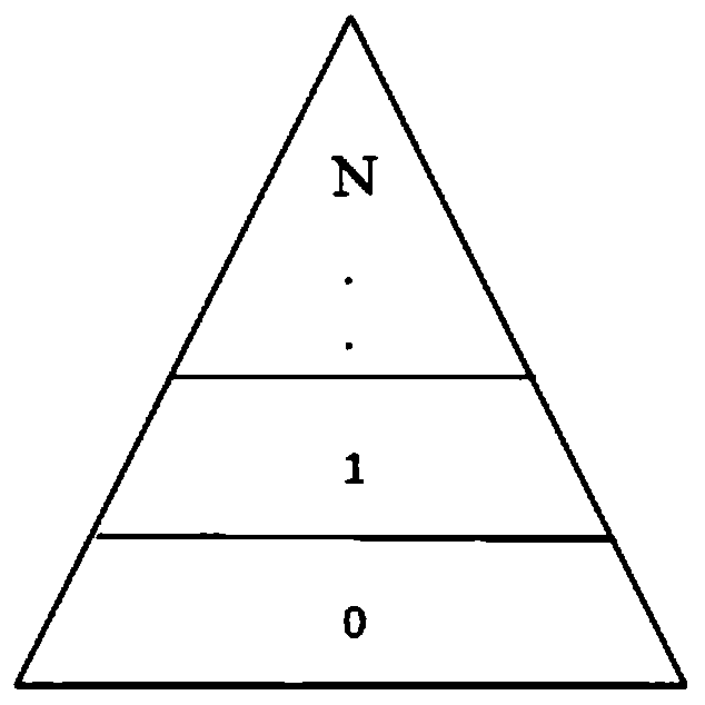
[0025] The third step is to judge whether the number of pyramid layers read is the 0th layer pyramid, if it is the 0th layer pyramid, then call the ZIP lossless compression program to compress the image file, if it is not the 0th layer pyramid lay...


PUM


Abstract

The invention discloses a pyramid layer-based storage method and a spatial database system for image data. The image data can be stored by the aid of the pyramid layer-based storage method. The pyramid layer-based storage method includes that original spatial data on layers 0 are stored by the aid of ZIP lossless compression processes, and data on layers 1 and layers higher than the layers 1 are stored by the aid of JPEG (joint photographic experts group) loss compression processes. The pyramid layer-based storage method is implemented by the spatial database system. The pyramid layer-based storage method and the spatial database system have the advantages that the spatial data can be massively stored and quickly visualized in network environments, and the multi-source heterogeneous spatial data on super-large scales can be efficiently scheduled; images can be quickly processed and outputted.

Description

technical field [0001] The invention relates to a data storage method, in particular to a pyramid layer storage method for image data. Background technique [0002] Image data is a map that directly reflects the surface conditions of aerial or satellite remote sensing images. The images are usually corrected orthophotos. The symbols and annotations superimposed on the images are selected according to certain principles. Image maps can be divided into common image maps and thematic image maps according to their content. Imagery is the main body of transmitting spatial geographic information. The easily identifiable features on the imagery are not represented by symbols, but are directly displayed by the imagery; only those contents that cannot be displayed or identified by the imagery are displayed in the form of symbols or notes when necessary. be expressed. [0003] The content displayed by the geo-browser is the image data mainly organized by spatial position. It not onl...

Claims


Application Information

Patent Timeline
Patent Type & Authority Patents(China)
IPC IPC(8): G06F16/51G06F16/587
CPCG06F16/29G06F16/51
Inventor 霍亮沈涛畅开狮王红杨建朋田军孙晨龙高泽辉张春星艾丛
Owner 霍亮
Why Eureka
Try Eureka