A cirrus identification method based on satellite 2.0 micron channel data
A micron channel and satellite technology, applied in the field of satellite atmospheric remote sensing, can solve problems such as inability to effectively identify high-altitude cirrus clouds and inversion result errors, and achieve the effect of fast and effective technical methods
- Summary
- Abstract
- Description
- Claims
- Application Information
AI Technical Summary
Problems solved by technology
Method used
Image
Examples
Embodiment Construction
[0020] specific implementation plan
[0021] The following describes in detail in conjunction with the accompanying drawings and embodiments.
[0022] Such as figure 1 As shown, according to a kind of cirrus cloud identification method step based on satellite 2.0 micron channel data of the present invention comprises:
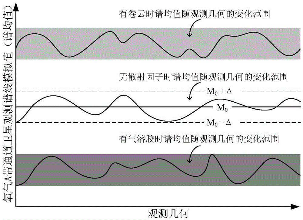
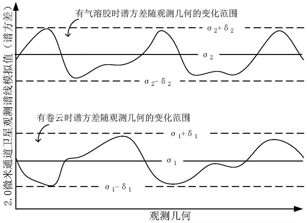
[0023] Step S1, according to the GOSAT satellite data, use the forward model to simulate the 2.0 micron channel and the oxygen A band channel in the observation field without scattering factors and with scattering factors (including when there are cirrus clouds and aerosols) under different observation geometric conditions Satellite observation spectral line simulation value;
[0024] Step S1 further includes:
[0025] S1.1. According to the characteristics of GOSAT satellite data, forwardly simulate the 2.0 micron channel under different observation geometric conditions, and the satellite observation spectrum line simulation value when there is no scatterin...
PUM
 Abstract
Description
Claims
Application Information
 - Generate Ideas
- Intellectual Property
- Life Sciences
- Materials
- Tech Scout
- Unparalleled Data Quality
- Higher Quality Content
- 60% Fewer Hallucinations
Browse by: Latest US Patents, China's latest patents, Technical Efficacy Thesaurus, Application Domain, Technology Topic, Popular Technical Reports.
© 2025 PatSnap. All rights reserved.Legal|Privacy policy|Modern Slavery Act Transparency Statement|Sitemap|About US| Contact US: help@patsnap.com


