A Method to Quantify Road Network Characteristics and Their Land Use Effects
A land and road network technology, applied in special data processing applications, instruments, calculations, etc., can solve the problems of ignoring the actual distance, only considering the network connectivity, and unable to effectively reveal the spatial differentiation of land use landscape pattern
- Summary
- Abstract
- Description
- Claims
- Application Information
AI Technical Summary
Problems solved by technology
Method used
Image
Examples
Embodiment
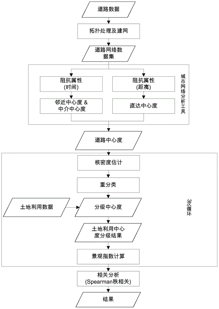
[0037] Such as figure 1 Shown, the detailed steps of the present invention are as follows:
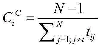
[0038]1. Process road data and land use data (shp format) through ArcGIS10.1 software. Create a geographic database (GeoDatabase) and create a new dataset (dataset) in it, create a topology, and create a topology according to the prompts, add topology processing rules; perform topology analysis. The topological processing rules include must not have pseudo-nodes, must not have wired overlap (between different elements) (must not overlay), must not self-cover (must notself overlay), must not have wired intersections (between different elements) (must not intersect), and must not self intersect. After the topology processing is completed, build a network dataset (NetWork Dataset) for roads under the same dataset. Set the corresponding traffic speed according to the road level, and set the time and distance respectively when setting the impedance attribute. The time is the length divid...
PUM
 Abstract
Description
Claims
Application Information
 - R&D
- Intellectual Property
- Life Sciences
- Materials
- Tech Scout
- Unparalleled Data Quality
- Higher Quality Content
- 60% Fewer Hallucinations
Browse by: Latest US Patents, China's latest patents, Technical Efficacy Thesaurus, Application Domain, Technology Topic, Popular Technical Reports.
© 2025 PatSnap. All rights reserved.Legal|Privacy policy|Modern Slavery Act Transparency Statement|Sitemap|About US| Contact US: help@patsnap.com


