A method and system for identifying missing pedestrian facilities
A technology of pedestrian facilities and recognition methods, applied in the field of mobile navigation, can solve the problems of heavy workload and inability to guarantee coverage, and achieve the effect of reducing manual workload and improving recognition coverage
- Summary
- Abstract
- Description
- Claims
- Application Information
AI Technical Summary
Problems solved by technology
Method used
Image

Examples
Embodiment 1
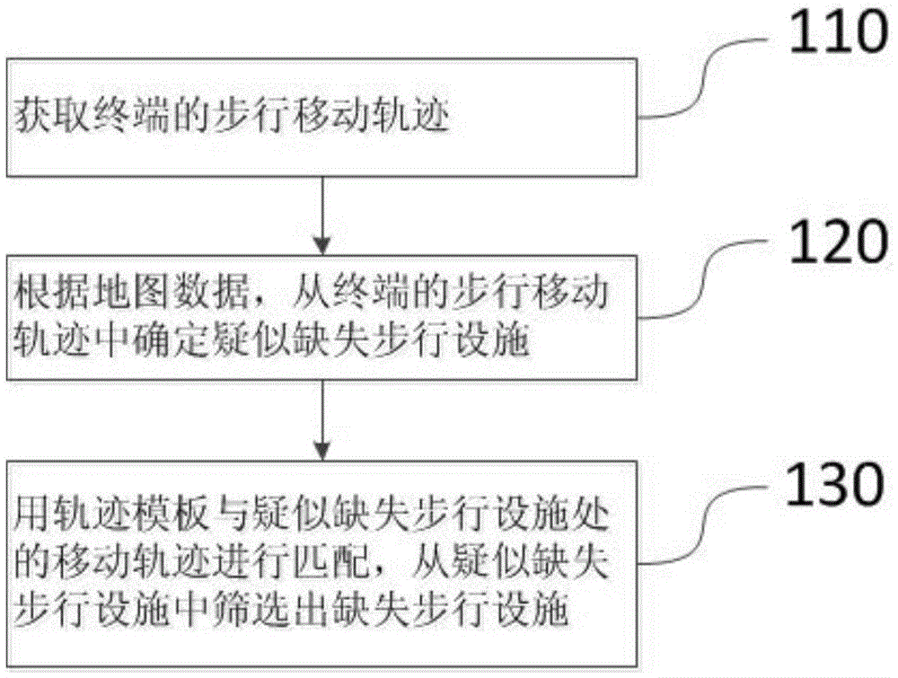
[0021] figure 1 It is a flow chart of the method for identifying missing pedestrian facilities provided by Embodiment 1 of the present invention.
[0022] like figure 1 As shown, the method for identifying missing pedestrian facilities provided by the embodiment of the present invention can be realized through cooperation between a server and a user terminal equipped with a positioning system. And to move, the navigation software can collect the user's movement track of this trip and send it to the server, and the server will perform the operation of identifying the missing walking facilities. The missing pedestrian facility identification method provided by the embodiment of the present invention is executed by the server, including:
[0023] 110. Acquire the walking trajectory of the terminal.
[0024] Wherein, the walking movement track refers to a track generated by the user carrying the terminal while walking. The positioning system such as the satellite positioning s...
Embodiment 2
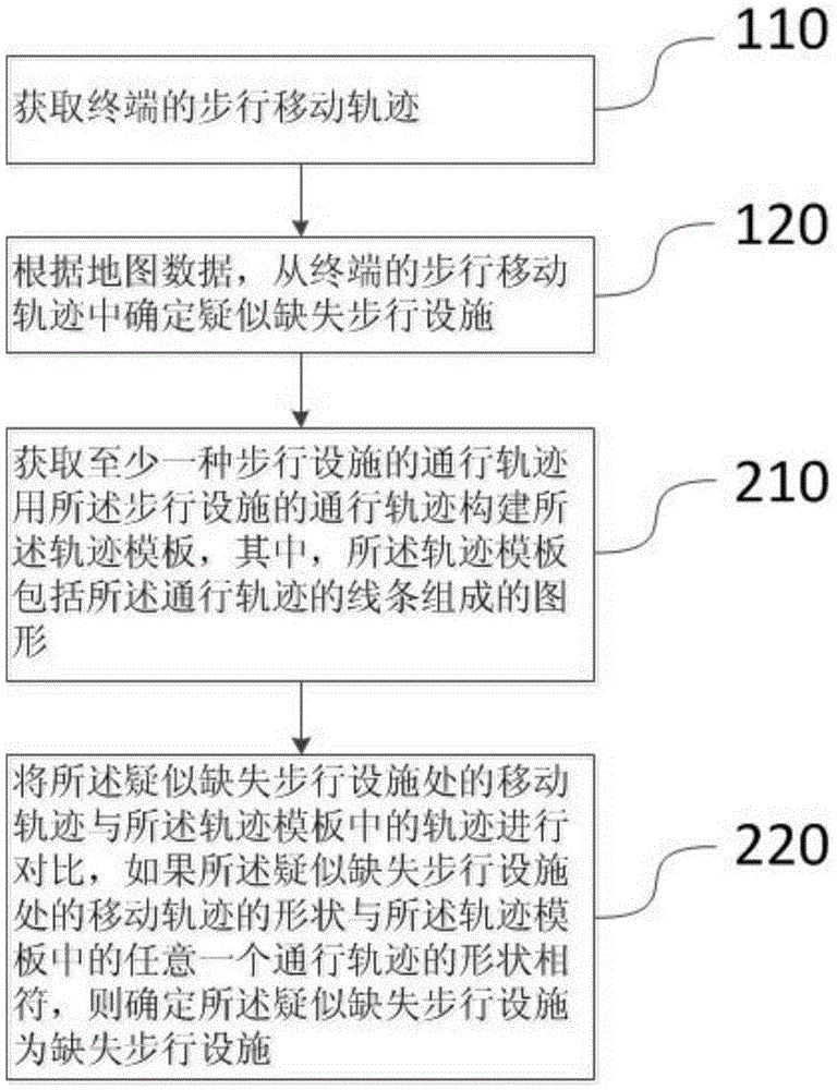
[0032] figure 2 It is a flow chart of the method for identifying missing pedestrian facilities provided by Embodiment 2 of the present invention.
[0033] like figure 2 As shown, on the basis of the above-mentioned embodiments, the missing walking facility identification method provided by the embodiment of the present invention uses a trajectory template to match the movement trajectory of the suspected missing walking facility, and screens out the missing walking facilities from the suspected missing walking facilities. Before the operation can also include:
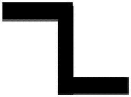
[0034] 210. Acquire passing trajectories of at least one pedestrian facility, and use the passing trajectories of the pedestrian facilities to construct the trajectory template, wherein the trajectory template includes a graph composed of lines of the passing trajectory.
[0035] Among them, the traffic trajectory refers to the walking route of pedestrians passing through the pedestrian facilities, such as image ...
Embodiment 3
[0041] On the basis of the above-mentioned embodiments, the walking trajectory of the acquisition terminal can be preferably:
[0042] Acquire the movement trajectory of the terminal, and filter the movement trajectory according to the movement time threshold to determine the walking movement trajectory.
[0043]Since there may be multiple ways for the user to carry the terminal to move, the purpose of this operation is to filter out the walking movement trajectory from the movement trajectory. The difference between various moving modes is that the moving speed is different, so the moving modes can be distinguished according to the time spent in moving, for example, setting the threshold value of moving time, if the time taken by the mobile terminal to move within a unit distance is higher than the threshold value, That is, it means that the moving speed of the user is relatively slow, and it can be determined that the moving manner of the user terminal is walking.
[0044] ...
PUM
 Abstract
Description
Claims
Application Information
 - Generate Ideas
- Intellectual Property
- Life Sciences
- Materials
- Tech Scout
- Unparalleled Data Quality
- Higher Quality Content
- 60% Fewer Hallucinations
Browse by: Latest US Patents, China's latest patents, Technical Efficacy Thesaurus, Application Domain, Technology Topic, Popular Technical Reports.
© 2025 PatSnap. All rights reserved.Legal|Privacy policy|Modern Slavery Act Transparency Statement|Sitemap|About US| Contact US: help@patsnap.com