
Mixed orbit IGSO (inclined geosynchronous satellite orbit) constellation capable of covering target area and global scale

A technology of regional coverage and geosynchronous orbit, which is applied in the field of satellite communication, can solve the problems of large Doppler frequency shift and delay change, susceptibility to interference and attack, low average coverage elevation angle, etc., and achieve good diversity effect, Doppler The effect of Le frequency shift and delay change is small

Active Publication Date: 2014-01-22
PLA UNIV OF SCI & TECH
View PDF3 Cites 18 Cited by
  • Summary
  • Abstract
  • Description
  • Claims
  • Application Information

AI Technical Summary

Problems solved by technology

[0004] 2) It cannot cover the whole world, and there are communication blind spots near the poles;
[0006] 4) The satellite position is fixed and vulnerable to interference and attack;
[0007] 5) Orbital resources are crowded, and it is difficult to coordinate orbital positions and frequency resources
[0010] To sum up, due to the large Doppler frequency shift and time delay changes in low-orbit satellite communication, it is difficult to be used for broadband multimedia communication, and the existing GEO broadband multimedia constellation has communication blind spots in the north and south poles, and the average The coverage elevation angle is low and the fading margin is large, but the coverage performance of a single IGSO satellite for a specific area is not as good as that of a GEO satellite
[0011] Therefore, the problem in the existing technology is: how to achieve multiple coverage of the target area by only relying on the location-limited gateway station, while taking into account the global coverage

Method used


Image

  • Mixed orbit IGSO (inclined geosynchronous satellite orbit) constellation capable of covering target area and global scale
  • Mixed orbit IGSO (inclined geosynchronous satellite orbit) constellation capable of covering target area and global scale
  • Mixed orbit IGSO (inclined geosynchronous satellite orbit) constellation capable of covering target area and global scale

Examples


Embodiment Construction

[0027] The present invention will be described in further detail below in conjunction with the accompanying drawings.

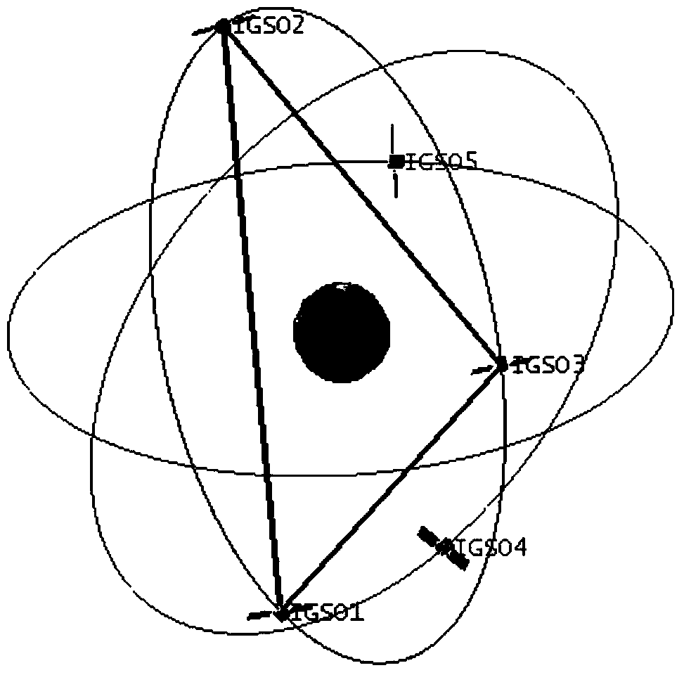
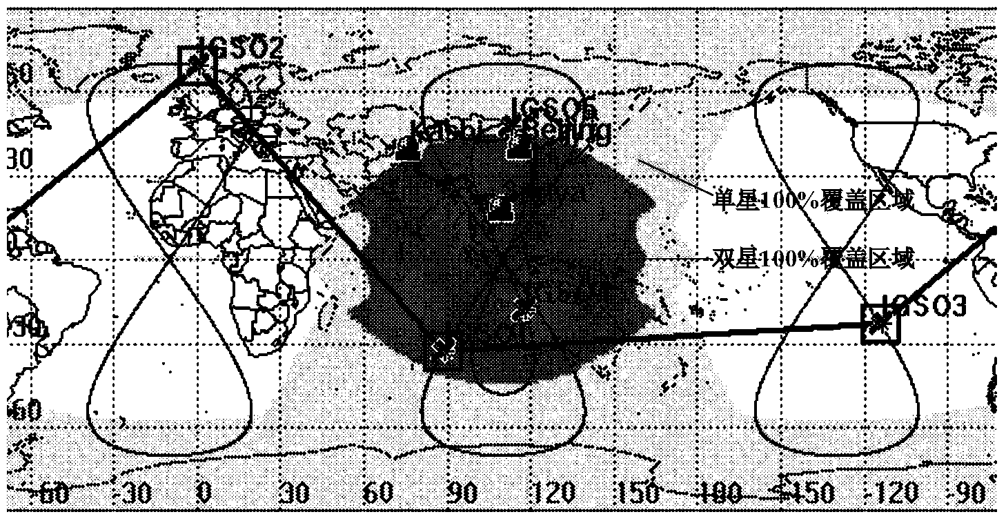
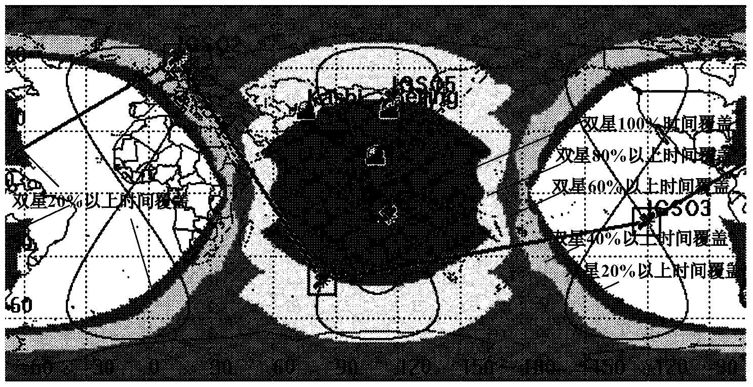
[0028] Such as figure 1 As shown, the regional coverage of the present invention takes into account the global hybrid orbit IGSO constellation, including at least 5 IGSO satellites located in geosynchronous orbits, the at least 5 IGSO satellites are divided into two groups, each group contains at least 3 IGSO satellites, two One IGSO satellite is shared between groups;

[0029] At least 3 IGSO satellites in the first group share one orbital plane, the right ascension of the ascending node is the same, the difference between the mean points is 120°, and they have the same orbital inclination, and the 3 IGSO satellites are connected by fixed inter-satellite link communication ;

[0030] The at least 3 IGSO satellites in the second group have the same sub-satellite point crossing the equator longitude, and the difference between the mean anomaly angles is 120°...


PUM


Abstract

The invention discloses a mixed orbit IGSO (inclined geosynchronous satellite orbit) constellation capable of covering a target area and the global scale. The constellation comprises at least five IGSO satellites which are positioned on an earth synchronous orbit and are divided into two groups, wherein each group of IGSO satellites contains at least three IGSO satellites; the two groups of IGSO satellites share one IGSO satellite; the at least three IGSO satellites in the first group share one orbit surface, the right ascensions of ascending nodes are same, each mean anomaly is 120 degrees, the three IGSO satellites have the same orbit inclination angle, and the three IGSO satellites are connected by fixed inter-satellite links in a communication way; the at least three IGSO satellites in the second group have the same sub-satellite point across-equator longitude, each mean anomaly is 120 degrees, wherein the at least two IGSO satellites not shared by the first group have the same orbit inclination angle and the same ground track, inter-satellite links are not established among the three IGSO satellites in the second group, and the three IGSO satellites are always observed by a position-limited and signal-closing station by adjusting the orbit inclination angle. According to the mixed orbit IGSO constellation, the target area can be covered in a multiple way only in the way that the position-limited and signal-closing station lands, and meanwhile, the global scale is also covered by the mixed orbit IGSO constellation.

Description

technical field [0001] The invention belongs to the technical field of satellite communication, in particular to a mixed-orbit IGSO constellation with regional coverage and global consideration. Background technique [0002] In recent years, the R&D and test activities of broadband multimedia satellite communication systems abroad have continued. Typical systems such as Amerhis, Spaceway3, WINDS, WGS, etc., these satellite broadband communication systems are composed of one or more geostationary orbit (Geostationary Orbit , GEO) satellite composition. GEO satellites work on the equatorial ring at an altitude of 35,786km from the ground, remain stationary relative to the ground, and have a large coverage area. Quasi-global coverage can be achieved by using 3 to 5 GEO satellites (the north and south poles cannot be covered), and the technology is relatively mature. Easy to maintain, but there are some problems: [0003] 1) The average coverage elevation angle for middle and ...

Claims


Application Information

Patent Timeline
IPC IPC(8): H04B7/185H04B7/02
Inventor 张更新张威谢智东边东明李永强张飞孔博胡婧孙谦
Owner PLA UNIV OF SCI & TECH
Learn More