Three-dimensional measurement method for tunnel rock formation attitude
A technology of rock stratum occurrence and three-dimensional measurement, applied in the field of engineering geological survey, can solve the problems of long processing period, unsuitable for large-scale, batch occurrence calculation, high cost of aerial stereo image acquisition, etc.
- Summary
- Abstract
- Description
- Claims
- Application Information
AI Technical Summary
Problems solved by technology
Method used
Image
Examples
Embodiment Construction
[0043] Below in conjunction with accompanying drawing and embodiment the present invention is described in further detail:
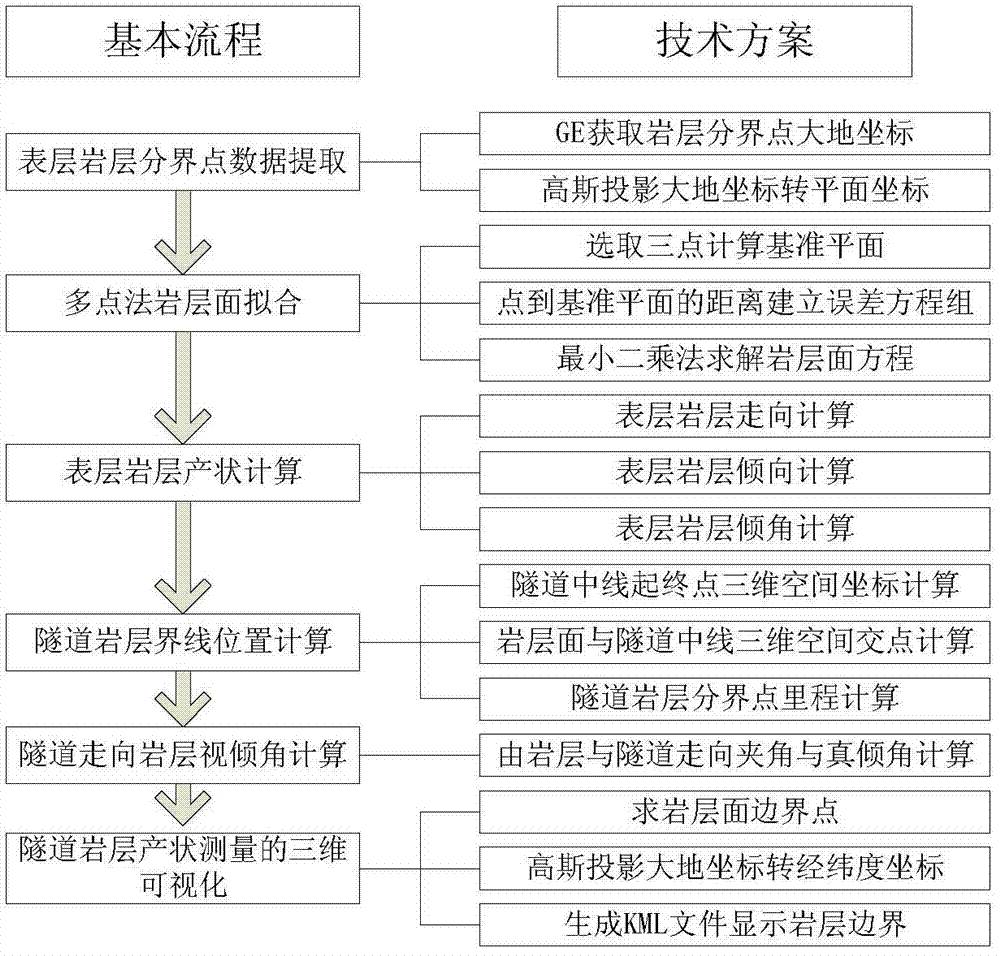
[0044] Such as figure 1 The three-dimensional measurement method for the occurrence of tunnel rock strata is characterized in that it comprises the following steps:
[0045] Step 1: In the Google Earth software database, manually select the geodetic coordinates of a plurality of boundary points of the surface rock formations to be measured, and the selected number of boundary points of the surface rock formations to be measured is not less than 3;
[0046] Step 2: using Gaussian projection to convert the geodetic coordinates of the boundary points of the surface rock layers to be measured into plane coordinates;
[0047] Step 3: Select three points arbitrarily in the plane coordinate system in step 2 to determine the datum plane equation:
[0048] A 0 X+B 0 Y+C 0 Z+1=0 (1)
[0049] Among them, A 0 , B 0 、C 0 is the datum plane equation coefficie...
PUM
 Abstract
Description
Claims
Application Information
 - Generate Ideas
- Intellectual Property
- Life Sciences
- Materials
- Tech Scout
- Unparalleled Data Quality
- Higher Quality Content
- 60% Fewer Hallucinations
Browse by: Latest US Patents, China's latest patents, Technical Efficacy Thesaurus, Application Domain, Technology Topic, Popular Technical Reports.
© 2025 PatSnap. All rights reserved.Legal|Privacy policy|Modern Slavery Act Transparency Statement|Sitemap|About US| Contact US: help@patsnap.com


