Method for preparing typical ground object reference picture by using multispectral image classification

A multi-spectral image and reference map technology, applied in the field of image recognition, can solve the problem of insignificant target features, and achieve the effects of excellent matching and recognition performance, high accuracy, high efficiency and automation

Active Publication Date: 2013-05-08
HUAZHONG UNIV OF SCI & TECH
View PDF2 Cites 12 Cited by
  • Summary
  • Abstract
  • Description
  • Claims
  • Application Information

AI Technical Summary

Problems solved by technology

[0005] The purpose of the present invention is to provide a reference map preparation method using multispectral image classification, which uses a variety of feature information to quickly classify multispectral images, extract relatively complete classes of interest, select some of them as landmarks, and Predict the infrared characteristics of landmarks to solve the problem of indirect positioning and identification of targets in complex environments by preparing feature reference maps containing landmarks when the target features are not obvious in the navigation and guidance process of the aircraft. support

Method used


Image

  • Method for preparing typical ground object reference picture by using multispectral image classification
  • Method for preparing typical ground object reference picture by using multispectral image classification
  • Method for preparing typical ground object reference picture by using multispectral image classification

Examples


Embodiment Construction

[0035] In order to make the object, technical solution and effect of the present invention more clear, the present invention will be further described in detail below in conjunction with the accompanying drawings and specific embodiments. The following examples are only for explanatory purposes and do not constitute a limitation to the present invention. All modifications that do not depart from the spirit of the present invention belong to the protection scope of the present invention.

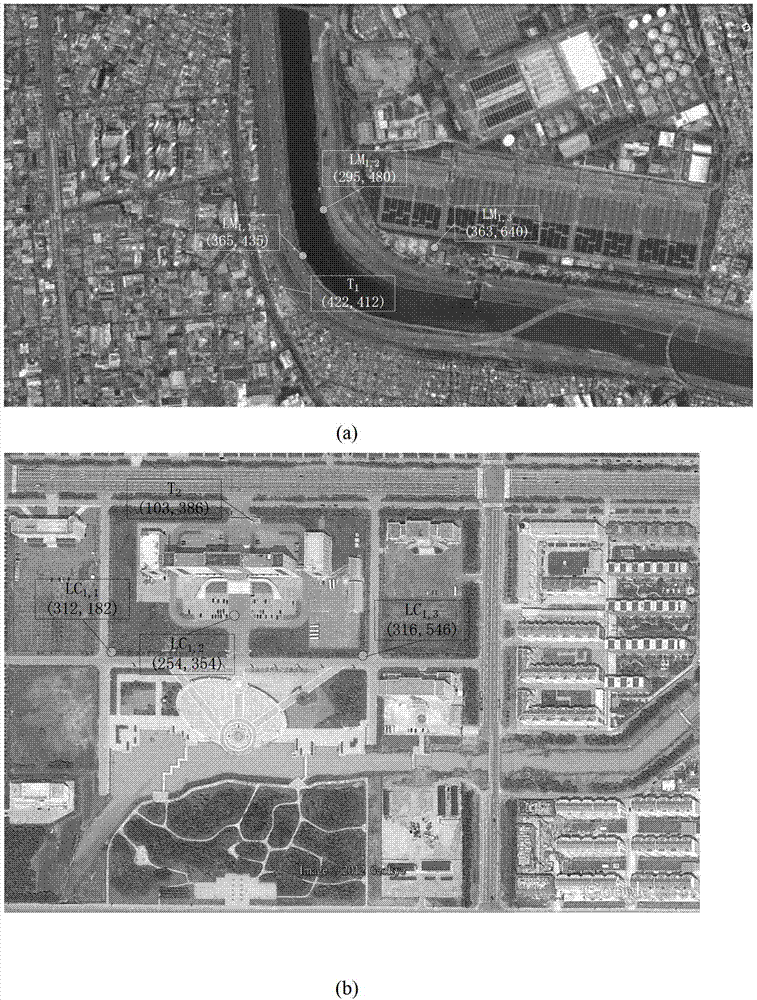
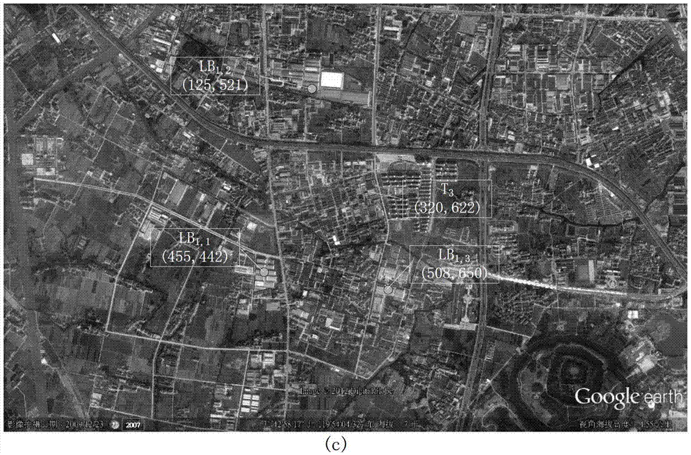
[0036] Under a certain imaging distance, flying height and suitable flying angle, the visibility of ground features such as rivers, roads, and building groups can be guaranteed, so the present invention is considered under the condition that these ground features are visible. Below to figure 2 The multispectral image shown is taken as an example to illustrate the present invention in further detail.

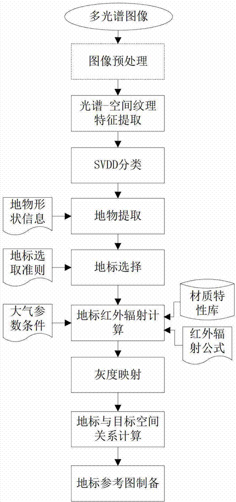
[0037] Such as figure 1 As shown, the specific process for the preparation of the referen...


PUM


Abstract

The invention discloses a method for preparing a typical ground object reference picture by using multispectral image classification. An interesting type is extracted from a multispectral image and is taken as a landmark, and the reference picture comprising the landmark can be prepared and is used for indirectly positioning and identifying a target. The method specifically comprises the following steps of: selecting the interesting type from the multispectral image, extracting a spectral-spatial texture characteristic of the interesting type, and classifying the multispectral image according to the extracted spectral-spatial texture characteristic; on the basis of classification, extracting the complete interesting type, and taking the interesting type as the interesting type of the landmark according to a landmark selection rule; calculating an infrared radiation amount of the landmark under an atmospheric parameter condition by using an infrared radiation formula according to a landmark material type; and mapping the infrared radiation amount to obtain a gray scale value, and preparing the reference picture comprising a landmark shape, the gray scale of the landmark shape and a background gray scale. According to the method, accuracy and automation are relatively high, and the performance of a matching and identification algorithm based on the reference picture can be improved.

Description

technical field [0001] The invention belongs to the technical field of image recognition, and in particular relates to a method for preparing a reference map using multispectral image classification, which is used for preparing reference maps of typical ground objects and is suitable for target recognition in aircraft navigation and guidance. Background technique [0002] With the development of infrared imaging and guidance technology, the research on the characteristics of target background radiation and its infrared imaging features has been paid more and more attention by researchers at home and abroad, which is of great significance in the field of aircraft navigation and guidance research. Under different time phases, different climates, different lighting conditions, and long-distance imaging conditions, the optical images acquired by the imaging sensor present different characteristics and are complex and changeable, especially when the target features are not obvious...

Claims


Application Information

Patent Timeline
IPC IPC(8): G01C21/20G06K9/62
Inventor 张天序边小勇颜露新李姣高慧杰彭凡张力周刚朱虎
Owner HUAZHONG UNIV OF SCI & TECH
Why Eureka
Try Eureka