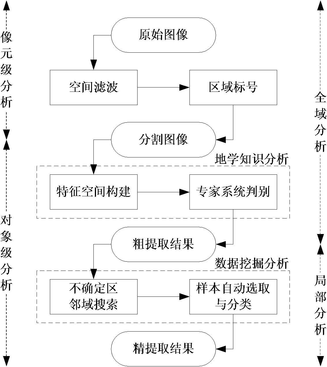
Method for full automatic extraction of water remote sensing information in coastal zone
An extraction method and fully automatic technology, which is applied in image data processing, instruments, calculations, etc., can solve the problems of extensive extraction results and difficulty in fully automatic extraction of water body remote sensing information, achieve roughly uniform range, reduce salt and pepper noise effects, The effect of reducing uncertainty
- Summary
- Abstract
- Description
- Claims
- Application Information
AI Technical Summary
Problems solved by technology
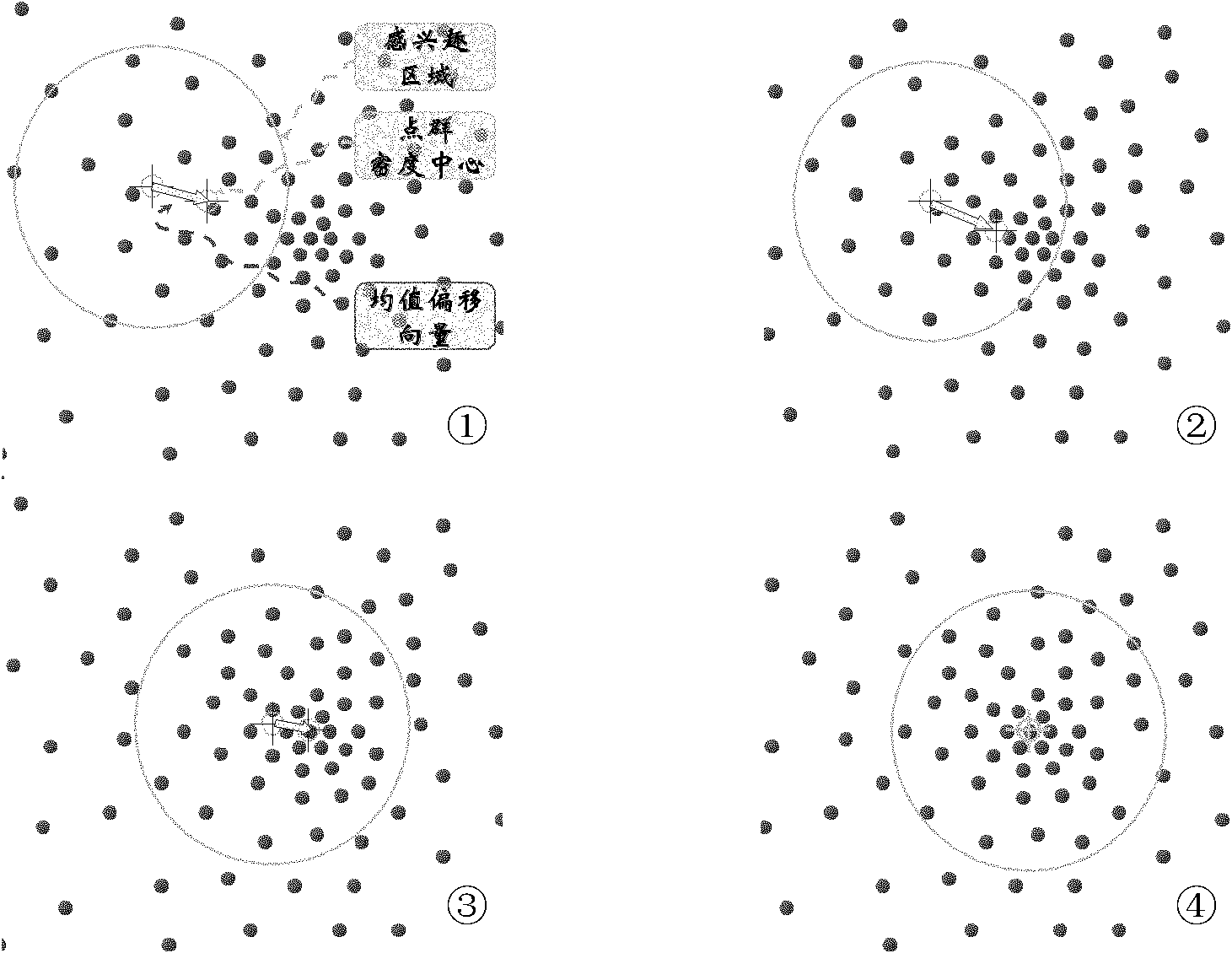
Method used
Image

Examples
Embodiment Construction
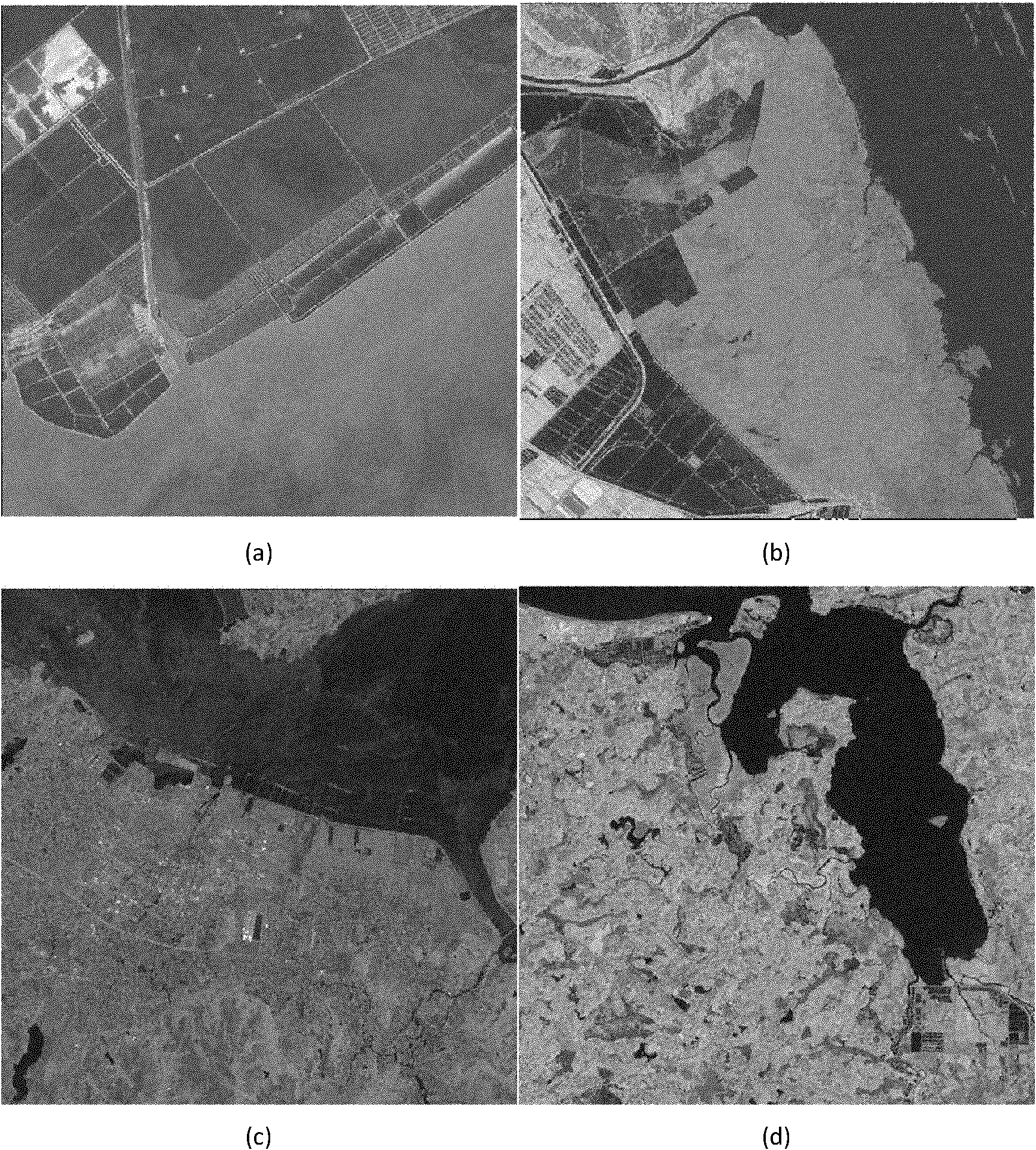
[0042] Attached image 3 The shown group of remote sensing images is used as remote sensing image data of an embodiment of the method for fully automatic extraction of coastal water remote sensing information, and the data is used to verify the effectiveness of the automatic extraction method for coastal water remote sensing information. This group of image data is for different types of coastal zones in the four major seas of my country. Among them, the Bohai Sea example area is located in the coastal zone near Caofeidian Development Zone, Tangshan City, Hebei Province ( image 3 (a)), the regular distribution of salt fields and aquaculture water in the area; the Yellow Sea example area is located in the coastal zone near the Dafeng Red-crowned Crane National Nature Reserve in Yancheng City, Jiangsu Province ( image 3 (b)), there are many tidal flats and wetlands in the area; the example area of the East China Sea is located in the coastal zone near Beilun Port, Ningbo Ci...
PUM
 Abstract
Description
Claims
Application Information
 - R&D
- Intellectual Property
- Life Sciences
- Materials
- Tech Scout
- Unparalleled Data Quality
- Higher Quality Content
- 60% Fewer Hallucinations
Browse by: Latest US Patents, China's latest patents, Technical Efficacy Thesaurus, Application Domain, Technology Topic, Popular Technical Reports.
© 2025 PatSnap. All rights reserved.Legal|Privacy policy|Modern Slavery Act Transparency Statement|Sitemap|About US| Contact US: help@patsnap.com