Method for automatically generating large-scale digitization altitude data model based on image set
A technology for automatic generation of elevation data, applied in image data processing, 3D modeling, instruments, etc., can solve problems such as manual processing
- Summary
- Abstract
- Description
- Claims
- Application Information
AI Technical Summary
Problems solved by technology
Method used
Image
Examples
Embodiment Construction
[0044] The present invention will be described in detail below in conjunction with the accompanying drawings and embodiments.
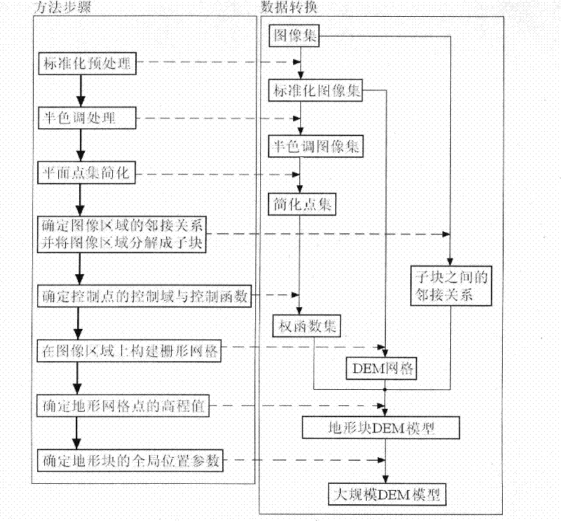
[0045] like figure 1 As shown, the large-scale digital virtual terrain automatic generation method based on the image set, its specific implementation steps are as follows:
[0046] According to the series of images input by the user ∑={I i,j} and terrain preparation control parameters (including the size of the standardized image, the level of point set simplification and the point set segmentation control parameter K, the density of the terrain grid, the control domain parameter radius or num, and the terrain relief control parameter η etc.), to construct large-scale digital virtual terrain.
[0047] 1. Standardize the series of images: the present embodiment adopts the bilinear interpolation method to scale the image I whose size is length*width pixels, and convert it into a square standard image whose size is size*size pixels: The pixel in the...
PUM
 Abstract
Description
Claims
Application Information
 - R&D
- Intellectual Property
- Life Sciences
- Materials
- Tech Scout
- Unparalleled Data Quality
- Higher Quality Content
- 60% Fewer Hallucinations
Browse by: Latest US Patents, China's latest patents, Technical Efficacy Thesaurus, Application Domain, Technology Topic, Popular Technical Reports.
© 2025 PatSnap. All rights reserved.Legal|Privacy policy|Modern Slavery Act Transparency Statement|Sitemap|About US| Contact US: help@patsnap.com


