Real time automatic update system and method for disaster damage investigation
A disaster and loss technology, applying online communication and real-time automatic updating of network geographic information systems, can solve problems such as difficulty in retrieving and publishing disaster records, and excessive labor.
- Summary
- Abstract
- Description
- Claims
- Application Information
AI Technical Summary
Problems solved by technology
Method used
Image
Examples
Embodiment Construction
[0040] Hereinafter, preferred embodiments of the present invention will be described in more detail with reference to the accompanying drawings. The embodiments provided below are only for illustrating the present invention and are not intended to limit the technical aspect or scope of the present invention in any way.
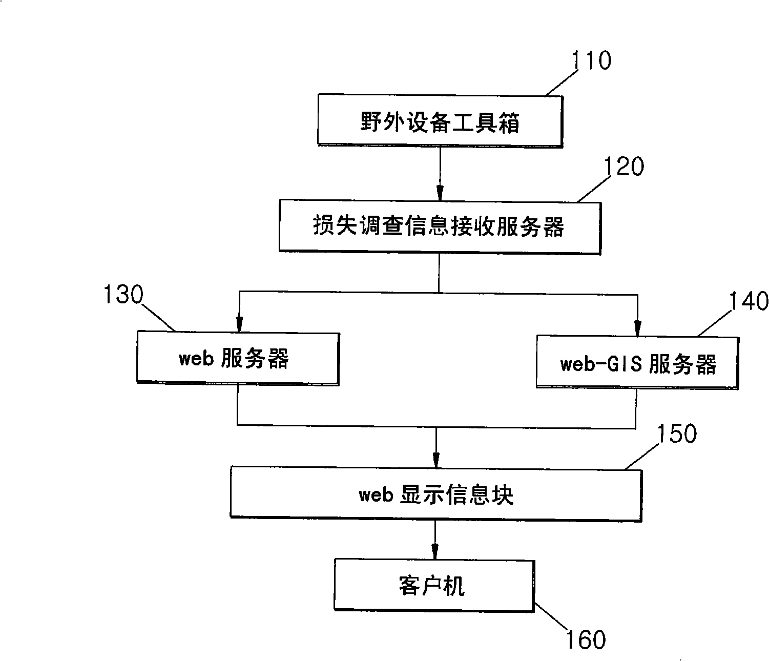
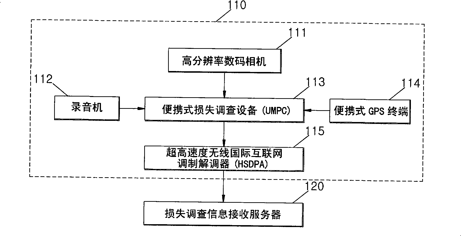
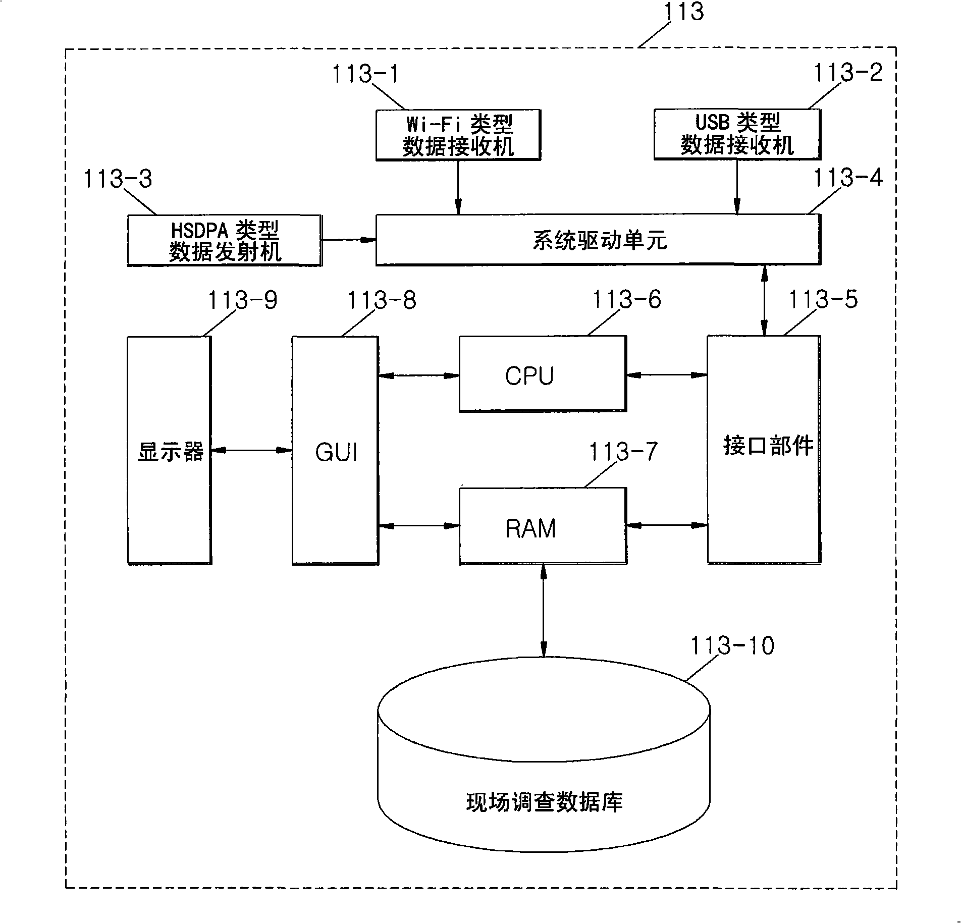
[0041] figure 1 is a block diagram showing the overall structure of a real-time automatic update system using wireless communication and web-GIS for disaster loss investigation according to the present invention. figure 2 yes figure 1 Detailed block diagram of the Field Equipment Toolbox 110. Figure 3A yes figure 2 Detailed block diagram of the portable loss investigation device 113. Figure 3B , 3C and 3D is figure 1 A detailed block diagram of the loss survey information receiving server 120, web server 130 and web-GIS server 140 of . Figure 4 yes figure 1 An illustration of the display and structure of the web display information box 150.
[00...
PUM
 Abstract
Description
Claims
Application Information
 - R&D
- Intellectual Property
- Life Sciences
- Materials
- Tech Scout
- Unparalleled Data Quality
- Higher Quality Content
- 60% Fewer Hallucinations
Browse by: Latest US Patents, China's latest patents, Technical Efficacy Thesaurus, Application Domain, Technology Topic, Popular Technical Reports.
© 2025 PatSnap. All rights reserved.Legal|Privacy policy|Modern Slavery Act Transparency Statement|Sitemap|About US| Contact US: help@patsnap.com


