
Method and system for GPS based navigation and hazard avoidance in a mining environment

a mining environment and hazard avoidance technology, applied in the direction of navigation instruments, process and machine control, instruments, etc., can solve the problems of not being obvious, changing the allowable routes for navigation in mining environments,

Active Publication Date: 2012-01-10
MODULAR MINING SYSTEMS
View PDF61 Cites 5 Cited by
  • Summary
  • Abstract
  • Description
  • Claims
  • Application Information

AI Technical Summary

Benefits of technology

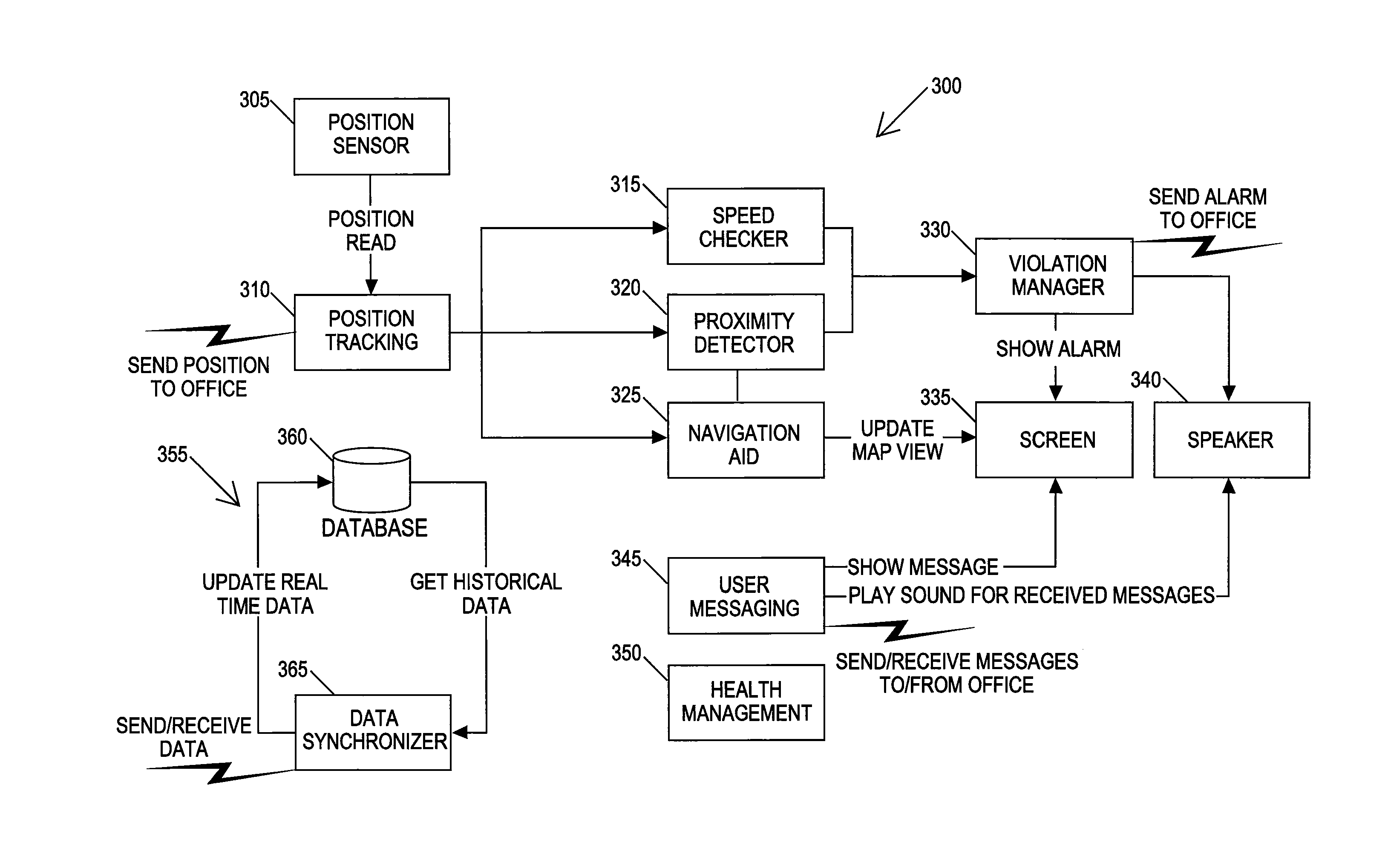
The invention is a navigation and hazard avoidance system that allows users to define features in a geographical information systems database and import overhead imaging data corresponding to a geographical area in which the features are defined. The system also includes a position sensor, a position tracker, a navigation aid, a violation manager, and a communication link for exchanging data between the central application and the remote application. The technical effects of the invention include improved navigation and hazard avoidance capabilities for remote vehicles.

Problems solved by technology

First, the allowable routes for navigation in a mining environment are constantly changing.
Routes in a mining environment, on the other hand, may not be obvious as they can be ad hoc, constantly shifting, and are often destroyed in the course of day-to-day material removal operations.

Method used


Image

  • Method and system for GPS based navigation and hazard avoidance in a mining environment
  • Method and system for GPS based navigation and hazard avoidance in a mining environment
  • Method and system for GPS based navigation and hazard avoidance in a mining environment

Examples


Embodiment Construction

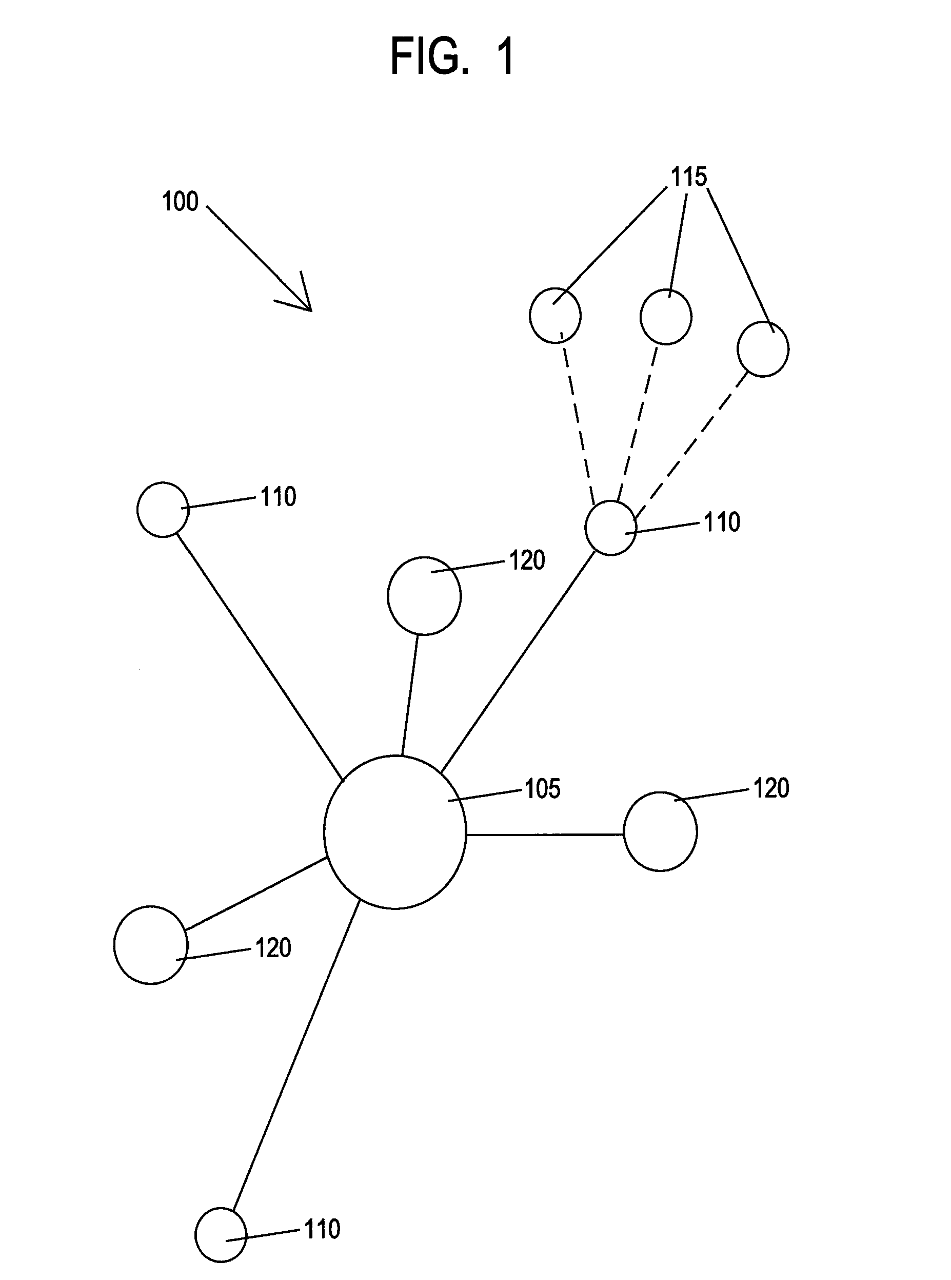
[0022]FIG. 1 shows a network 100 of functional nodes arranged according to the invention. A central node 105 is arranged to communicate with remote mobile nodes 110 and remote semi-static nodes 120. The central node 105 includes an application that runs at least partially on central physically stationary computer. The central node 105 may also optionally include certain functions such as processing or storage that are distributed among multiple computers that communicate as part of a local, wide area or global network.

[0023]The mobile nodes 110 include applications that run on computers or other data processing devices located in vehicles, for example light vehicles that can be found in a mining environment such as pickup trucks. The applications included in the mobile nodes 110 are optionally included in a personal data assistant (“PDA”) accessible by the driver of a vehicle, but can also be included in a laptop, smart phone, or other programmable data device. The mobile nodes 110 ...


PUM


Abstract

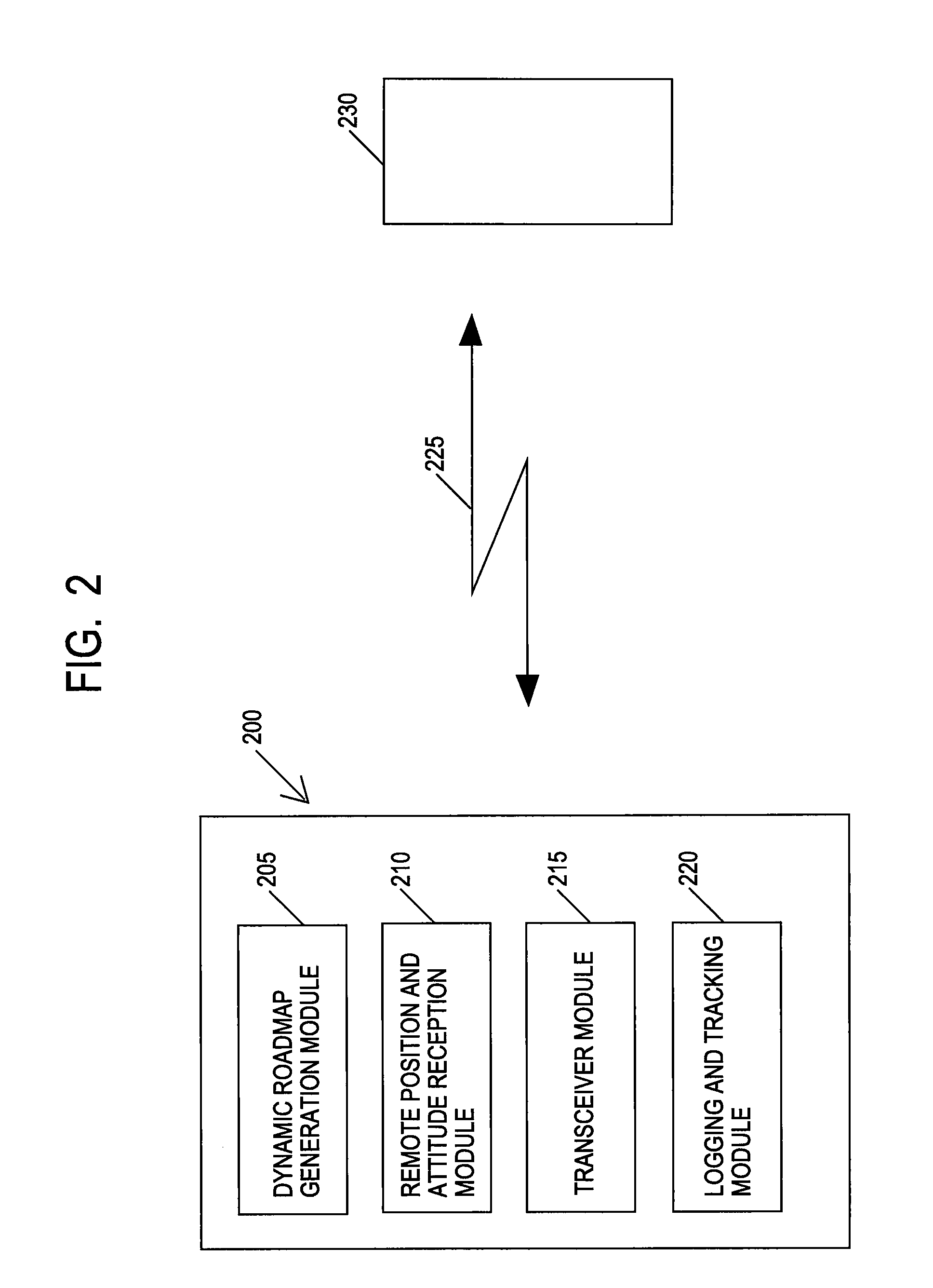
A system and method for GPS based navigation and hazard avoidance in a mining environment are described. The system includes a central application that has a dynamic roadmap definition module adapted to at least allow a user to arbitrarily define features in a geographical information systems database and import overhead imaging data corresponding to a geographical area in which said features are defined. The central application includes a remote position and attitude reception module adapted to at least receive data concerning the position of at least one remote vehicle, a transceiver module adapted for exchanging data with at least one remote vehicle; and a logging and tracking module adapted for at least logging said position of at least one remote vehicle over time. The system also has a remote application; and a communications link adapted for exchanging data between the central application and the remote application.

Description

BACKGROUND OF THE INVENTION[0001]The invention relates to global positioning system (“GPS”) based systems for controlling the navigation of vehicles in a mining environment.[0002]Mining environments, and open pit mining environments in particular, are characterized by two features that are significant to navigation. First, the allowable routes for navigation in a mining environment are constantly changing. Equipment is routed into and out of the mining environment along different routes that can change on a daily or even an hourly basis depending on where material is being removed at a particular time. The location of allowable routes, whether the routes are one-way or two-way, the day-to-day existence of ramps to allow passage from one mining level to another, and whether a particular area is open or closed all change rapidly on the basis of mine operations. Adding to the challenge of navigating in the dynamic mining environment is the fact that there may be few physical visual cue...

Claims


Application Information

Patent Timeline
Patent Type & Authority Patents(United States)
IPC IPC(8): G01C21/34
CPCG01S19/14G01C21/20
Inventor ROTTIG, ANDREEREARTE, MARIO LEONELANDRADE, PAULO ROGERIO
Owner MODULAR MINING SYSTEMS
Learn More