Eureka AIR delivers breakthrough ideas for toughest innovation challenges, trusted by R&D personnel around the world.

Adaptive and personalized navigation system

a navigation system and adaptive technology, applied in the field of navigation systems, can solve the problems of system failure to consider changes over time, many conventional navigation systems are not adaptive, and still not sufficiently adaptive, so as to reduce instabilities in the system, improve route-finding, and accurately predict travel times

Active Publication Date: 2009-03-31
GOOGLE LLC
View PDF17 Cites 201 Cited by
  • Summary
  • Abstract
  • Description
  • Claims
  • Application Information

AI Technical Summary

Benefits of technology

The present invention provides a method and system for generating directions for use in navigation during a current driving session. The method involves receiving a route request from a user, generating a set of candidate routes, computing a score for each candidate route based on attribute models learned from previous user driving sessions, and providing at least one scored route to the user. The attribute models include conditional variant models that determine the likelihood of a particular attribute being observed during a driving session. The system includes one or more machine-readable media encoded with instructions for carrying out the method. The technical effects of the invention include improving the efficiency and accuracy of navigation during driving sessions by providing relevant directions based on the user's current location and driving preferences.

Problems solved by technology

Such navigation systems, while helpful, are associated with a number of problems.
One such problem is that many conventional navigation systems are not adaptive, and continue to make the same mistakes or otherwise provide undesirable directions repeatedly.
Although such navigation systems provide additional driver support, they are still not sufficiently adaptive.
For instance, such systems fail to consider changes over time (e.g., rush-hour vs. weekend) and under different conditions (e.g., when road is under construction, different weather conditions, driver is in a hurry, local stadium event just ended, etc).
In addition, conventional systems fail to consider multiple route attributes simultaneously; nor do they consider multiple conditions.
In addition, while such aggregated systems provide representative coverage, they fail to consider the relevance of personal driving history (e.g., the extent to which the individual driver departs from the mean in terms of driving style, preferences, and road knowledge).

Method used


Image

  • Adaptive and personalized navigation system
  • Adaptive and personalized navigation system
  • Adaptive and personalized navigation system

Examples


Embodiment Construction

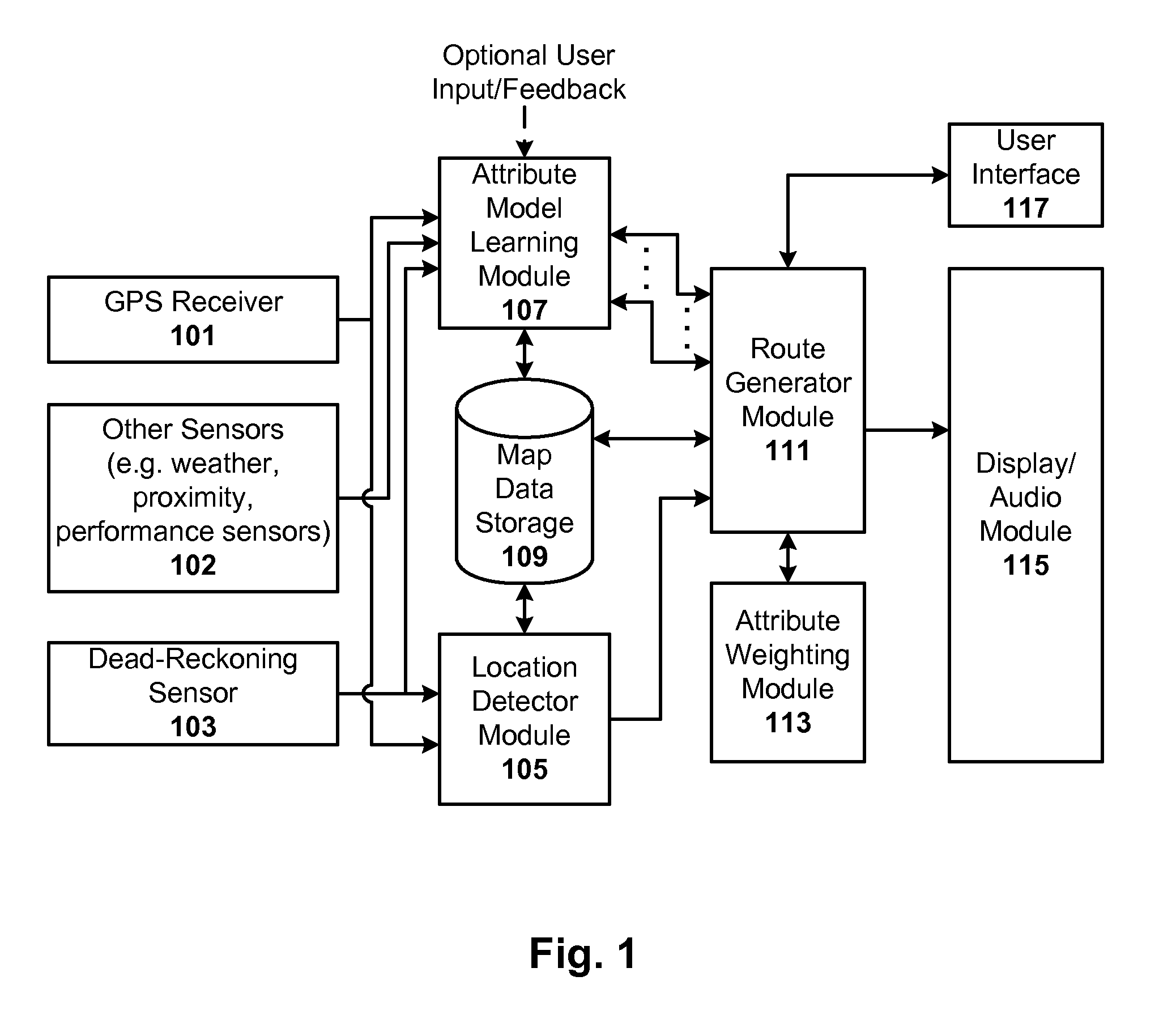
[0016]Navigation techniques are disclosed that are adaptive to changes over time and changes under other conditions, and personalized to an individual's driving style, preferences, and road knowledge. The techniques can optionally be used in conjunction with data aggregated from multiple users to provide benefits of both individual and group based data, if so desired.

[0017]General Overview

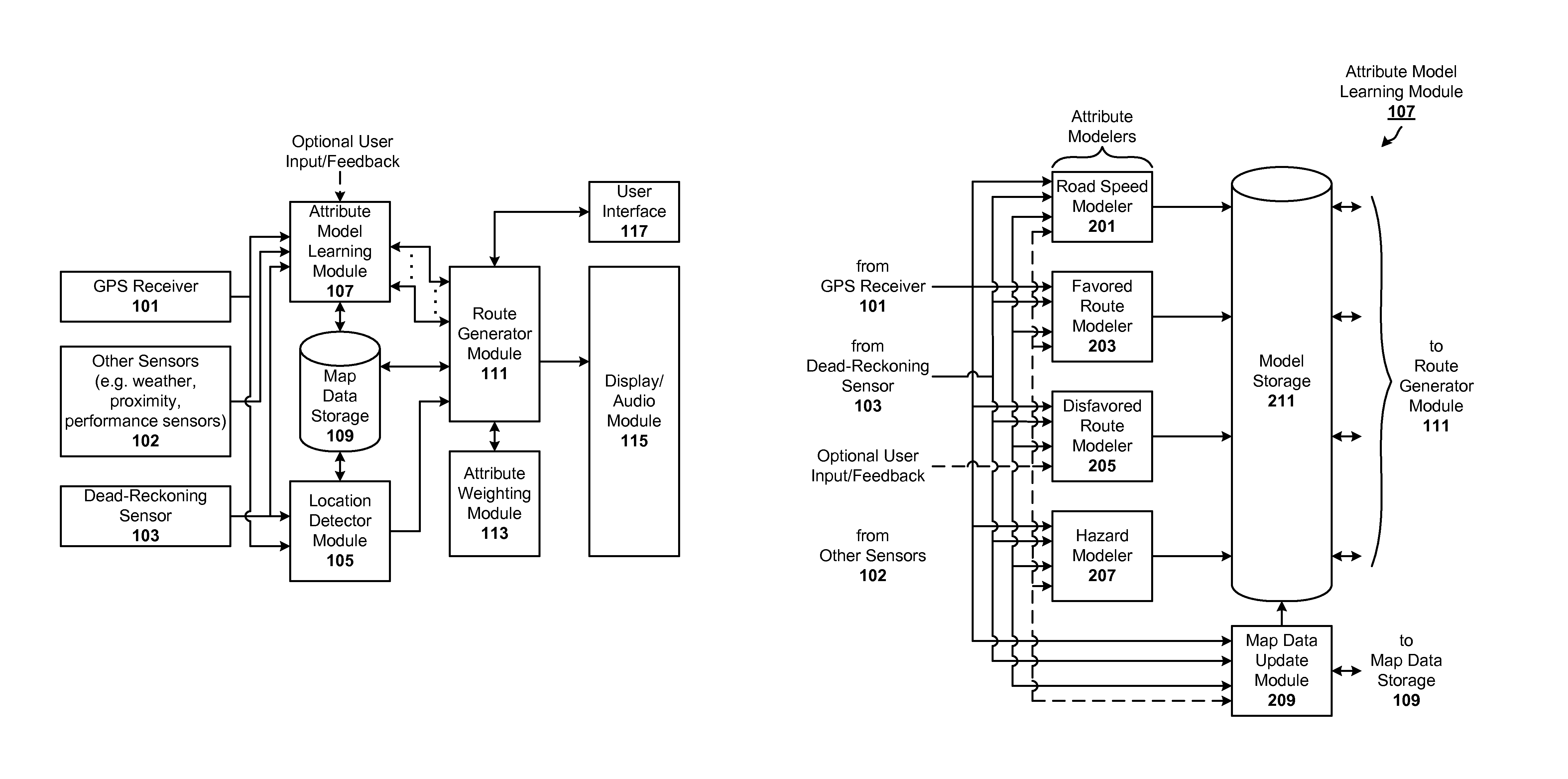
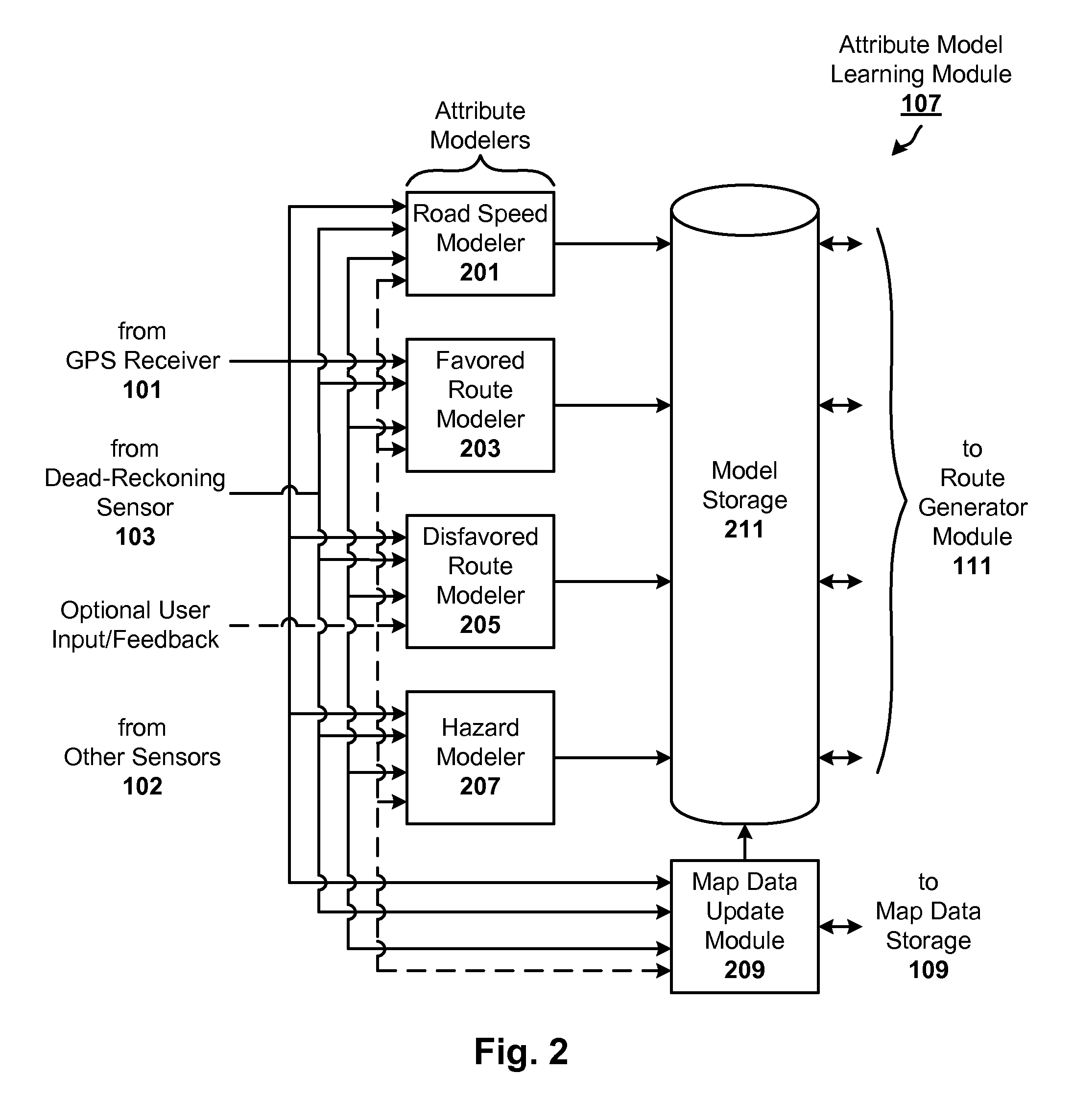
[0018]As a user drives, modelers are employed to develop and maintain attribute models, which effectively capture the driver's personal driving habits and preferences. Example models include road speed models, hazard models, favored route models, and disfavored route models. Other attributes associated with user's driving experiences can be modeled as well, whether based on the user's personal driving data or driving data aggregated from a number of users. In one particular embodiment, each of the modelers is configured to learn not just one model for an attribute, but rather a plurality of alterna...


PUM


Abstract

Adaptive navigation techniques are disclosed that allow navigation systems to learn from a user's personal driving history. As a user drives, models are developed and maintained to learn or otherwise capture the driver's personal driving habits and preferences. Example models include road speed, hazard, favored route, and disfavored route models. Other attributes can be used as well, whether based on the user's personal driving data or driving data aggregated from a number of users. The models can be learned under explicit conditions (e.g., time of day / week, driver ID) and / or under implicit conditions (e.g., weather, drivers urgency, as inferred from sensor data). Thus, models for a plurality of attributes can be learned, as well as one or more models for each attribute under a plurality of conditions. Attributes can be weighted according to user preference. The attribute weights and / or models can be used in selecting a best route for user.

Description

RELATED APPLICATIONS[0001]This application is related to U.S. application Ser. No. 11 / 556,128, filed Nov. 2, 2006, titled “Generating Attribute Models for Use in Adaptive Navigation Systems”, which is herein incorporated in its entirety by reference.FIELD OF THE INVENTION[0002]The invention relates to navigation systems, and more particularly, to an adaptive navigation system that learns from a user's driving history.BACKGROUND OF THE INVENTION[0003]Vehicle navigation systems typically use position data from a global positioning system (GPS) system to determine a vehicle's location. Such systems also may include additional sensors such as an odometer or gyroscope to provide dead-reckoning navigation when GPS signals are lacking. In operation, the driver inputs a destination address into the vehicle's navigation system. The navigation system will then calculate the position of the vehicle and the route to be traveled, and guide the driver to that destination, using audible and visual...

Claims


Application Information

Patent Timeline
Patent Type & Authority Patents(United States)
IPC IPC(8): G01C21/00G01C21/30
CPCG01C21/3484G01C21/36G01C21/3492
Inventor GOLDING, ANDREW R.RASMUSSEN, JENS EILSTRUP
Owner GOOGLE LLC
Why Eureka
Eureka Blog
Learn More