Method of determining structural damage using positive and negative tree proximity factors
- Summary
- Abstract
- Description
- Claims
- Application Information
AI Technical Summary
Benefits of technology
Problems solved by technology
Method used
Image
Examples
example 1
[0118]FIG. 6A is a graph showing the relationship between the Tree Proximity Score of the present disclosure and Wind Loss Frequency as well as Wind Loss Ratio and FIG. 6B is a table showing correlation coefficients between the Tree Proximity Score and Wind Loss Frequency and Tree Proximity Score and Wind Loss Ratio. As shown in the table of FIG. 6B, the correlation coefficient between Tree Proximity Score and Wind Loss Frequency was 0.964 and the correlation coefficient between Tree Proximity Score and Wind Loss Ratio was 0.977. However, other embodiments of the present disclosure may have correlation coefficients representing the relationship between the Tree Proximity Score and Wind Loss Frequency and Tree Proximity Score and Wind Loss Ratio of at least 0.50 up to 1.00, including at least 0.55, 0.60, 0.65, 0.70, 0.75, 0.80, 0.85, 0.90, 0.91, 0.92, 0.93, 0.94, 0.95, 0.96, 0.97, 0.98, and 0.99.
example 2
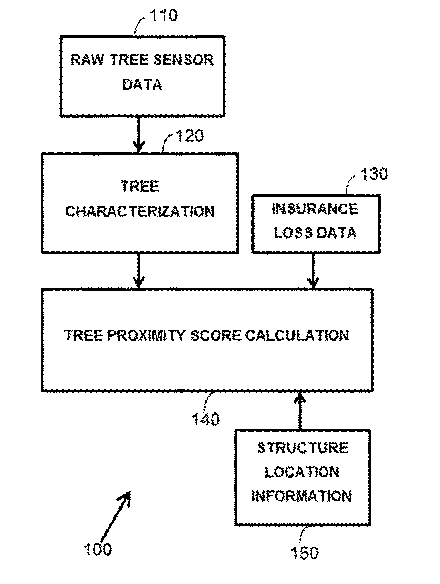
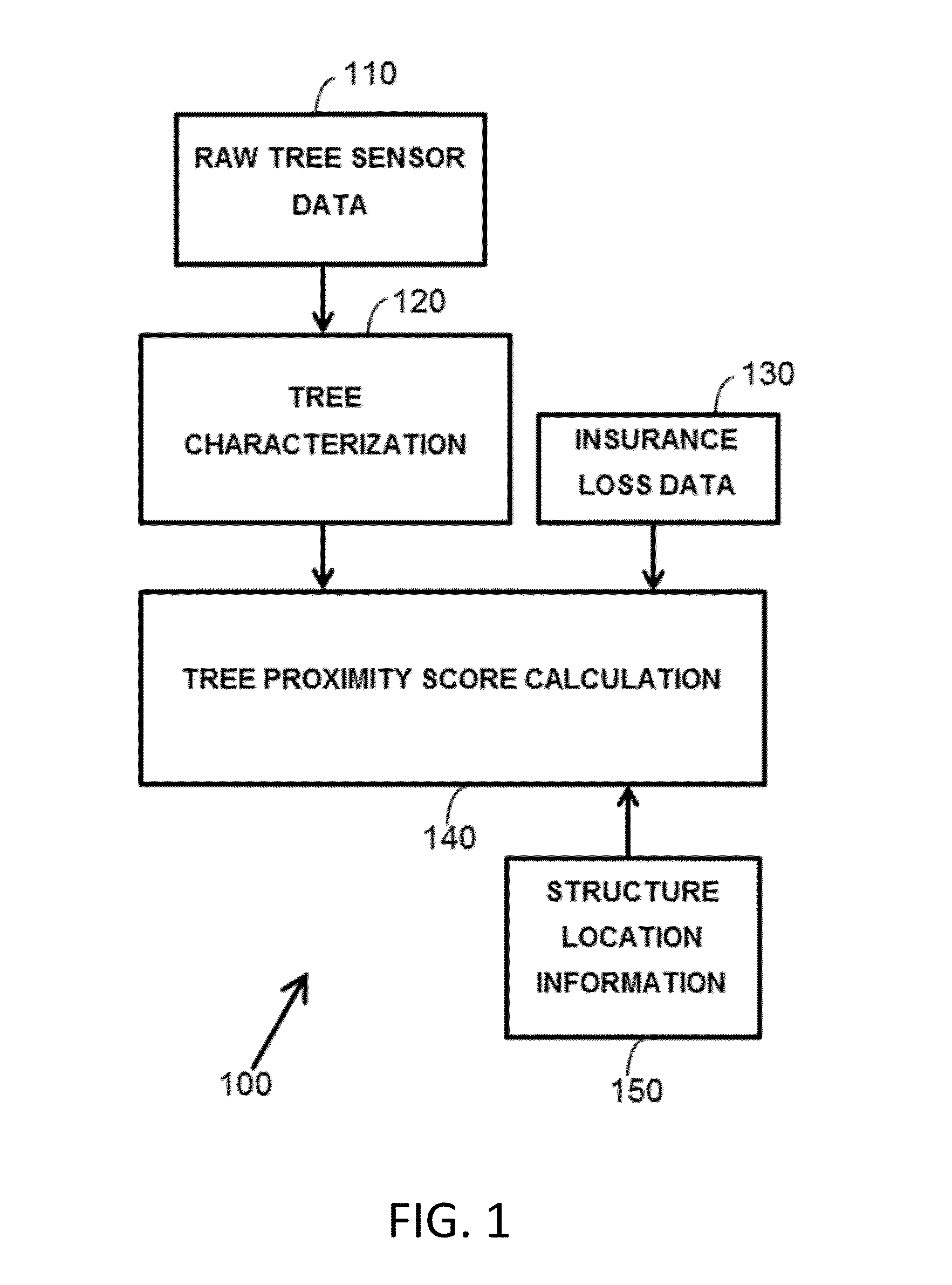
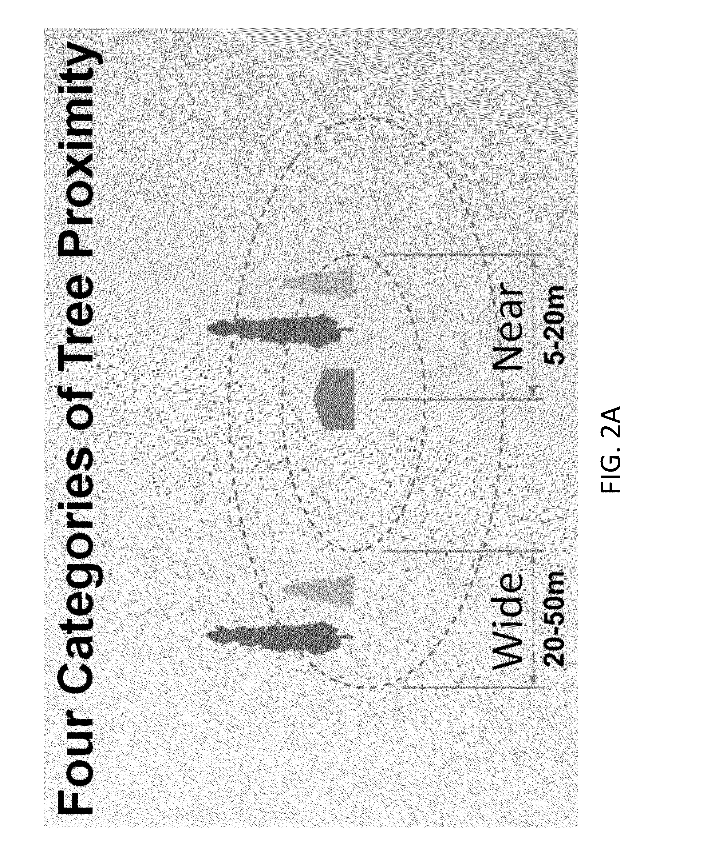
[0119]An end user such as an insurance agent or adjuster uses a client computer to send an address over a network such as the internet to a server connected to or including a processor and memory of this disclosure. The processor then geocodes that address to a latitude and longitude, calculates a Tree Proximity Score for that latitude and longitude according to the computer executable instructions, satellite or aerial imagery for that latitude and longitude, and insurance data stored in the memory, and transmits the Tree Proximity Score through the server over the network to the client computer.
example 3
[0120]An end user such as an insurance agent or adjuster uses a client computer to send geospatial coordinates (a point or a polygon) over a network such as the internet to a server connected to or including a processor and memory of this disclosure. The processor then calculates the Tree Proximity Score for those geospatial coordinates according to the computer executable instructions, satellite or aerial imagery for those geospatial coordinates, and insurance data stored in the memory, and transmits the Tree Proximity Score through the server over the network to the client computer. For polygons, the processor runs the radius from the edges of the polygon.
[0121]The above examples 2 and 3 could be performed on-demand to get a score in less than a second on an individual location, or in batch to get results on millions of properties within a day or two. The score may be calculated in direct response to the query or returned from a memory from a previously calculated value.
PUM
 Abstract
Description
Claims
Application Information
 - R&D
- Intellectual Property
- Life Sciences
- Materials
- Tech Scout
- Unparalleled Data Quality
- Higher Quality Content
- 60% Fewer Hallucinations
Browse by: Latest US Patents, China's latest patents, Technical Efficacy Thesaurus, Application Domain, Technology Topic, Popular Technical Reports.
© 2025 PatSnap. All rights reserved.Legal|Privacy policy|Modern Slavery Act Transparency Statement|Sitemap|About US| Contact US: help@patsnap.com


