
Mobile geolocation

a mobile communication unit and geolocation technology, applied in the field of mobile geolocation, can solve the problems of inability to accurately calculate the received power as a function of distance, inability to accurately calculate the received power, and inability to use differential power techniques

Active Publication Date: 2013-08-15
VIAVI SOLUTIONS UK
View PDF6 Cites 56 Cited by
  • Summary
  • Abstract
  • Description
  • Claims
  • Application Information

AI Technical Summary

Benefits of technology

The invention described in this patent preserves the context of each piece of information, which allows for the creation of signatures with higher dimensions. These dimensions can then be used for estimating the location of a mobile communication unit. This is useful in situations where the unit reports pilot signals from multiple base stations. The "technical effect" is improved accuracy in locating mobile units.

Problems solved by technology

However, both the shape and extent of the coverage areas of a typical base station depend on many variables, and may change with time.
However, power measurements in event-driven technologies, such as LTE, can be relatively infrequent.
However, differential power techniques can be limited in scenarios where there are few pilots to make use of.
a) Received power levels at a receiver vary as a function of location within a network. Generally, the exact calculation of received power as a function of distance is not possible. This due to factors whose magnitude is unknown a priori. Examples of such factors are the rate at which the power level attenuates with distance, and the attenuation of power at a reference distance. Additional attenuation may arise as a consequence of the mobile communication unit being in-car or in-building. More than half of all calls are made within buildings or vehicles.
b) Timing Advance is not a direct measure of distance. Its use is primarily for synchronisation of communication channels. As such its value depends not only on distance, but also on various effects such as multi-path fading, hardware timing delays and such like. Hardware timing delays may be in the base station, or in a repeater in the cable from the antenna. If so, they are usually inaccessible, and hence may only be known to the infrastructure operator. However, some equipment allows the delays to be programmable, and hence both controllable and known. Timing advance is a coarse measure, each unit of timing advance corresponding to a distance of ˜553 metres in GSM. Timing advance is however more precise in LTE, due to the higher symbol rate. It may be less than 100 metres in LTE.
c) Power measurements in event-driven technologies such as LTE can be relatively infrequent. This has caused prior art approaches often to focus on making use of alternate sources of information.
d) Other control information (peak burst rate, dynamic rate control information, timing advance information) can vary as a function of location within the network.
e) The set of observed cells varies as a function of location within the network.
f) GPS information is only provided infrequently by mobile stations, even with the proliferation of GPS chipsets in mobile devices. As little as one call in ten-thousand might report a GPS coordinate.

Method used


Image

  • Mobile geolocation
  • Mobile geolocation
  • Mobile geolocation

Examples


Embodiment Construction

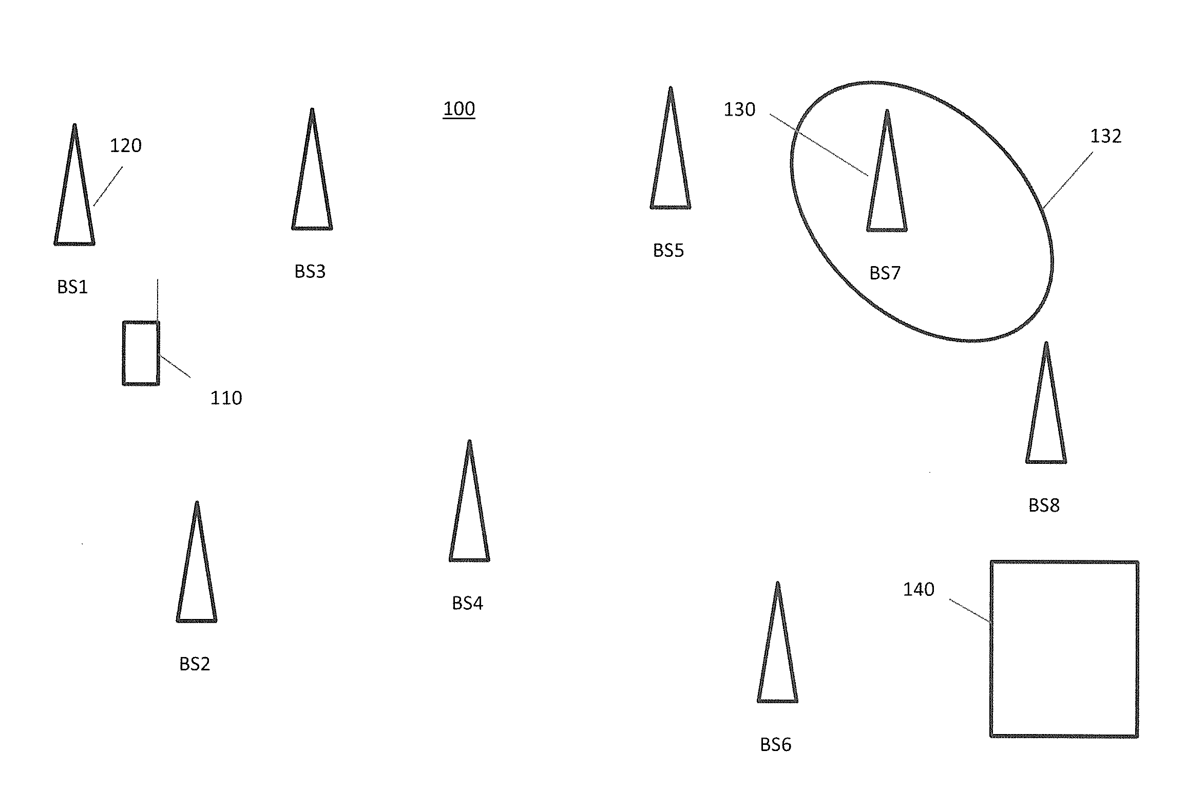
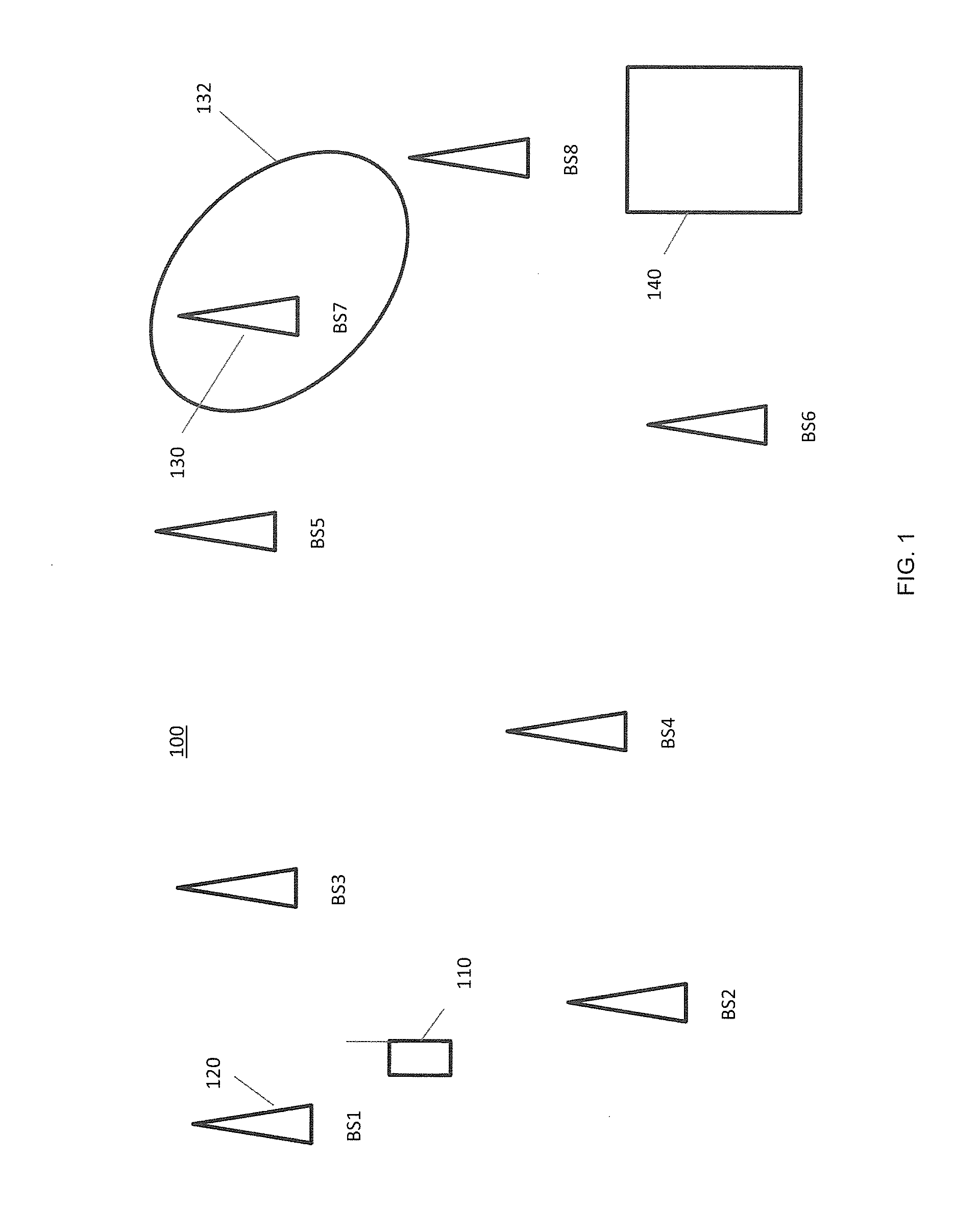
[0035]A cellular wireless communications system is provided. The cellular wireless communication system may, for example, operate in accordance with the GSM, UMTS or LTE standards. The cellular wireless communications system comprises network nodes and mobile communication units. Each network node supports communications with mobile communication units in cell.

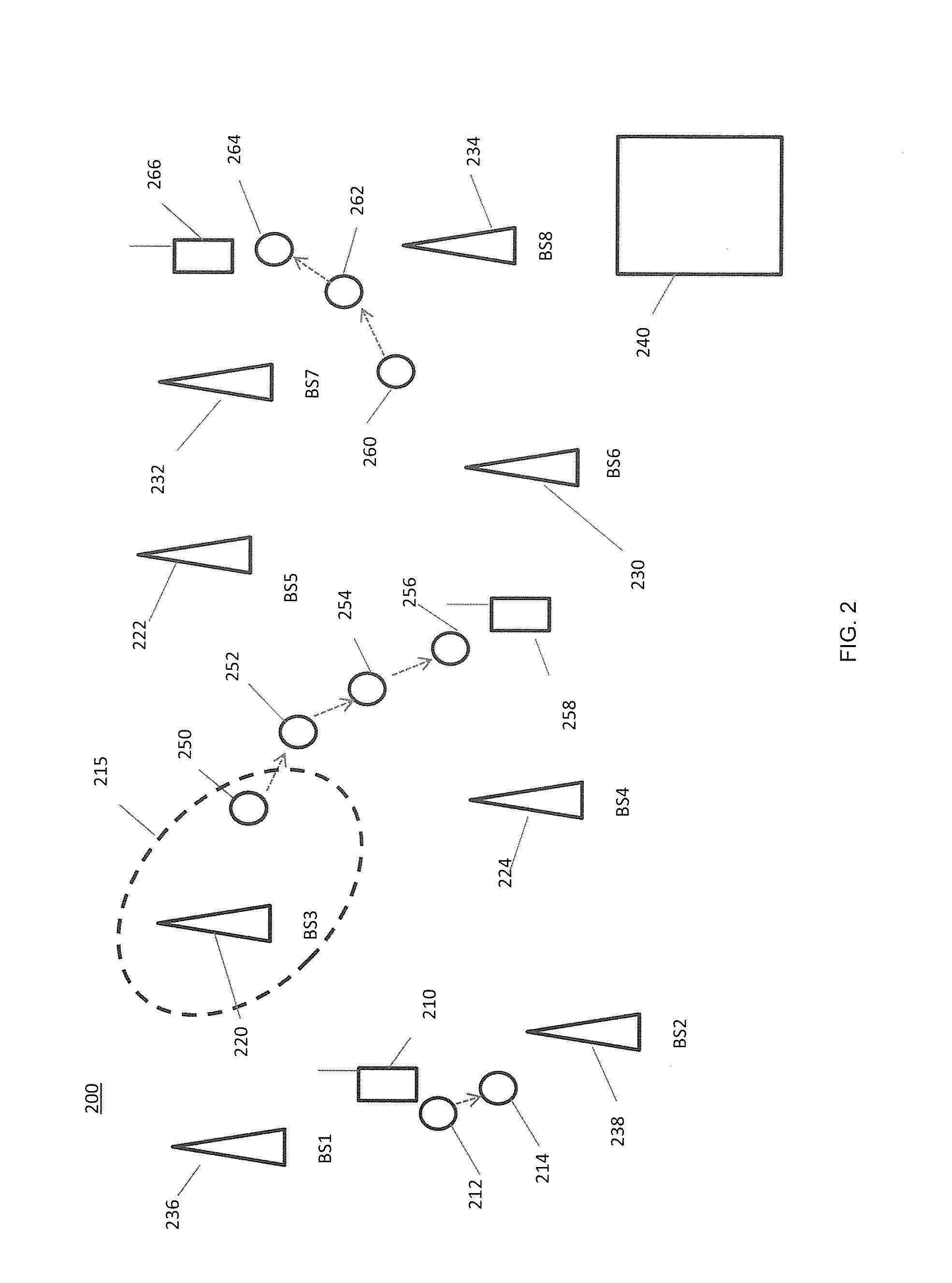
[0036]A method of estimating a location of a mobile communication unit in the cellular wireless communications system comprises compiling a first signature, for signals received by a mobile communication unit at a first point in time. The first signature comprises: control information; a set of cells, the set of cells being cells observable by the mobile communication unit; and received power level information, for signals received from the observable cells. A particular known signature is then selected from known signatures entered in a database, by comparing the first signature with known signatures entered in a database. Th...


PUM


Abstract

Estimating a location of a first mobile communication unit (220) in a cellular wireless communications system (200) comprises comparing a first signature from the first mobile communication unit with known signatures. The first signature may comprise control information, a set of observable cells and received power level information for the first mobile communication unit (220). A location estimate is provided from the known location of a known signature in a database (410), if that known signature matches the first signature. The comparison may be a correlation to determine the degree of matching. Context information may link two or more known signatures in the database (410), the known signatures having been obtained in temporal succession from one mobile device (258) in use in the system. The context information may be used in the comparison.

Description

FIELD OF THE INVENTION[0001]The field of the invention relates to a system and method for geolocating mobile communication units, in a mobile communications system.BACKGROUND OF THE INVENTION[0002]Wireless communication systems, such as GSM and the 3rd Generation (3G) of mobile telephone standards and technology, are well known. An example of 3G standards and technology is the Universal Mobile Telecommunications System (UMTS™), developed by the 3rd Generation Partnership Project (3GPP™) (www.3gpp.org).[0003]The 3rd and 4th generations of wireless communications, and in particular systems such as LTE, have generally been developed to support macro-cell mobile phone communications. Here the ‘phone’ may be a smart phone, or another mobile or portable communication unit that is linked wirelessly to a network through which calls are connected. Henceforth all these devices will be referred to as mobile communication units. ‘Calls’ may be data, video, or voice calls, or a combination of th...

Claims


Application Information

Patent Timeline
Patent Type & Authority Applications(United States)
IPC IPC(8): H04W24/00
CPCH04W64/00G01S5/0252G01S5/02521
Inventor FLANAGAN, MICHAEL JOSEPH
Owner VIAVI SOLUTIONS UK
Learn More