[0014]The present invention provides a true scale, coordinate matched, linked in real time, dual three-dimensional / two-dimensional visual display (viewer). The combined, simultaneous and real-time visual display of the present invention can be used to effectively assess risks, define safe and kill zones, visualize critical assets, alarms and sensor, hazards and true scale structural / architectural details for interior and / or external structural scenes. By combining 3D and 2D displays in a synchronized, coordinate-linked, true scale visual display, contextual location and spatial data are no longer mutually exclusive. Rather the combined 3D / 2D display uses scale information embedded in the header of an image to enable a user to attain real time information that can be manipulated simultaneously in 3D and 2D provides a unique state of situational awareness and intelligence of the environment being viewed. The simultaneous display of the 3D and 2D views are independent of 3D and 2D window placement or size, fixed or floating.
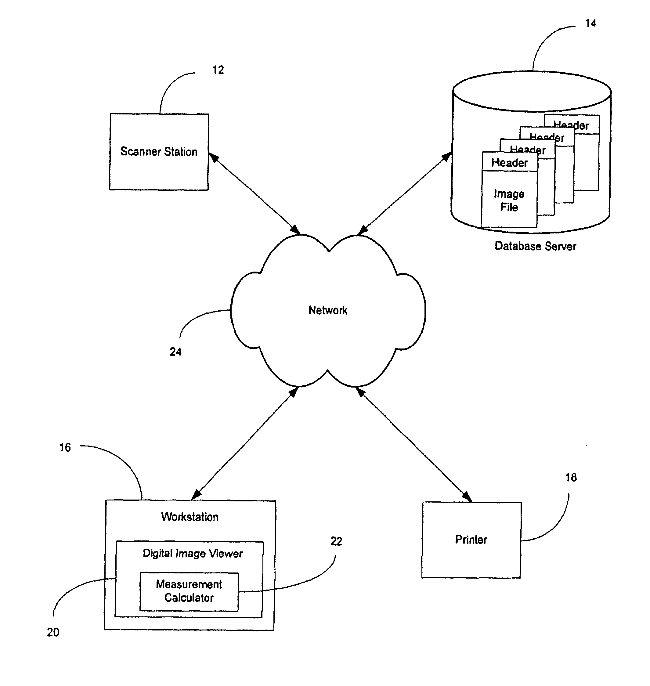
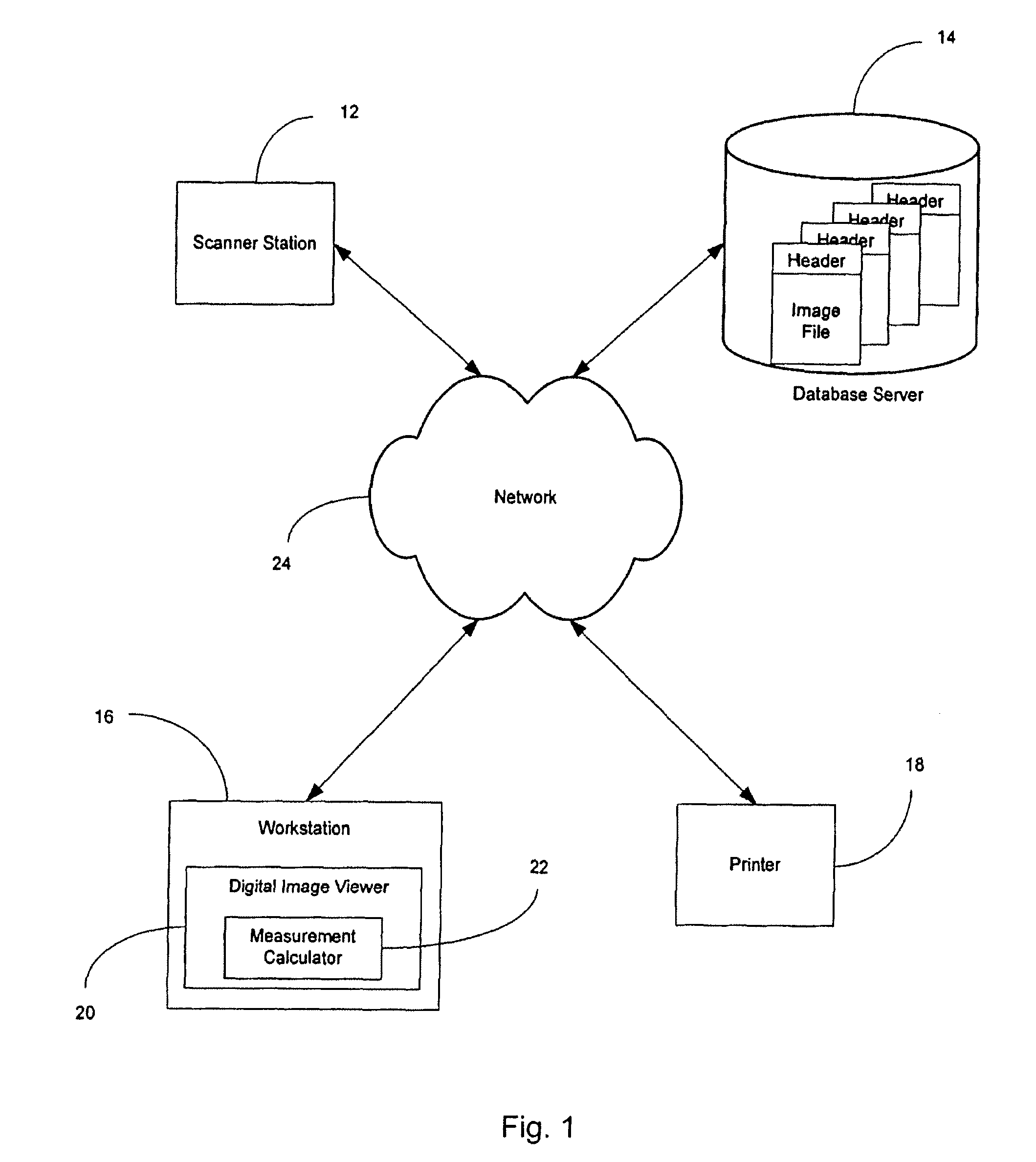
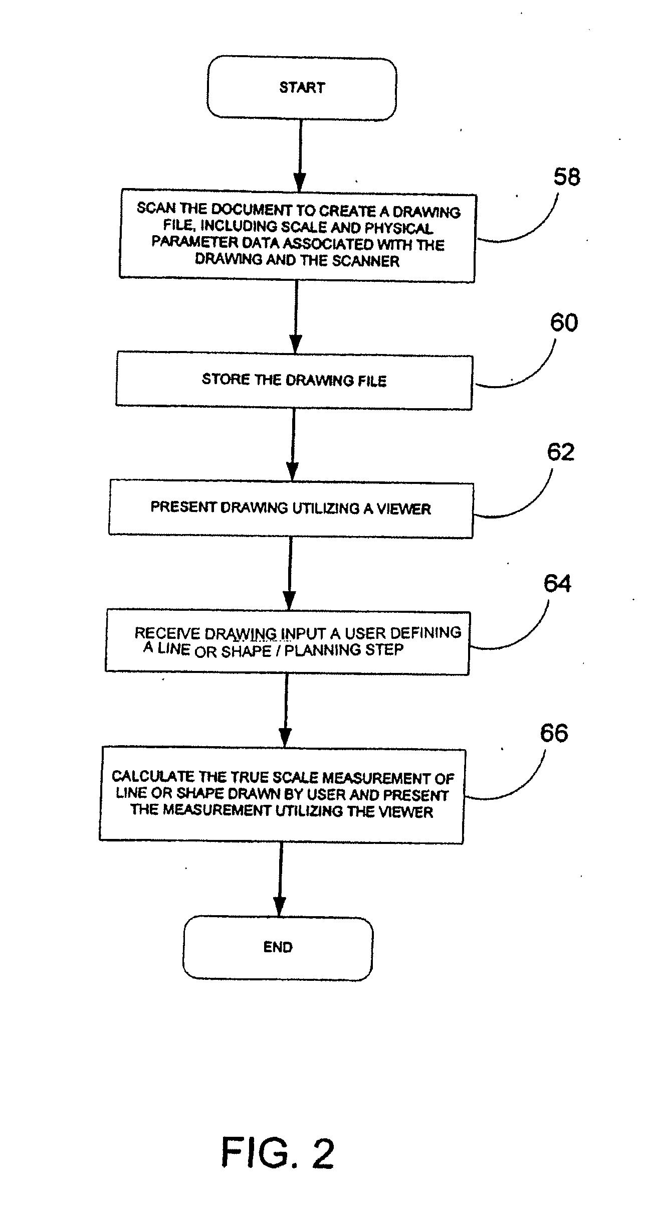
[0018]When viewing the TIFF image, a user can use the drawing tools that are a part of the viewer to draw a line or shape. The locations of the pixels that define the line or shape are captured by the viewer for use with the header data to calculate the true scale measured length of the line. As mentioned above, the present invention provides for the measurement of lengths (for both lines and polylines) and areas (for both regular shapes as well as irregular shapes, such as rectangles, polygons and inverse polygons). Other tools employed with the TIFF image include a Find Shortest Path tool that in part uses the embedded scale information in the TIFF header to calculate the shortest, fastest path between two user chosen or dynamically updated points marked on the 2D map or in the 3D rendering, the Find Shortest Path tool can also calculate and simultaneously display multiple routes between two user chosen or dynamically updated points e.g. the Primary (shortest) route, the Secondary (next shortest) route, and Tertiary (optional) route to allow for advanced contingency planning, a barrier tool that allows discreet pathways and entry / exit points to be manually or automatically marked as impassable, stairwells to be marked for attack or evacuation, and have those dynamic details trigger a recalculation of the shortest path. The 3D Record Path tool records a path navigated on a 3D window and simultaneously maps the path on the 2D display pane. Upon playback a Door Detection Tool automatically tabulates environmentally orientated doorways and passageways along an allotted path as a critical aid to emergency and response personnel operating in adverse conditions such as dark and smoked filled environments. Generated path can be stored and embedded in the digital file to facilitate planning, preparedness, simulated evacuations, and enhanced training.
[0021]The scale plans are useful to the public and emergency personnel for planning ingress and egress routes both before and during an emergency. To prepare for possible emergencies, building tenants or management can use the disclosed system to determine pre-arranged routes for entering and exiting the building while viewing such detail simultaneously in 3D and 2D. When an emergency occurs, emergency personnel can use the invention's dynamic searching and delivery capabilities to determine, in real time the routes to emergency exits. The system also allows emergency personnel to determine multiple routes presented in a hierarchical shortest to longest format to and from a specific building location or area, and allows them to access or block specific portions of the building in both 3D and 2D. The system allows the routes to be determined across multiple stories of a building, taking into consideration all human transportation infrastructures, e.g. building stairwells, and even from the exterior of a structure to any accessible location on any floor of a structure.
[0022]The current invention facilitates point-to-point routing within a structure, allowing personnel to identify exact measured routes for reaching a specific location. Emergency personnel will know how to get from point A to point B, and the exact distance they must travel along the route. For example, when a building is engulfed in smoke, fire personnel cannot see and must rely on other means to assess where they need to go. Utilizing this system, firefighters will know exactly how far to go in any given direction to reach a location. Similarly, in stadiums and arenas, security can utilize the disclosed system to pinpoint problem areas and address security situations that may arise. Both emergency personnel and tenants or other people in the building will be able to determine the location of emergency exits and routes to the exits. Various routes to emergency exits can be determined in real time using dynamic searching.
[0023]The invention can deliver the scale plan information in at least three ways. First, in one embodiment, the invention displays the information on a computer monitor screen or display device and allows users to pick selected points or areas using a pointing device, such as a mouse, stylus or other user directed selection device. Second, the invention can display the information on hand-held devices that personnel can carry. Third, the system can use a heads-up display, which displays the relevant information in a user's line of sight. Using the invention in this manner would aid firefighters who often work in situations involving reduced visibility. With the invention, a firefighter walking in darkness can view a heads-up display that details any needed information, including current location and routes to a desired destination.
[0024]At last, simultaneously 3D and 2D, to-scale displays can be used so that a planning board or planning personnel can determine access routes as well as containment strategies or other strategies. Utilizing the disclosed system, pre-arranged routes can be developed by building tenants or building management to determine ingress and egress routes which can increase fire safety preparedness, effectively for fire drills and training. Further, for stadiums, arenas, and the like, security can utilize the disclosed system to pinpoint problem areas and determine solutions to various security situations that may arise.