GNSS position coasting
a technology of global navigation satellite system and position coasting, applied in satellite radio beaconing, measurement devices, instruments, etc., can solve the problems of significant error in estimated rover position, incurring delay, and inability to run the full weighted-average solution
- Summary
- Abstract
- Description
- Claims
- Application Information
AI Technical Summary
Benefits of technology
Problems solved by technology
Method used
Image
Examples
Embodiment Construction
Part 1: Moving Base Concepts
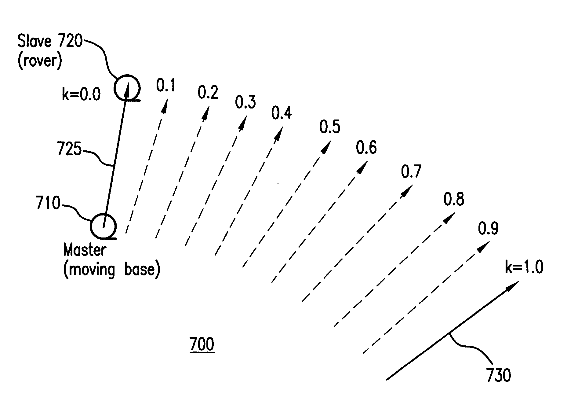
[0056]An important machine control application of RTK GNSS is the precise positioning of the blade cutting edge of graders, bulldozers, excavators and scrapers. For example, the Trimble MS990 system is an integrated GNSS receiver / antenna which can be mounted on masts located at either end of the cutting blade. One of these is considered a “master” (moving base) and the other a “slave” (rover).
[0057]FIG. 6 shows in plan view an example 600 in which a master unit 605 (moving base) is located on the right side of a blade 610 of a bulldozer 615, and a slave unit 620 (rover) is located on the left side of the blade. The master unit 605 uses corrections from a fixed base receiver 625 to perform RTK positioning and thereby to determine the location of the right end of the blade 610 relative to the fixed base 625. The master unit 605 then transmits its RTK position plus GNSS carrier phase data, for example at 10 Hz, to the slave unit 620 mounted on the other end ...
PUM
 Abstract
Description
Claims
Application Information
 - R&D
- Intellectual Property
- Life Sciences
- Materials
- Tech Scout
- Unparalleled Data Quality
- Higher Quality Content
- 60% Fewer Hallucinations
Browse by: Latest US Patents, China's latest patents, Technical Efficacy Thesaurus, Application Domain, Technology Topic, Popular Technical Reports.
© 2025 PatSnap. All rights reserved.Legal|Privacy policy|Modern Slavery Act Transparency Statement|Sitemap|About US| Contact US: help@patsnap.com


