Best fit map searching
a map and best fit technology, applied in the field of best fit map search, can solve the problems of difficult to take in the displayed information, visual overlay and information loss, disorienting users, undesirable, etc., and achieve the effect of optimizing the display of maps, minimizing or avoiding graphical results
- Summary
- Abstract
- Description
- Claims
- Application Information
AI Technical Summary
Benefits of technology
Problems solved by technology
Method used
Image
Examples
examples
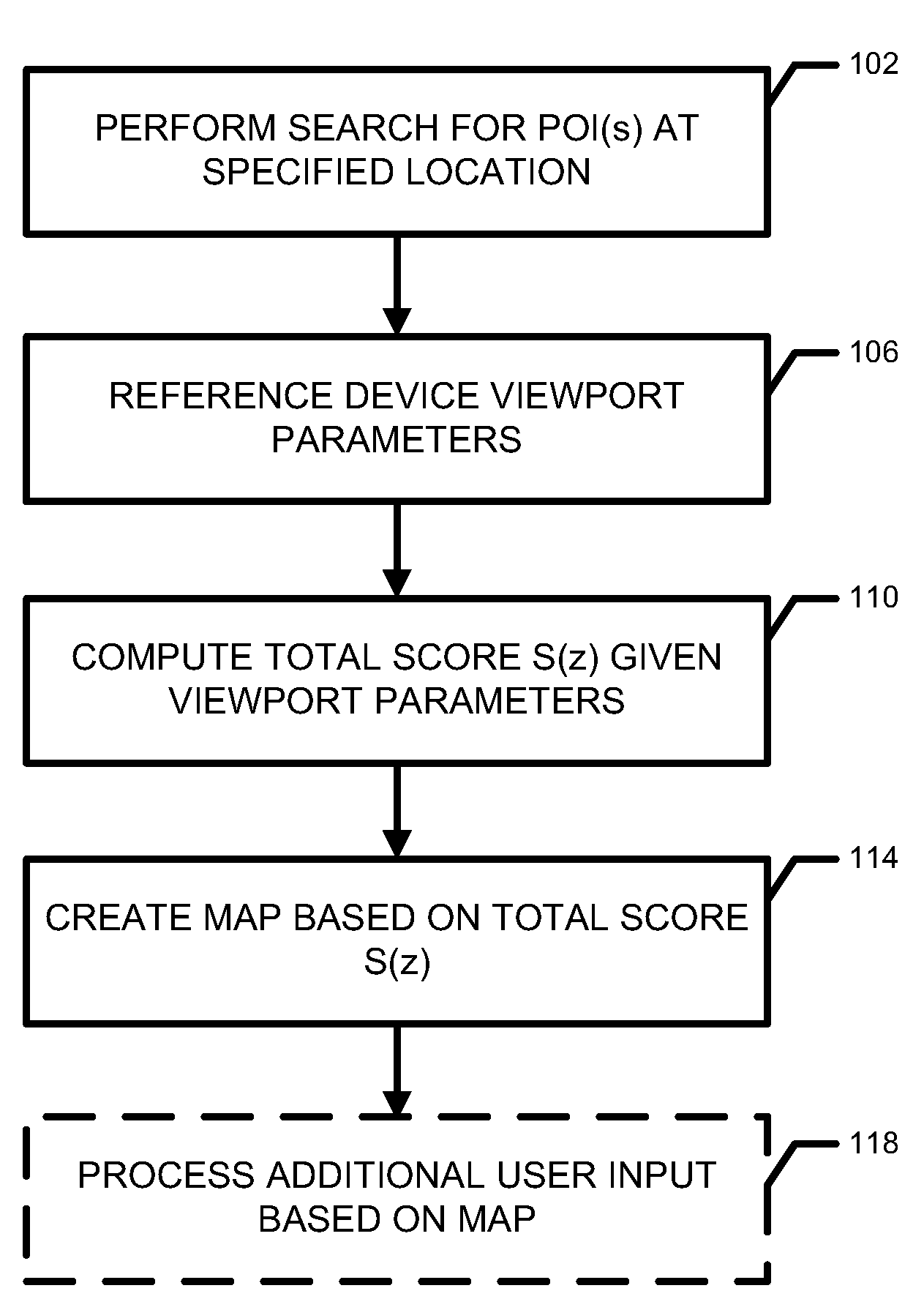
[0057]The tables in FIGS. 3A and 3B illustrate examples of the best fit technique as used in a search to determine the best fit for results of a search for sushi at a first location, and for a McDonalds at a second location, respectively. The score in the right hand column is the total score S(z), as shown in equation (1) above, reproduced below for convenience:
S(z)=((F1+ . . . +Fn)*V(z, Point[Pz])*G(z)) / n, (1)
[0058]For each zoom level 1-8 (9-17 not shown) G(z), one scoring function (F1) and V(z) are shown, along with the resulting total score S(z).
[0059]In FIG. 3A, the sushi search was done to find sushi at latitude / longitude 37.77916, −122.420067. Each of zoom levels 4 and 5 achieved a total score S(z) of 0.2, the highest of any of the levels. In this example, either level 4 or 5 would be used as the best fit for the particular search results. In other words, either of these levels would, at the original map center of latitude / longitude 37.77916, −122.420067, most clearly displa...
PUM
 Abstract
Description
Claims
Application Information
 - R&D
- Intellectual Property
- Life Sciences
- Materials
- Tech Scout
- Unparalleled Data Quality
- Higher Quality Content
- 60% Fewer Hallucinations
Browse by: Latest US Patents, China's latest patents, Technical Efficacy Thesaurus, Application Domain, Technology Topic, Popular Technical Reports.
© 2025 PatSnap. All rights reserved.Legal|Privacy policy|Modern Slavery Act Transparency Statement|Sitemap|About US| Contact US: help@patsnap.com


