
Method for Representing Linear Features in a Location Content Management System

a content management system and linear feature technology, applied in the field of location-based services, can solve the problems of not being suitable for representing linear features in the location content management system, the two representations of linear objects in the geographic database, links and strands, and becoming more difficult for map vendors to add third-party data to the geographic databas

Active Publication Date: 2010-08-05
HERE GLOBAL BV
View PDF20 Cites 18 Cited by
  • Summary
  • Abstract
  • Description
  • Claims
  • Application Information

AI Technical Summary

Problems solved by technology

As the amount of information stored in a geographic database increases, it becomes more difficult for the map vendor to add the third party data to the geographic database.
As a linear location code, like the point location code, necessarily remains outside a geographic database, the geographic database's two representations of linear objects, links and strands, are not suitable for representing linear features in the location content management system.
Links suffer from the problem of being split and merged due to attribution requirements, while strands suffer from the problem of being so tightly coupled to conditions that the strand can only be referenced by the condition.

Method used


Image

  • Method for Representing Linear Features in a Location Content Management System
  • Method for Representing Linear Features in a Location Content Management System
  • Method for Representing Linear Features in a Location Content Management System

Examples


Embodiment Construction

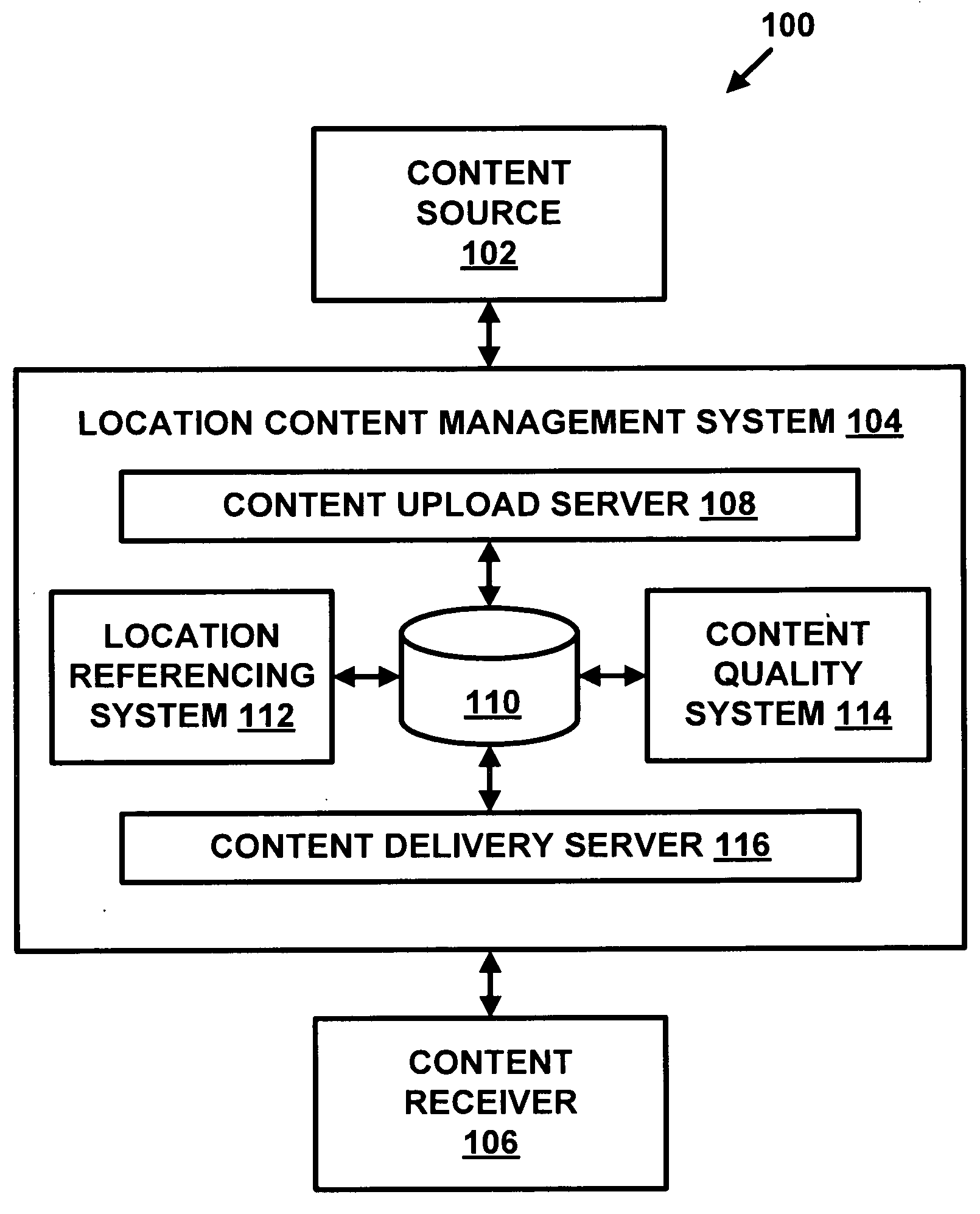
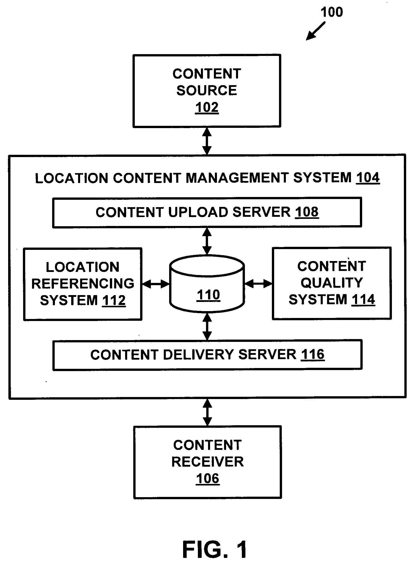
[0022]FIG. 1 is a block diagram showing a location-based system 100. The location-based system 100 includes a content source 102, a location content management system 104, and a content receiver 106. The location content management system 104 obtains content from the content source 102. The location content management system 104 provides content to the content receiver 106. In some situations, the content source 102 and the content receiver 106 may be the same entity.

[0023]The content is any information associated with a location. The information may be static content (i.e., does not change frequently), such as a street address, a telephone number, a fax number, and hours of operation. The information may be dynamic content (i.e., changes frequently), such as gas prices, weather reports, air travel status, and traffic reports. The information may be in any format, including text, two-dimensional images, three-dimensional images, video, multimedia, and so on.

[0024]The content source ...


PUM


Abstract

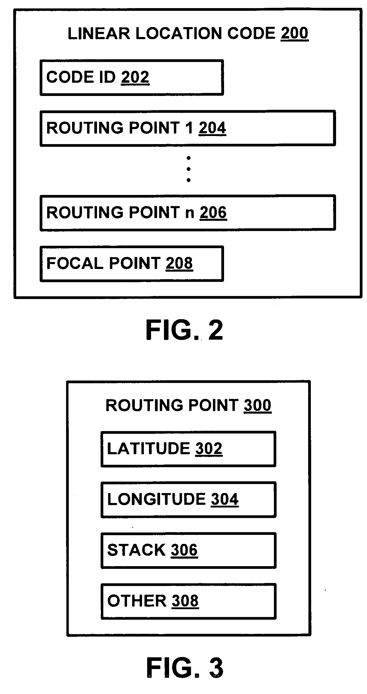
A method for representing linear features in a location content management system is disclosed. A linear feature is represented using a sequence of routing points that define a unique path when routed on a map through those points. A routing point consists of latitude, longitude, and optional stack position. Stack position defines an upper or lower level of a double-decker bridge or road. The data representing the linear feature is stored outside of a geographic database.

Description

REFERENCE TO RELATED APPLICATIONS[0001]The present patent application is related to the copending patent applications filed on the same date, Ser. No. ______, entitled “METHOD AND SYSTEM FOR ASSESSING QUALITY OF LOCATION CONTENT,” Attorney Docket No. N0258US; Ser. No. ______, entitled “METHOD AND SYSTEM FOR MANAGING RELATIONSHIPS BETWEEN LOCATION IDENTIFIERS,” Attorney Docket No. N0297US; Ser. No. ______, entitled “METHOD AND SYSTEM FOR REFRESHING LOCATION CODE DATA,” Attorney Docket No. N0300US; and Ser. No. ______, entitled “METHOD AND SYSTEM FOR EXCHANGING LOCATION CONTENT DATA IN DIFFERENT DATA FORMATS,” Attorney Docket No. N0302US.FIELD[0002]The present invention relates generally to location-based services, and more particularly, relates to how to represent a linear feature that does not rely on linear features stored in a geographic database.BACKGROUND[0003]Various technologies have been developed that provide navigation-related and map-related services. For example, vehicle ...

Claims


Application Information

Patent Timeline
IPC IPC(8): G01C21/36
CPCG09B29/007G01C21/32G01C21/3867G06F17/00G06Q50/10
Inventor PAINTER, JEFFREY E.SAMSALOVIC, VOJISLAV
Owner HERE GLOBAL BV
Learn More