
Computer-aided geologic investigation system based on portable machine

A computer-aided, geological survey technology, applied in the field of information processing and geo-information engineering, can solve the problems of small memory and poor graphics processing ability, and achieve the effect of improving efficiency and accuracy and being widely used.

Inactive Publication Date: 2006-04-19
CHINA UNIV OF GEOSCIENCES (WUHAN)
View PDF0 Cites 1 Cited by
  • Summary
  • Abstract
  • Description
  • Claims
  • Application Information

AI Technical Summary

Problems solved by technology

[0003] In terms of the hardware platform of the system, the traditional handheld computer working mode has the advantages of lightness and power saving, but its memory is small (generally only 32M), and its ability to process graphics is poor, so it is more suitable for recording text information

Method used


Image

  • Computer-aided geologic investigation system based on portable machine
  • Computer-aided geologic investigation system based on portable machine
  • Computer-aided geologic investigation system based on portable machine

Examples


Embodiment Construction

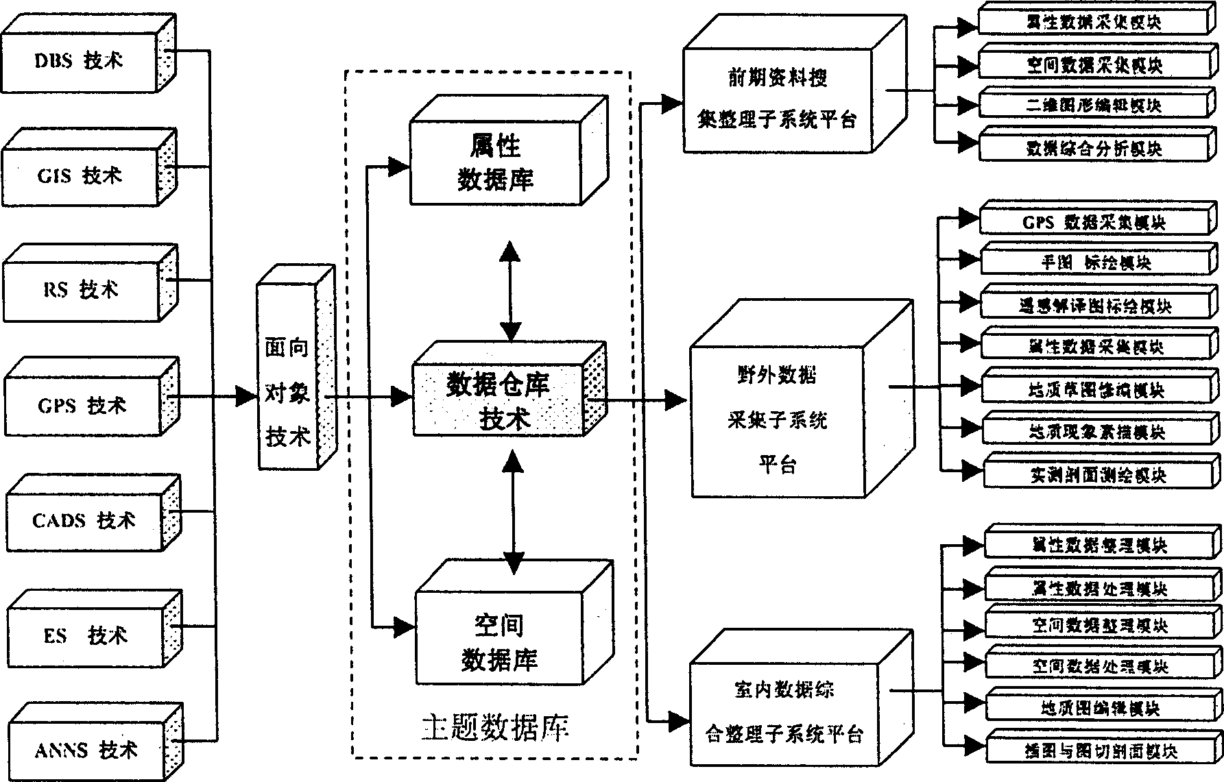
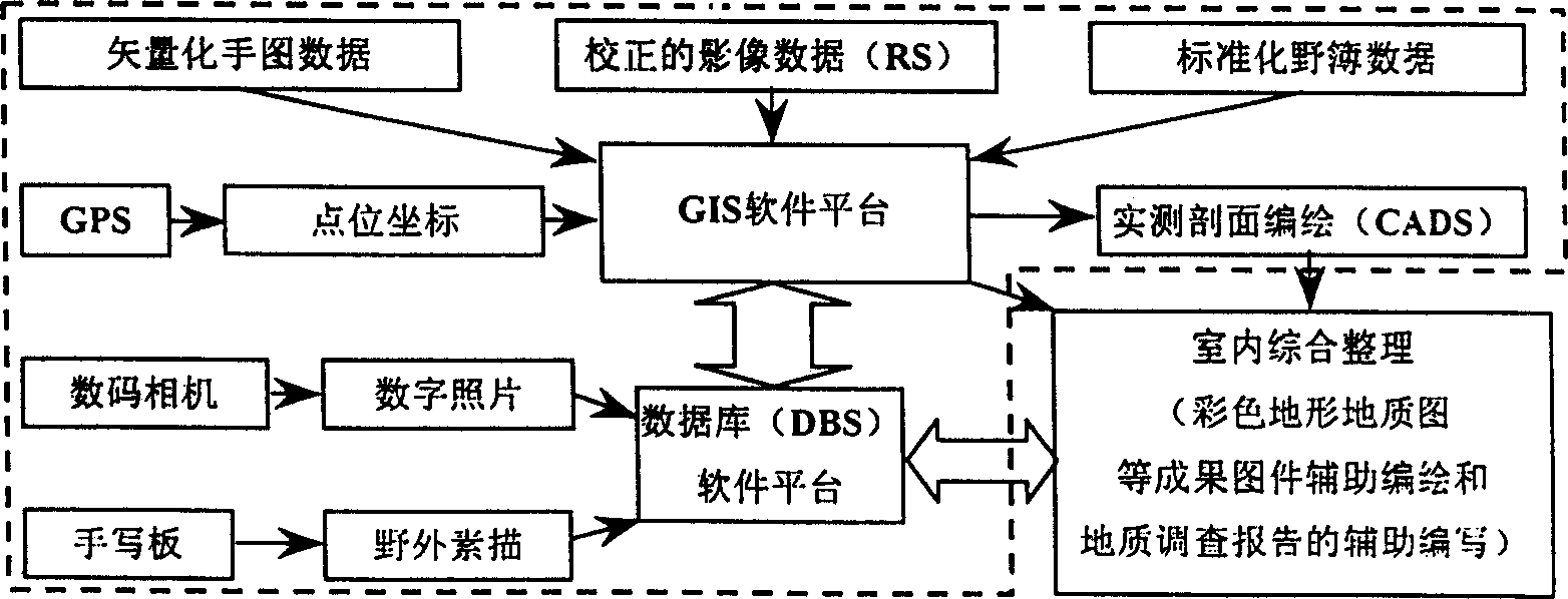
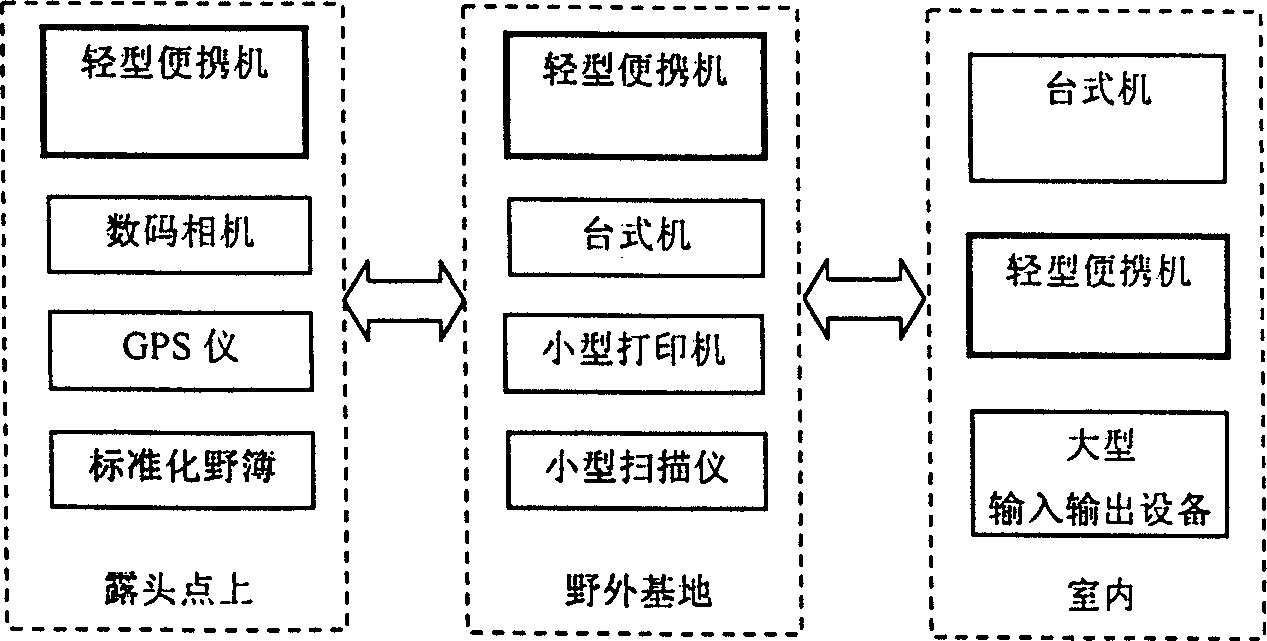
[0030] The invention is a computer-aided geological survey system based on portable computers (light portable computers including tablet computers). The system is a high-tech system with data as the core, combined application of multiple technologies, and multi-S integration. The development of the system is based on the design principles and methods of the geological and mineral point source information system, which embodies the design idea based on the subject-type relational database and spatial database system, with spatial information and attribute information management as the core. The system is equipped with an outdoor data collection subsystem supported by ultra-light portable computers (including tablet computers) as hardware; indoors is equipped with a sorting and editing subsystem supported by PC-586 or above microcomputers as hardware, including comprehensive sorting, Processing devices for statistical analysis, spatial analysis, regional evaluation, geological m...


PUM


Abstract

The present invention relates to a computer-aided geological survey system based on portable machine. It adopts the multiple S integration technique including GIS, GPS, DBS, RS, CADS, ES and ANNS systems and method oriented towards object to make design and development. The data collected by said system are fed into unified space data base and attribute data base, and the data base technique can be used to make effective connection and information extraction. The system includes front-stage material collecting and reduction, wild data acquisition and indoor data comprehensive reduction three subsystem platforms.

Description

technical field [0001] The invention relates to the fields of data acquisition, information management, system integration, information processing and geoscience information engineering, in particular to a computer-aided geological survey system based on a portable computer. Background technique [0002] Since the 1950s and 1960s, many countries have paid attention to the use of geophysical prospecting, chemical prospecting and remote sensing and other technical methods to explore new methods and means of geological survey field work, strengthened the investigation of regional geological conditions, and greatly improved the efficiency of field work and speed. In the 1970s and 1980s, due to the rapid development and mutual penetration of theories, methods and technologies in various disciplines in the field of geological sciences, especially the development and application of geographic information system (Geographical Information System, GIS) technology, the geological scien...

Claims


Application Information

Patent Timeline
Patent Type & Authority Patents(China)
IPC IPC(8): G06F17/50G01V11/00
Inventor 吴冲龙刘刚汪新庆李伟忠张夏林何珍文赵温霞欧阳建平柳庆武李义才方世明
Owner CHINA UNIV OF GEOSCIENCES (WUHAN)
Learn More