
Method for shooting and splicing full-width low-temperature area image of new paved asphalt pavement

A technology for asphalt pavement and image capture, which is applied in image analysis, graphic image conversion, image data processing, etc., can solve problems such as SIFT splicing errors, temperature differences, and time differences, and achieve elimination of splicing errors, improvement of accuracy, improvement of shooting and The effect of splicing efficiency

Pending Publication Date: 2022-07-29
山东高速基础设施建设有限公司 +1
View PDF0 Cites 0 Cited by
  • Summary
  • Abstract
  • Description
  • Claims
  • Application Information

AI Technical Summary

Problems solved by technology

When the drone takes each image, it needs to adjust the position, angle, focal length and other parameters, which leads to a time difference between two adjacent infrared images, which in turn leads to a temperature difference in the overlapping area of ​​the two adjacent infrared images, which is reflected in the infrared image. On the image, there are differences in color values ​​(including color saturation, color scale, etc.) in the overlapping areas of two adjacent infrared images, and the difference in color scales in the overlapping areas will cause SIFT splicing errors

Method used


Image

  • Method for shooting and splicing full-width low-temperature area image of new paved asphalt pavement
  • Method for shooting and splicing full-width low-temperature area image of new paved asphalt pavement
  • Method for shooting and splicing full-width low-temperature area image of new paved asphalt pavement

Examples


Embodiment 1

[0056] This embodiment provides a method for capturing and splicing a full-width low temperature area image of a newly paved asphalt pavement, including the following steps:

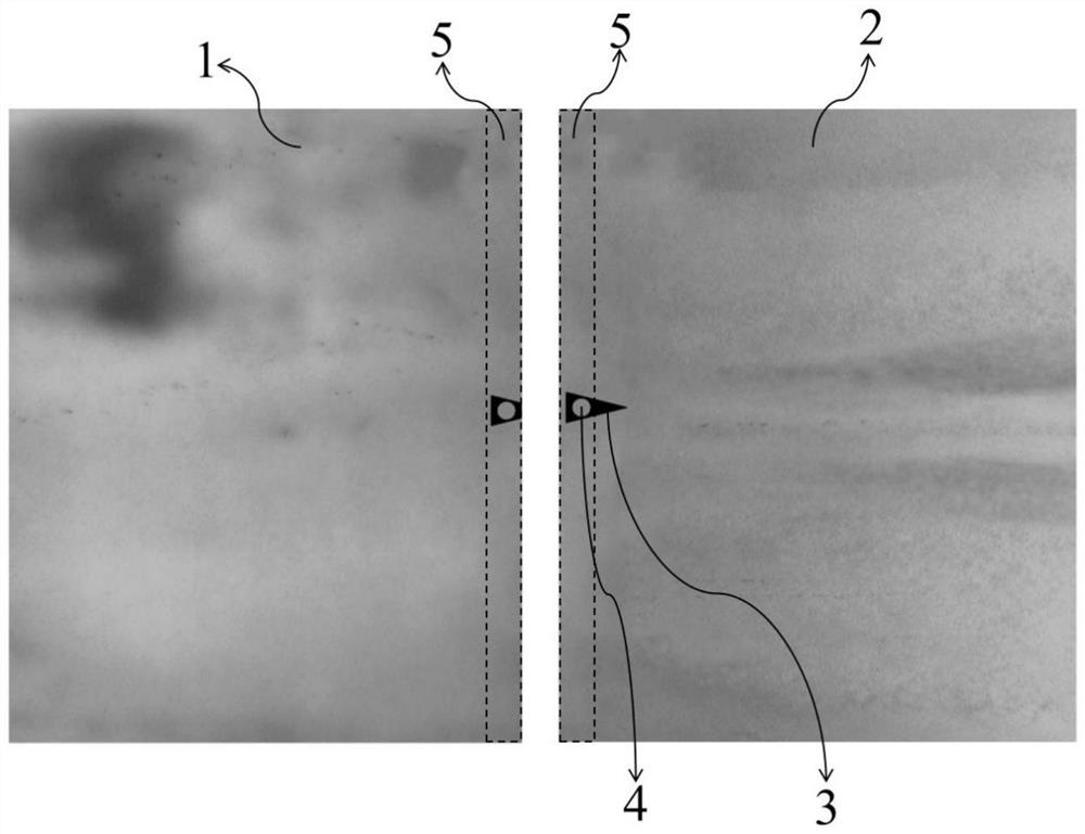
[0057] S1: Use a drone equipped with an infrared camera to view the newly paved asphalt road, place the splicing reference plate 3 between the two adjacent areas to be photographed, and place the splicing reference plate 3 in an area that meets the required temperature for paving .

[0058] like figure 2 As shown, the splicing reference plate 3 is an iron plate, in the shape of an isosceles triangle, and the bisector of the apex angle of the isosceles triangle is parallel to the extending direction of adjacent images. The splicing reference plate 3 is provided with a circular hollow portion 4 . The circular hollow part 4 can provide an infinite number of feature points (key corner points) 8 to ensure the success of image splicing; in addition, the circular hollow part 4 makes the splicing reference pl...

Embodiment 2

[0065] This embodiment provides a method for capturing and splicing a full-width low temperature area image of a newly paved asphalt pavement, including the following steps:

[0066] S1: Use a drone equipped with an infrared camera to view the newly paved asphalt road, and use the drone to check that there is a large area that meets the paving temperature requirements between two adjacent low-temperature areas, and place the splicing reference plate 3 on the Between two adjacent areas to be photographed, the splicing reference plate 3 is located in an area that meets the required temperature for paving.

[0067] like figure 2 As shown, the splicing reference plate 3 is an iron plate, in the shape of an isosceles triangle, and the bisector of the apex angle of the isosceles triangle is parallel to the extending direction of adjacent images. The splicing reference plate 3 is provided with a circular hollow portion 4 . The circular hollow part 4 can provide an infinite number ...


PUM


Abstract

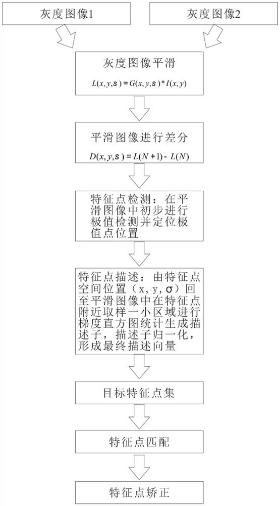
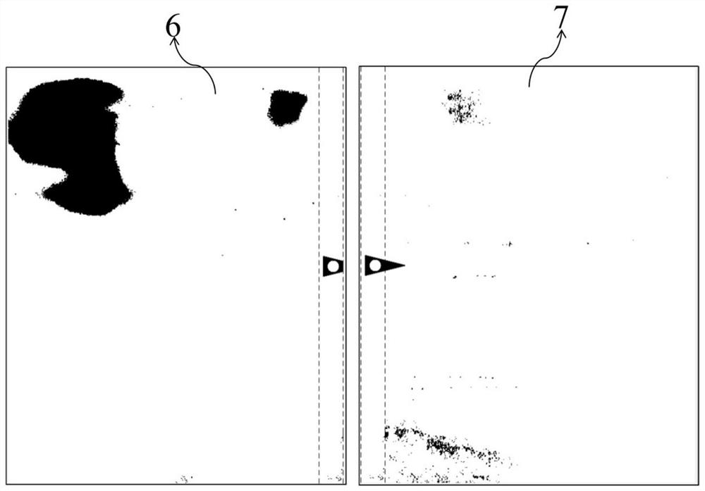
The invention relates to the technical field of asphalt pavement construction quality inspection, in particular to a newly paved asphalt pavement full-width low-temperature region image shooting and splicing method, which comprises the following steps: S1, checking a newly paved asphalt pavement by using an unmanned aerial vehicle equipped with an infrared camera, and placing a splicing reference plate between two adjacent regions to be shot, the splicing reference plate is located in an area meeting the temperature required by paving; s2, shooting a first infrared image and a second infrared image, wherein both the first infrared image and the second infrared image comprise all or part of the splicing reference plate; s3, repeating the steps S1 to S2; s4, converting the obtained infrared image into a grey-scale image, and obtaining a binary image by using a threshold segmentation method; and S5, splicing the adjacent binary images through SIFT (Scale Invariant Feature Transform) to obtain a new full-width low-temperature region image of the asphalt pavement. According to the invention, the accuracy of identifying the full-width low-temperature region image of the newly paved asphalt pavement can be improved, and the shooting and splicing efficiency can be improved.

Description

technical field [0001] The invention relates to the technical field of asphalt pavement construction quality inspection, in particular to a method for photographing and splicing images in a full-width low temperature area of ​​a newly paved asphalt pavement. Background technique [0002] Temperature segregation during asphalt pavement paving will seriously affect the pavement quality. Quickly and accurately obtaining the low-temperature region of the full-width pavement is of great significance for the evaluation of asphalt pavement paving quality. [0003] UAV remote sensing has been widely used in various ground survey applications due to its advantages of fast acquisition speed, high image resolution, convenient operation, good safety, and low investment. However, due to the low flight height and the limited focal length of the camera, the scene field of the UAV image is small, and it is necessary to use some kind of registration, fusion and other algorithms to collect se...

Claims


Application Information

Patent Timeline
Patent Type & Authority Applications(China)
IPC IPC(8): G06T3/40G06T7/11G06T7/136G06T7/90G06V20/17
CPCG06T3/4038G06T7/11G06T7/136G06T7/90G06T2200/32G06T2207/10048
Inventor 陈成勇魏帅帅高立勇马士杰韩文扬张轩瑜岳秀鹏张欢董永泉牛磊
Owner 山东高速基础设施建设有限公司
Learn More