
Terrain information acquisition device for land space planning and acquisition method thereof

A technology for space planning and information collection, applied in the direction of measuring devices, supporting machines, instruments, etc., can solve problems such as data errors, measurement data errors, and aging of equipment display screens

Inactive Publication Date: 2022-02-08
周亚
View PDF0 Cites 0 Cited by
  • Summary
  • Abstract
  • Description
  • Claims
  • Application Information

AI Technical Summary

Problems solved by technology

[0004] However, when the total station is used, one of the most important steps is the horizontal adjustment of the equipment. This step is related to the accuracy of the test data. However, when the existing total station is used for horizontal adjustment, it is often through manual observation. Adjust the position of the air bubbles and adjust the height of the corresponding support for horizontal adjustment. This process will waste a certain amount of manpower, and if the entire equipment is not in a horizontal state after adjustment, it will easily lead to data errors. Use and record at this time If the total station is used, if it is under the scorching sun, long-term exposure to the sun will easily lead to aging of the display screen of the equipment, and then there will be errors in the measurement data, and if the total station is used for a long time Under the scorching sun, it is very easy to cause some damage to the skin of the staff. Therefore, when using the total station, it is usually necessary to manually perform sunshade treatment. This process not only leads to a waste of manpower, but is also relatively troublesome.

Method used


Image

  • Terrain information acquisition device for land space planning and acquisition method thereof
  • Terrain information acquisition device for land space planning and acquisition method thereof
  • Terrain information acquisition device for land space planning and acquisition method thereof

Examples


Embodiment Construction

[0031] The technical solutions in the present invention will be clearly and completely described below in conjunction with the accompanying drawings in the present invention. In addition, the forms of each structure recorded in the following embodiments are just examples. The land space planning involved in the present invention The terrain information acquisition device and its acquisition method are not limited to the structures described in the following embodiments, and all other embodiments obtained by those skilled in the art without creative work belong to the present invention scope of protection.

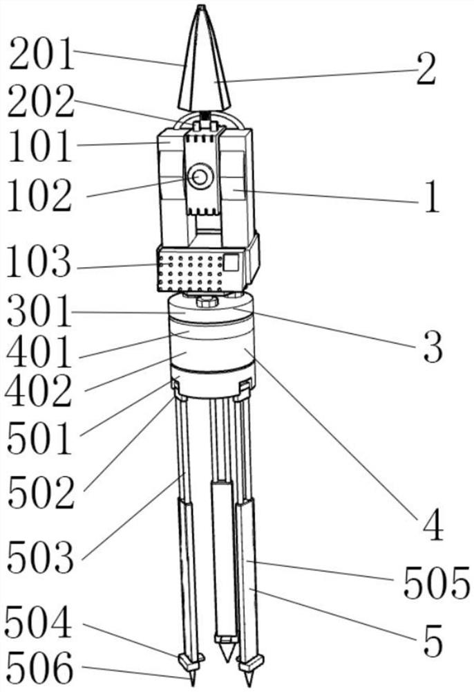
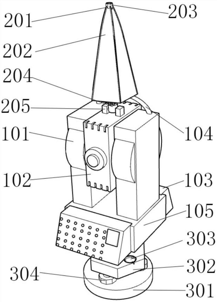
[0032] The present invention provides a terrain information acquisition device for land space planning, including a measuring mechanism 1, a sun protection mechanism 2, a connecting mechanism 3, a fixing structure 4, and a bracket mechanism 5, and also includes:

[0033]The sun protection mechanism 2 is arranged at the top of the measurement mechanism 1, and the sun protect...


PUM


Abstract

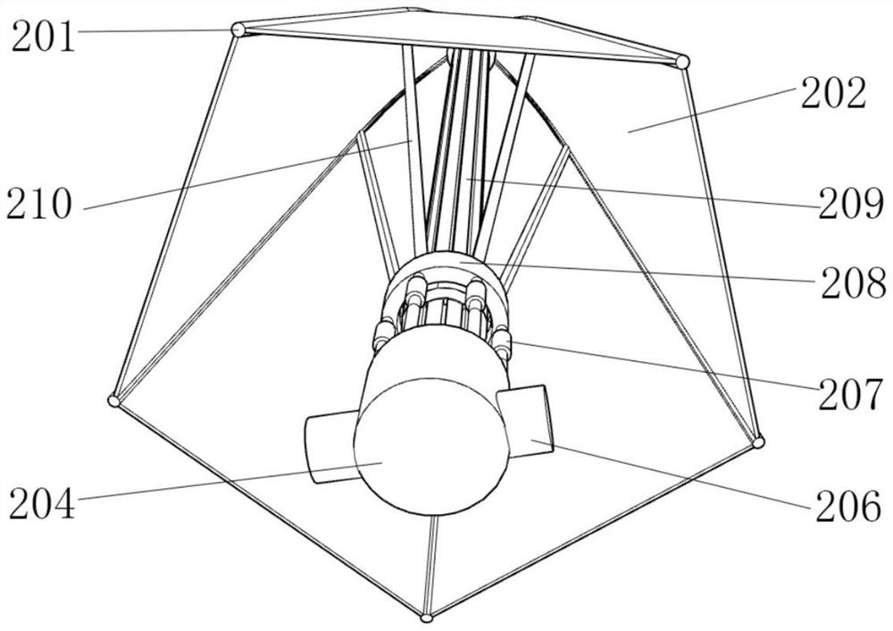
The invention relates to the technical field of terrain acquisition, and discloses a terrain information acquisition device for land space planning and an acquisition method thereof. The sunscreen mechanism further comprises a rotating cabin, the inner wall of the rotating cabin is movably connected with a torsional spring column, and the outer wall of the torsional spring column is movably connected with a fixed end. By arranging the rotating cabin, the torsional spring column and the fixing end, the sun-blocking mechanism can be fixed and can be folded and carried, by arranging the sensing device, an external light source can be sensed, and the sun-blocking device can be automatically opened; by arranging the sun-blocking layer, a certain shading effect and an effect of generating electricity through light energy can be achieved. Through the fixing support, fixation of the sunscreen layer is facilitated; and by arranging the lifting cabin, the electromagnets, the stretching circular rings and the stretching supports, the two electromagnets can work to generate certain magnetic repulsive force, the stretching circular rings are driven to move, then the stretching supports are made to move, the sunscreen layer is driven to be opened, and the sunscreen effect is achieved.

Description

technical field [0001] The invention relates to the technical field of terrain collection, and more specifically, the invention relates to a terrain information collection device for land space planning and a collection method thereof. Background technique [0002] Terrain is the general term for the shape and landform of ground objects. It specifically refers to the various states of ups and downs presented by fixed objects distributed above the surface. The undulating trend is called terrain, and the undulating shape of the surface is also called landform. According to the shape, it can be divided into five types: mountains, plateaus, plains, hills and basins. The terrain is the result of the joint action of internal and external forces, and it is always changing; [0003] In our daily life, we often use some special equipment to explore its terrain, the most common of which is the total station, the total station, that is, the total station electronic rangefinder, which i...

Claims


Application Information

Patent Timeline
Patent Type & Authority Applications(China)
IPC IPC(8): G01C15/00F16M11/36F16M11/04F16F15/067
CPCG01C15/00F16M11/36F16M11/04F16F15/067
Inventor 周亚邱晖
Owner 周亚
Learn More