


Quick Research
Generate reliable direction feasibility study reports for your R&D in just a few steps.

Technical Q&A
Discover and master advanced knowledge NOW. Basics, ideas, possibilities, all at once.

Find Solutions
As an expert in R&D theories, this can generate solutions to your technical problems instantly.

Evaluate Feasibility
Analyze your overall solution with one click, know your potential R&D risks in advance.

Monitor Landscape
Get weekly tech updates, stay abreast of the latest tech innovations and key insights.
An Efficient Ground Absolute Target Extraction and Global Optimization Method
A global optimization and absolute coordinate technology, applied in the field of mobile surveying and mapping, can solve problems such as cumbersome operation, decreased registration accuracy, image mapping accuracy, etc., and achieve the effect of flexible and easy operation and avoiding errors
- Summary
- Abstract
- Description
- Claims
- Application Information
AI Technical Summary
Problems solved by technology
Method used
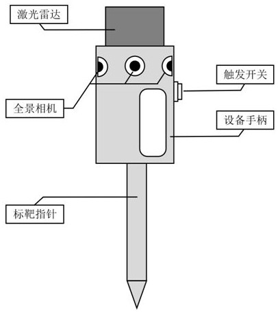
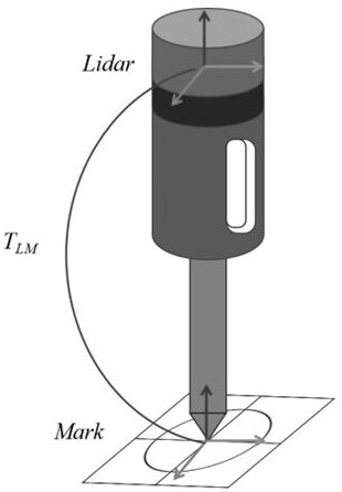
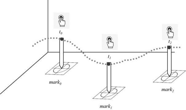
Image

Examples
Embodiment Construction
[0051] The technical solutions of the present invention will be further described below in conjunction with the accompanying drawings and embodiments.
[0052] This embodiment provides an efficient ground absolute target extraction and global optimization method, and its specific working process includes six stages, specifically:
[0053] 1) Layout control points
[0054] First, plan a suitable route according to the environment to be collected; then, on the collection route, arrange control point targets, which can be placed on the ground, walls, etc. place.
[0055] 2) Measuring control point coordinates
[0056] Use measuring equipment such as a total station to measure the absolute coordinates of all targets and record the numbers of the targets.
[0057] 3) Start data collection
[0058] Start the data collection function of the backpack and travel along the pre-planned route.
[0059] 4) Collect target
[0060] Every time you walk to a target position, touch the ce...
PUM
 Abstract
Description
Claims
Application Information
 - R&D Engineer
- R&D Manager
- IP Professional
- Industry Leading Data Capabilities
- Powerful AI technology
- Patent DNA Extraction
Browse by: Latest US Patents, China's latest patents, Technical Efficacy Thesaurus, Application Domain, Technology Topic, Popular Technical Reports.
© 2024 PatSnap. All rights reserved.Legal|Privacy policy|Modern Slavery Act Transparency Statement|Sitemap|About US| Contact US: help@patsnap.com