
Remote sensing measurement device for geological survey

A measuring device and geological survey technology, applied in the field of geological survey equipment, can solve the problems of short service life, poor mobility of equipment, and prone to bumps, etc., and achieve the effect of improving service life, mobility and battery life

Pending Publication Date: 2021-09-21
辽宁省冶金地质勘查研究院有限责任公司
View PDF4 Cites 2 Cited by
  • Summary
  • Abstract
  • Description
  • Claims
  • Application Information

AI Technical Summary

Problems solved by technology

[0003] The purpose of the present invention is to provide a remote sensing measuring device for geological survey, which has the advantages of good protection effect, convenient use and strong mobility, and solves the problem that the equipment is easily damaged when operating in rainy and snowy weather, and the mobility of the equipment is poor , easy to bump during the moving process, and the service life of the equipment is short

Method used


Image

  • Remote sensing measurement device for geological survey
  • Remote sensing measurement device for geological survey
  • Remote sensing measurement device for geological survey

Examples


Embodiment Construction

[0018] The following will clearly and completely describe the technical solutions in the embodiments of the present invention with reference to the accompanying drawings in the embodiments of the present invention. Obviously, the described embodiments are only some, not all, embodiments of the present invention. Based on the embodiments of the present invention, all other embodiments obtained by persons of ordinary skill in the art without making creative efforts belong to the protection scope of the present invention.

[0019] In the description of the invention, it should be noted that the terms "upper", "lower", "inner", "outer", "front end", "rear end", "both ends", "one end", "another end" etc. The indicated orientation or positional relationship is based on the orientation or positional relationship shown in the drawings, and is only for the convenience of describing the present invention and simplifying the description, rather than indicating or implying that the referre...


PUM


Abstract

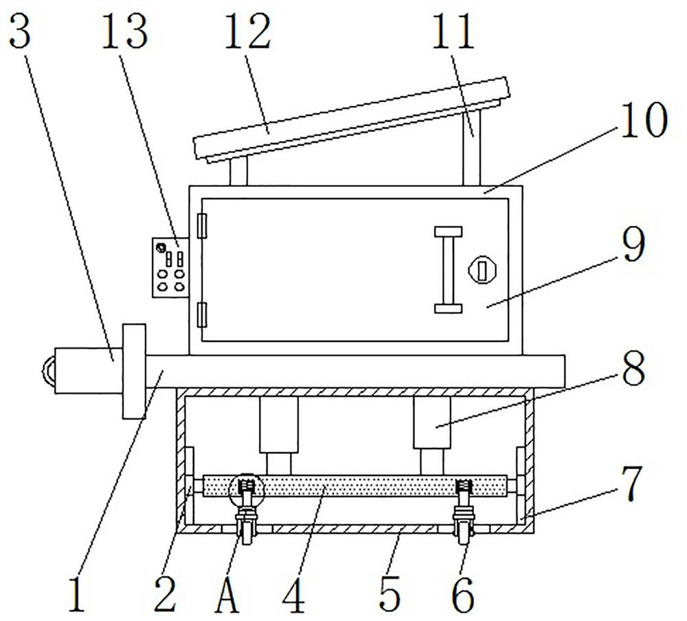
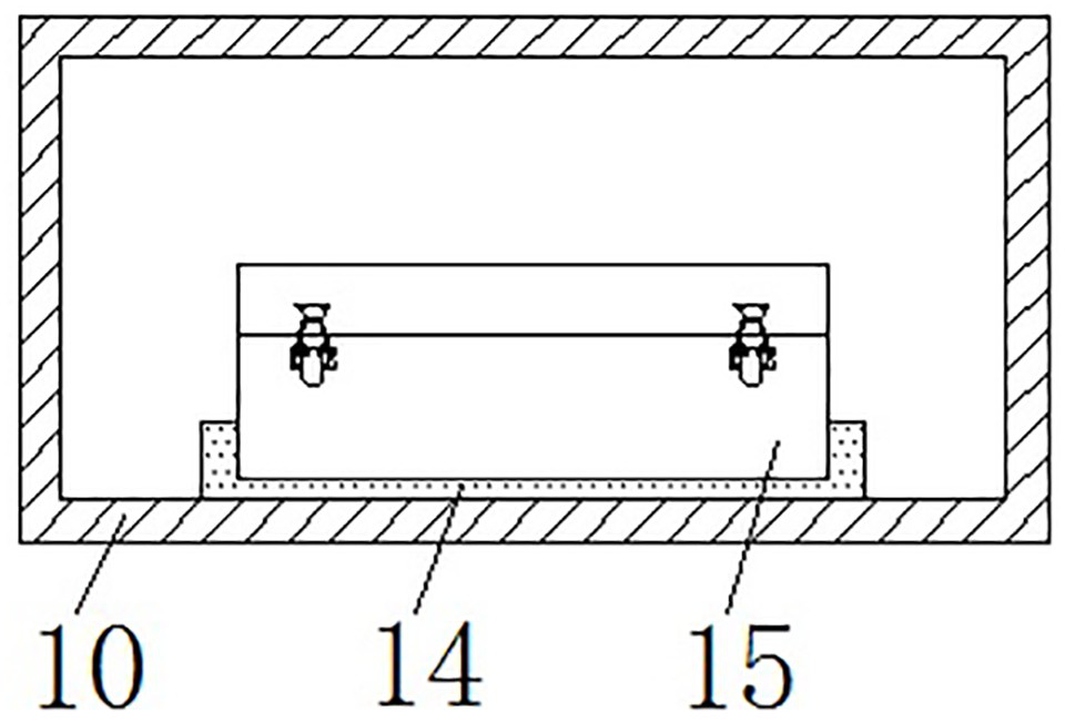
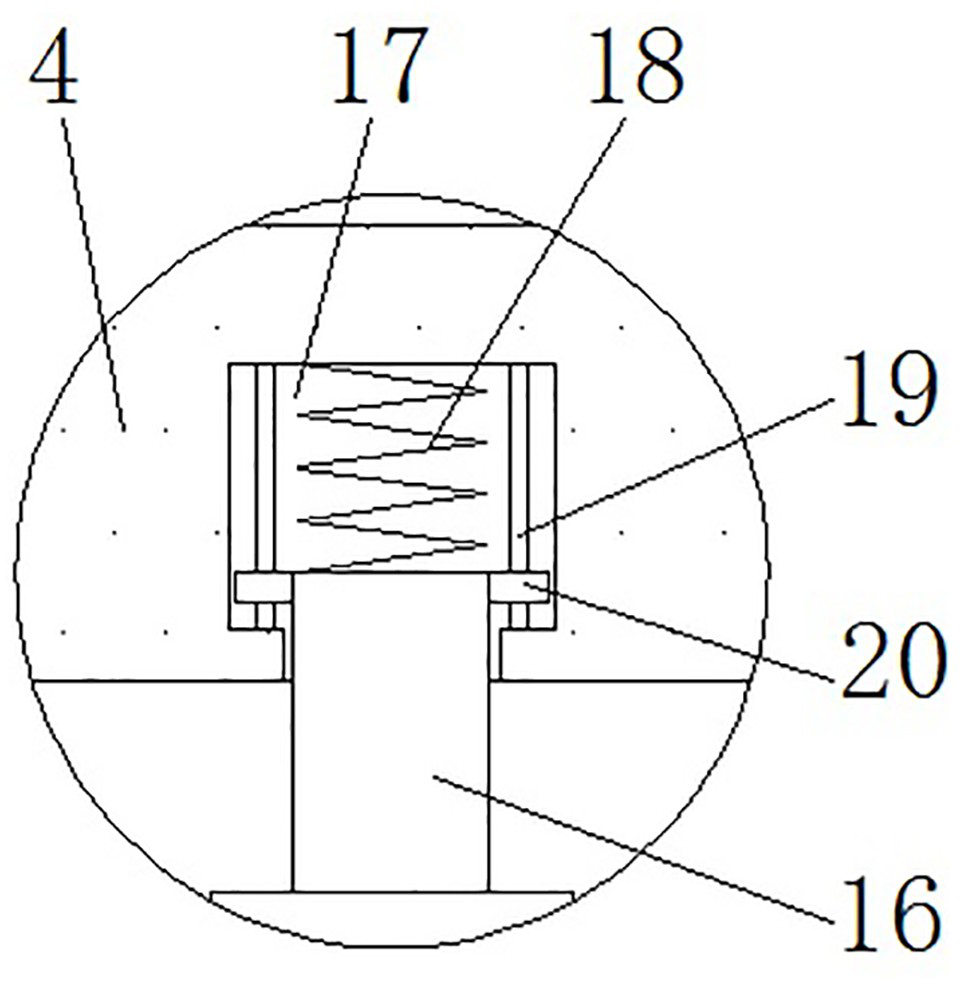
The invention discloses a remote sensing measurement device for geological survey, which comprises an operation table, wherein a protection box is fixedly connected to the top of the operation table, a box door is movably connected to the front face of the protection box, a supporting seat is fixedly connected to the bottom of an inner cavity of the protection box, remote sensing measurement equipment is arranged at the top of the supporting seat, and the bottom of the operation table is fixedly connected with a base box. According to the remote sensing measurement device, by arranging the protection box and the supporting seat, the remote sensing measurement device can be supported and protected, the sun-shading and rain-shielding effects are achieved, and the service life of the remote sensing measurement device is effectively prolonged; by arranging the movable plate, the base box, universal wheels and a telescopic air cylinder, the universal wheels can be driven to stretch out and draw back, and the maneuverability and the stability of the device are effectively improved; and by arranging a movable plate, a connecting rod, a telescopic groove and a spring, the buffering protection effect can be achieved, and when the road surface is not flat enough, jolt of the device can be relieved.

Description

technical field [0001] The invention relates to the technical field of geological survey equipment, in particular to a remote sensing measuring device for geological survey. Background technique [0002] "Geological prospecting" refers to surveying and detecting the geology through various means and methods, determining the appropriate bearing layer, determining the foundation type and calculating the foundation parameters according to the foundation bearing capacity of the bearing layer. Mineral deposits with industrial significance are found in the general survey of minerals. In order to ascertain the quality and quantity of minerals, as well as the technical conditions for mining and utilization, and provide mineral reserves and geological data required for mine construction design, the rocks, strata, structures, Mining, hydrology, geomorphology and other geological conditions are investigated and studied. The existing remote sensing measurement equipment lacks protection...

Claims


Application Information

Patent Timeline
Patent Type & Authority Applications(China)
IPC IPC(8): G01V9/00
CPCG01V9/00
Inventor 蓝海洋王鹏张学友朱恒党张卓张肖潇张道奎杨利华贾振华王大雪陈少龙李文成于莉
Owner 辽宁省冶金地质勘查研究院有限责任公司
Learn More