Gathering area identification and division method for rural domestic sewage treatment

A domestic sewage and rural technology, applied in the direction of general water supply saving, data processing applications, instruments, etc., can solve the problems of high vegetation coverage, complex terrain conditions, quantitative remote sensing is not suitable for rural residential area identification, etc., to achieve strong operability , environmental quality improvement, and the effect of authentic and reliable data sources

Active Publication Date: 2021-06-08
四川省环境政策研究与规划院
View PDF6 Cites 1 Cited by
  • Summary
  • Abstract
  • Description
  • Claims
  • Application Information

AI Technical Summary

Problems solved by technology

[0005] The traditional settlement area identification method is mostly determined by human investigation. This method can accurately determine the geographical location and population size of a certain settlement area, but it is time-consuming and laborious, and is greatly affected by subjective factors, which often leads to significant differences in results.
At present, many scholars use quantitative remote sensing methods to efficiently identify settlements. This method can effectively identify large-scale cities and town settlements. Quantitative remote sensing is not applicable to the identification of rural settlements to a certain extent

Method used


Image

  • Gathering area identification and division method for rural domestic sewage treatment
  • Gathering area identification and division method for rural domestic sewage treatment
  • Gathering area identification and division method for rural domestic sewage treatment

Examples


Embodiment 1

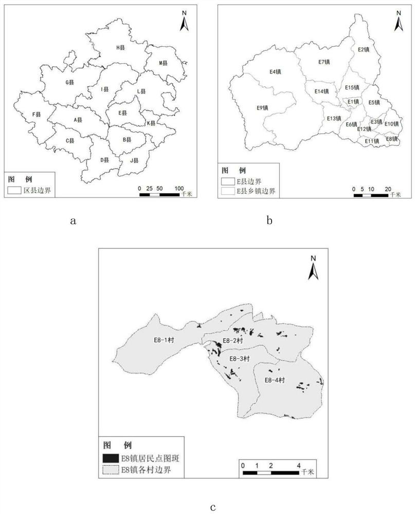
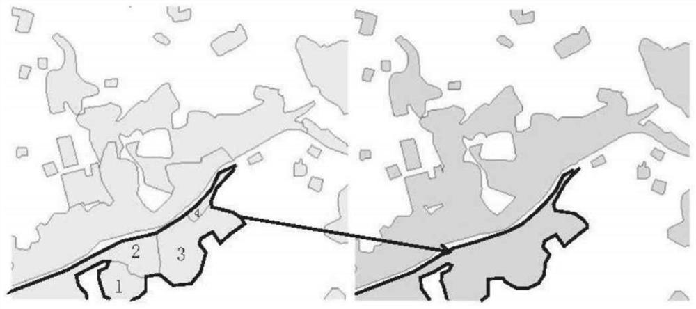
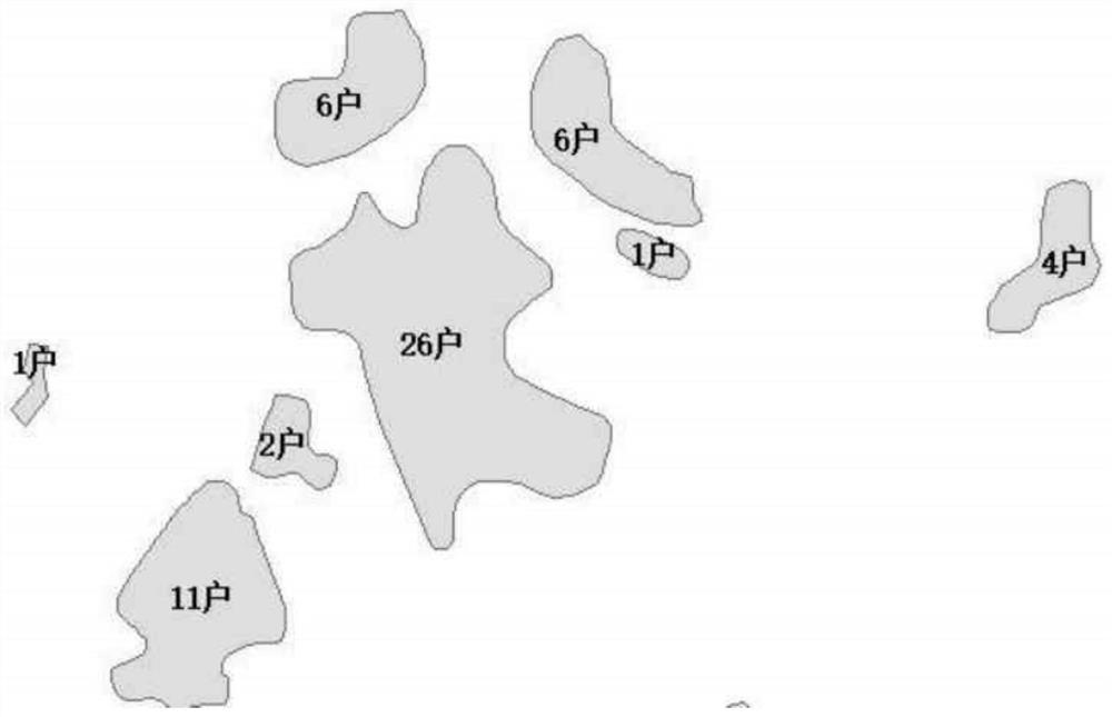
[0044] This embodiment identifies and divides the rural settlements in County E of a certain city:

[0045] (1) Basic data preparation. The main data used are: land geographic data, geospatial data cloud data, rural population data, and remote sensing image data. National land geographic data, derived from the latest national land survey data, are mainly used to obtain the distribution of rural residential areas and make supporting township (town)-village administrative boundaries; geospatial data cloud data, using the 30-meter digital data of geospatial data cloud data Elevation data, obtain DEM data, and then generate terrain and landform data, and obtain the distribution characteristics of rural settlements on different terrains and landforms such as valleys and mountains; rural population data comes from statistical yearbooks; remote sensing image data (the last two years and above level 16) Sourced from image tools such as Google Earth and Tiandi, it is used to verify th...


PUM


Abstract

The invention provides a gathering area identification and division method for rural domestic sewage treatment, and the method mainly comprises the steps: collecting territorial geographic data, geographic space data cloud data, rural population data and remote sensing image data; adopting ArcGIS software to process territorial and geographic data to obtain matched administrative boundaries (villages, towns, districts, counties and cities) and rural residential area distribution, generating DEM data and topographic and geomorphic data through geographic space data cloud data, and then coupling the DEM data, the topographic and geomorphic data and rural population data, establishing a rural residential area-rural gathering area-environment sensitive area space corresponding relation, and verifying a result by using a remote sensing image and adopting an on-site verification mode so as to finally obtain resident gathering area distribution conditions of different rural areas. The method can scientifically and efficiently identify the spatial distribution characteristics of the rural residence area, can support rural domestic sewage treatment, and can be used for improving the quality of the rural living environment.

Description

technical field [0001] The invention belongs to the field of rural environment management, and in particular relates to a method for identifying and dividing rural settlements. Background technique [0002] In recent years, my country's rural economic level has improved significantly, but the problems caused by the uncoordinated rural economic development and environmental construction have become increasingly prominent, among which water pollution is the most serious problem. Therefore, it is imperative to carry out rural domestic sewage treatment, comprehensively improve the quality of rural water environment, improve the rural living environment, and actively explore reasonable and effective rural domestic sewage treatment models. [0003] Rural settlements refer to all settlements except cities, townships and towns, which are the settlement places for farmers to produce and live. Rural agglomeration is a rural residential model, service management model and industrial p...

Claims


Application Information

Patent Timeline
IPC IPC(8): G06F17/18G06Q50/26
CPCG06F17/18G06Q50/26Y02A20/152
Inventor 任春坪黄田郑勇军王恒郑淋峰黄庆罗彬
Owner 四川省环境政策研究与规划院
Why Eureka
Try Eureka