
Unmanned HD Map data distribution method based on energy consumption

A technology for data distribution and unmanned driving, which is applied in the traffic control system of road vehicles, traffic flow detection, instruments, etc., can solve the problem of high cost of self-built collection fleets, and reduce HDMap data acquisition time and data transmission time. , the effect of reducing data throughput and data transmission interference

Active Publication Date: 2021-06-04
SOUTH CHINA UNIV OF TECH
View PDF3 Cites 1 Cited by
  • Summary
  • Abstract
  • Description
  • Claims
  • Application Information

AI Technical Summary

Problems solved by technology

However, the cost of self-built collection fleet is too expensive, and now the production of HD Map generally adopts the method of map crowdsourcing

Method used


Image

  • Unmanned HD Map data distribution method based on energy consumption
  • Unmanned HD Map data distribution method based on energy consumption
  • Unmanned HD Map data distribution method based on energy consumption

Examples


Embodiment Construction

[0049] The present invention will be further described below in conjunction with specific examples.

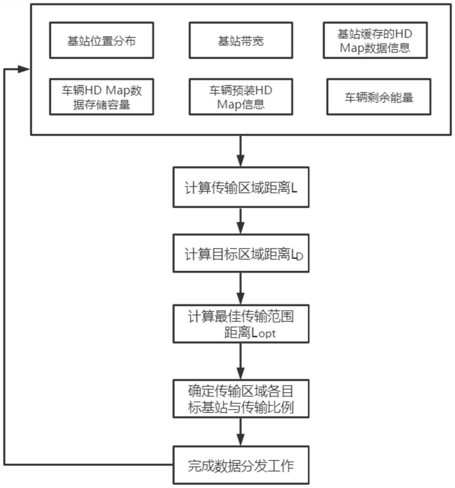
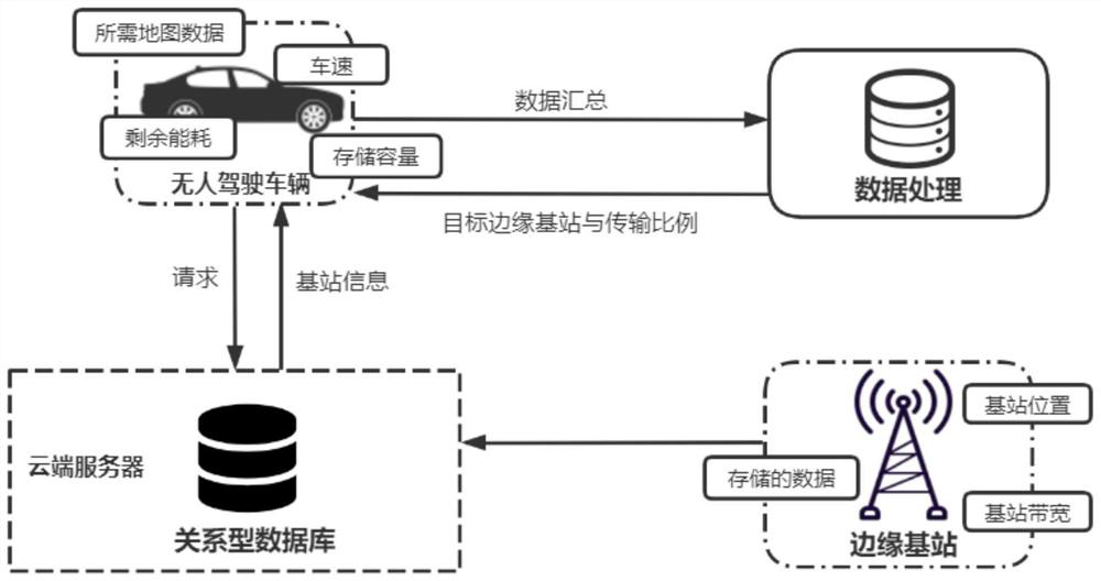
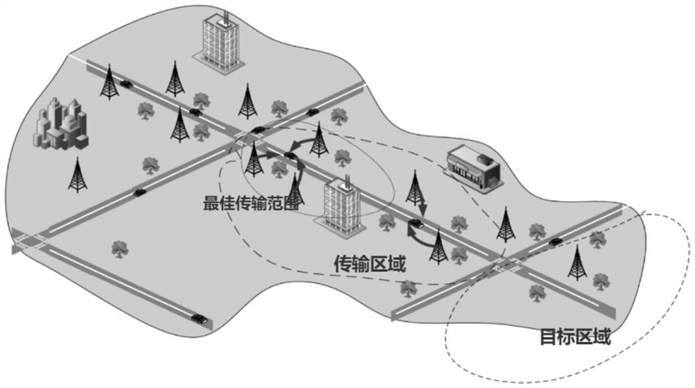
[0050] Such as figure 1 and figure 2 As shown, the energy-consumption-based unmanned HD Map data distribution method provided in this embodiment uses auxiliary equipment such as unmanned vehicles, edge base stations, and cloud servers, and includes the following steps:

[0051] 1) The unmanned vehicle obtains the edge base station information from the cloud server, including the edge base station ID, the location distribution of the edge base station, the bandwidth of the edge base station, and the HD Map data information cached by the edge base station. The string ID composed of the eight-digit ID of the road and the four-digit number of the edge base station near the road; the location distribution of the edge base station refers to the actual position of the edge base station on both sides of the current road, expressed by the relative position of the edge base station an...


PUM


Abstract

The invention discloses an unmanned HD Map data distribution method based on energy consumption, and the method comprises the steps that 1), an unmanned vehicle obtains edge base station information from a cloud server, wherein the edge base station information comprises an edge base station ID, an edge base station position distribution condition, an edge base station bandwidth and HD Map data information cached by an edge base station; (2) the unmanned vehicle obtains data information of the unmanned vehicle, wherein the data information comprises HD Map data storage capacity, pre-installed HD Map information and residual energy; 3) a transmission area distance L and a target area distance LD are calculated; 4) an optimal transmission range distance Lopt is calculated; and 5) the unmanned vehicle determines all target edge base stations and the respective data transmission ratios in the transmission area, and then completes the data distribution work. According to the invention, the required HD Map data information can be transmitted within the minimum transmission time under the condition that the energy consumption of the unmanned vehicle is limited.

Description

technical field [0001] The present invention relates to the technical field of high-precision map (HD Map) data distribution, in particular to a method for distributing unmanned driving HD Map data based on energy consumption. Background technique [0002] High-definition map (HD Map) is the basis for the realization of unmanned driving, and it plays an important role in unmanned driving. Traditionally, street view image data and 3D laser point cloud data are obtained through a self-built professional collection team. After an automated mapping process in the background, combined with manual error correction and labeling, a map with multi-level map data is finally formed. However, the cost of self-built collection fleets is too expensive, and now the production of HD Maps generally adopts the method of map crowdsourcing. Use social unmanned vehicles to complete data collection during driving, and then use edge computing nodes to perform data cleaning, aggregation, and compr...

Claims


Application Information

Patent Timeline
IPC IPC(8): G08G1/0967G08G1/0969G08G1/01
CPCG08G1/096725G08G1/0969G08G1/0125G08G1/0145
Inventor 唐洁谢锦粮
Owner SOUTH CHINA UNIV OF TECH
Learn More