Vegetation temperature and bare land temperature estimation method based on satellite remote sensing data
A satellite remote sensing data and satellite remote sensing technology, applied in the field of satellite remote sensing, can solve the problems that cannot be applied to areas with high spatial heterogeneity, and achieve the effect of improving the estimation accuracy
- Summary
- Abstract
- Description
- Claims
- Application Information
AI Technical Summary
Problems solved by technology
Method used
Image
Examples
Embodiment 1
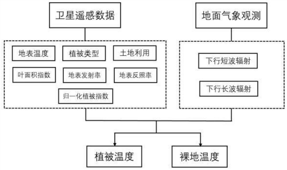
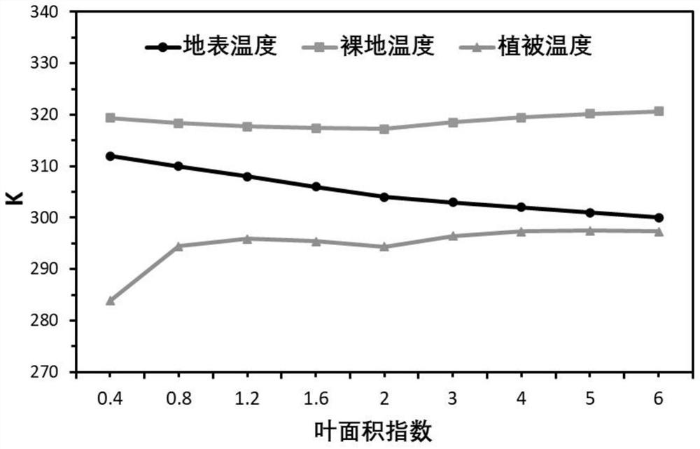
[0068] In this example, a mixed forest land in North China was taken as the research object, and the leaf area index, surface albedo, surface emissivity, surface temperature, etc. of 9 pixels of MOIDS satellite remote sensing data in June 2019 and the downlink of meteorological observations were taken. The short-wave radiation and the downlink long-wave radiation are used as the input data of the algorithm formula in the present invention, and the vegetation temperature and the bare ground temperature are calculated. The relationship between surface temperature, vegetation temperature and bare ground temperature with leaf area index figure 2 , whose details are shown in Table 1.
[0069] Table 1
[0070]
[0071] The above data show that the bare land temperature is higher than the surface temperature, while the vegetation temperature is lower than the surface temperature. The surface temperature decreased with the increase of LAI, and the vegetation temperature increase...
PUM
 Abstract
Description
Claims
Application Information
 - Generate Ideas
- Intellectual Property
- Life Sciences
- Materials
- Tech Scout
- Unparalleled Data Quality
- Higher Quality Content
- 60% Fewer Hallucinations
Browse by: Latest US Patents, China's latest patents, Technical Efficacy Thesaurus, Application Domain, Technology Topic, Popular Technical Reports.
© 2025 PatSnap. All rights reserved.Legal|Privacy policy|Modern Slavery Act Transparency Statement|Sitemap|About US| Contact US: help@patsnap.com


