Eureka AIR delivers breakthrough ideas for toughest innovation challenges, trusted by R&D personnel around the world.

Satellite-borne GNSS-R mirror reflection point calculation method based on ellipsoid transformation

A technology of specular reflection and calculation method, which is applied in the direction of calculation, satellite radio beacon positioning system, instrument, etc., can solve the problems of GNSS reflection signal capture, reduce the accuracy of GNSS reflection signal, etc., and achieve the effect of simple calculation and improved positioning accuracy

Active Publication Date: 2021-04-27
TIANJIN UNIV
View PDF7 Cites 0 Cited by
  • Summary
  • Abstract
  • Description
  • Claims
  • Application Information

AI Technical Summary

Problems solved by technology

When there is a large difference between the reference ellipsoid and the actual terrain surface, the accuracy of the GNSS reflection signal observation will be reduced, and even lead to the capture of the GNSS reflection signal

Method used


Image

  • Satellite-borne GNSS-R mirror reflection point calculation method based on ellipsoid transformation
  • Satellite-borne GNSS-R mirror reflection point calculation method based on ellipsoid transformation
  • Satellite-borne GNSS-R mirror reflection point calculation method based on ellipsoid transformation

Examples


Embodiment Construction

[0017] The specific implementation manner of the present invention will be described in detail below in conjunction with the accompanying drawings and preferred embodiments.

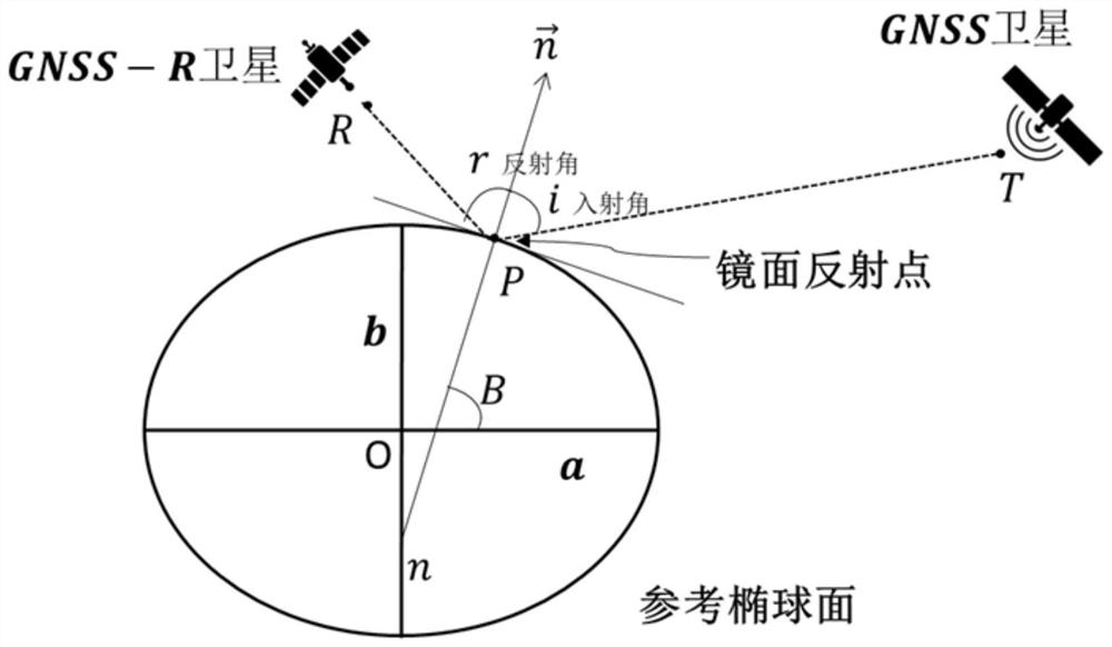
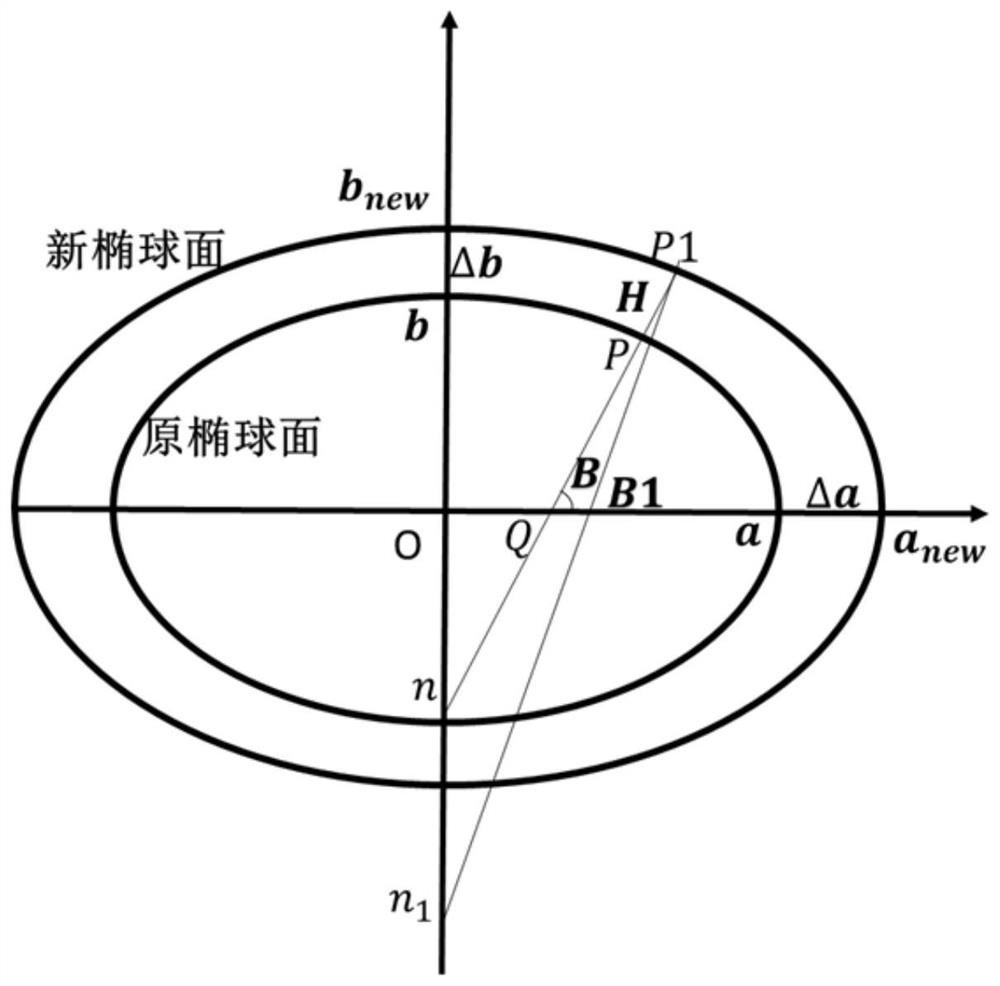
[0018] The present invention introduces a calculation method of space-borne GNSS-R specular reflection points based on ellipsoid transformation, which specifically refers to determining the earth height at the rough mirror reflection point through the digital elevation model DEM or sea surface terrain model, and changing the geodetic height to The semi-major axis value of the optimized ellipsoid is used to construct a new reference ellipsoid, and the specular reflection point is determined with the new reference ellipsoid as a reference, so as to improve the positioning accuracy of the specular reflection point.

[0019] The present invention is based on the ellipsoid transformation space-borne GNSS-R specular reflection point calculation method, which is composed of three main parts: calculation of the a...


PUM


Abstract

The invention discloses a satellite-borne GNSS-R mirror reflection point calculation method based on ellipsoid transformation. The method comprises the steps of determining the geodetic height of a general mirror reflection point through a digital elevation model (DEM) or a sea surface topography model, modifying the major semi-axis value of an ellipsoid through the geodetic height, constructing a new reference ellipsoid, and taking the new reference ellipsoid as a reference, and determining the mirror reflection point according to the navigation satellite position, the GNSS-R satellite position and the Fresnel reflection law, and improving the positioning precision of the mirror reflection point.

Description

technical field [0001] The invention belongs to the technical field of positioning methods for underwater submersibles, and in particular relates to a calculation method for spaceborne GNSS-R mirror reflection points based on ellipsoid transformation. Background technique [0002] The detection of geophysical parameters using satellite navigation signals reflected from the earth's surface is an innovative research hotspot in the global navigation satellite system (GNSS). This technology is usually called GNSS-R technology. Signal source, high temporal and spatial resolution and other advantages, mainly provide operational support for meteorology, ocean, agriculture, land resources, disaster emergency and other departments, including sea surface wind field, sea surface height, soil humidity, inland water resources and wetland distribution, flood monitoring etc. [0003] Using GNSS reflected signals for measurement requires knowing the orbit of navigation satellites and the p...

Claims


Application Information

Patent Timeline
Patent Type & Authority Applications(China)
IPC IPC(8): G01S19/42G06T7/62G06T7/68
CPCG01S19/42G06T7/62G06T7/68Y02A90/30
Inventor 郭博峰
Owner TIANJIN UNIV
Why Eureka
Eureka Blog
Learn More