
Multi-view optical satellite remote sensing image target recognition training sample set construction method

A training sample set and target recognition technology, which is applied in the field of multi-view optical satellite image target recognition deep learning training sample set construction, can solve the problem of high cost of multi-view optical satellite image acquisition, heavy workload of manual labeling of samples, integration of training samples Insufficient consideration of multi-view factors and other issues can achieve the effects of reducing production costs and professional thresholds, good versatility, and improving efficiency

Active Publication Date: 2021-04-06
PLA PEOPLES LIBERATION ARMY OF CHINA STRATEGIC SUPPORT FORCE AEROSPACE ENG UNIV
View PDF6 Cites 5 Cited by
  • Summary
  • Abstract
  • Description
  • Claims
  • Application Information

AI Technical Summary

Problems solved by technology

[0005] The purpose of the present invention is to solve the technical problems of high acquisition cost of multi-view optical satellite images, insufficient consideration of multi-view factors in integrated images of existing training samples, and heavy workload of manual labeling of samples

Method used


Image

  • Multi-view optical satellite remote sensing image target recognition training sample set construction method
  • Multi-view optical satellite remote sensing image target recognition training sample set construction method
  • Multi-view optical satellite remote sensing image target recognition training sample set construction method

Examples


Embodiment 1

[0034] Using the 3D model and vector map data of Dubai urban area, the multi-view optical satellite remote sensing image target recognition training sample set was constructed. The specific implementation process is as follows:

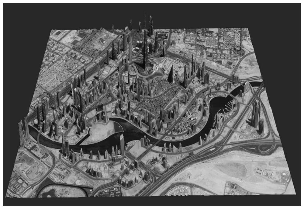
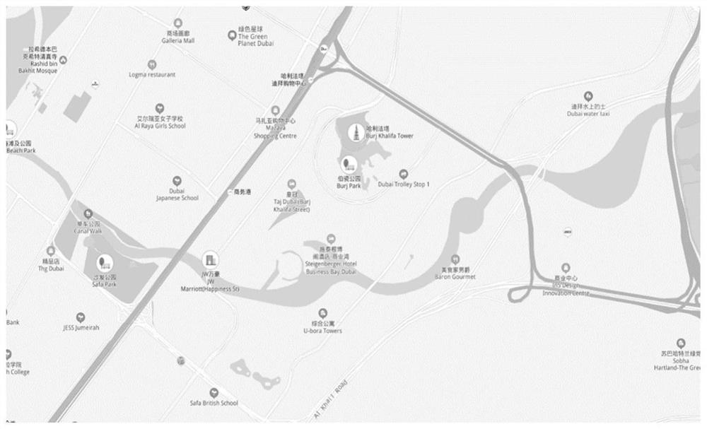
[0035] 1. Collected the 3D model of Dubai City ( figure 1 ) and an appropriate amount of map data ( figure 2 ), and evaluated its scale, resolution, timeliness, etc. The evaluation considers that the input data meet the needs of constructing multi-view satellite images with a resolution lower than 2m, and further work can be carried out.

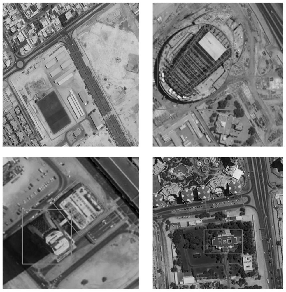
[0036] 2. Using the 3D model data and vector map data of Dubai City, set the orbital attitude, camera orientation elements, MTF, atmospheric conditions, platform tremor and other parameters of multi-view satellite imaging, and use the ray tracing method to trace each The whole process of light propagation at a ground point is modeled, and the multi-view satellite simulation image of Dubai city is obtained.

[00...


PUM


Abstract

The invention belongs to the technical field of satellite remote sensing information intelligent processing, and provides a multi-view optical satellite image target recognition deep learning training sample set construction method. The method includes: screening, collecting and sorting three-dimensional model data and digital line drawing information of the target area, evaluating and analyzing the consistency of the scale, the resolution and the timeliness of the three-dimensional model data and the digital line drawing information, screening data with relatively high consistency, and if the data does not meet the requirements, re-collecting the data until the requirements are met; and based on target labeling and satellite image imaging full-link simulation of a three-dimensional scene, labeling and augmenting the obtained multi-view satellite image. According to the method, the problem that the existing remote sensing image target detection data set cannot meet the multi-view optical satellite image processing requirement is solved, and a technical foundation is laid for the application of the multi-view satellite image in target recognition.

Description

technical field [0001] The invention belongs to the technical field of intelligent processing of satellite remote sensing information, and in particular relates to a method for constructing a deep learning training sample set for multi-view optical satellite image target recognition. Background technique [0002] The use of optical satellite remote sensing images for target recognition has important application value in the fields of land and resources census, maritime activity monitoring and military target search. In order to improve the coverage of satellite images, a new generation of optical remote sensing satellites can acquire multi-view images of targets through multi-lens imaging and large-angle side swing. Accurate identification of targets in multi-view images is an important prerequisite for the application of optical satellite images. At present, deep learning technology has shown great application potential in computer vision target recognition and remote sens...

Claims


Application Information

Patent Timeline
Patent Type & Authority Applications(China)
IPC IPC(8): G06K9/00G06K9/62G06T17/05
CPCG06T17/05G06V20/13G06F18/214
Inventor 薛武赵玲王鹏赵龙张河苇钟灵毓
Owner PLA PEOPLES LIBERATION ARMY OF CHINA STRATEGIC SUPPORT FORCE AEROSPACE ENG UNIV
Learn More