Space-near space-air sensing cooperative task planning method and device
A task planning and task technology, applied in the direction of instruments, calculation models, data processing applications, etc., can solve the problems of small coverage, weak maneuverability, poor timeliness of observation, etc., and achieve the effect of optimal configuration
- Summary
- Abstract
- Description
- Claims
- Application Information
AI Technical Summary
Problems solved by technology
Method used
Image
Examples
Embodiment Construction
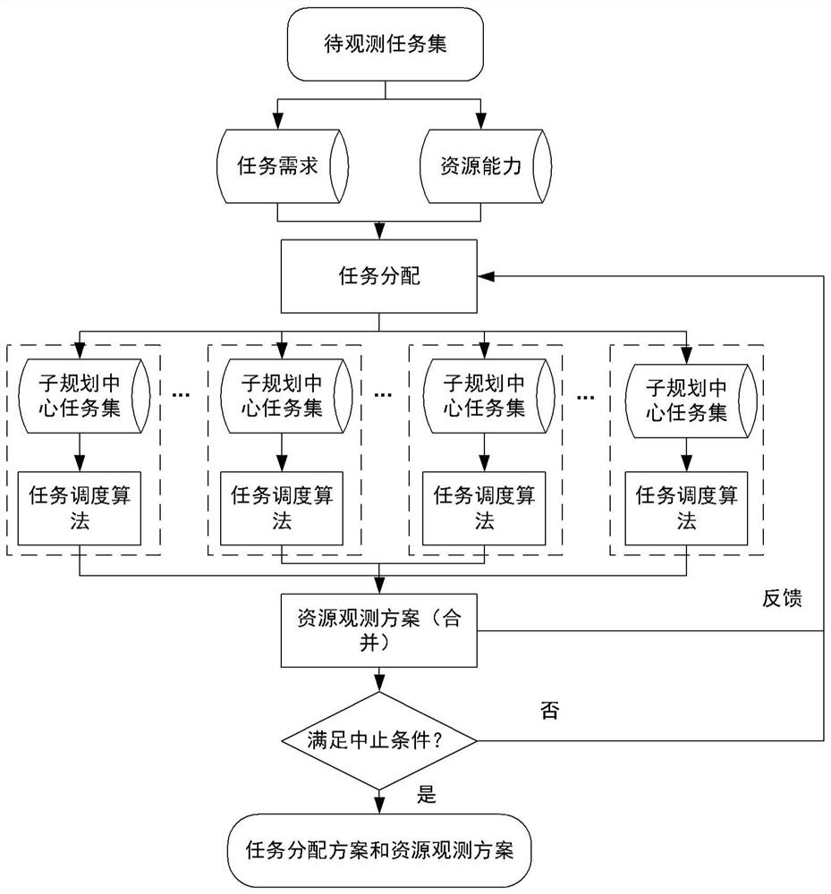
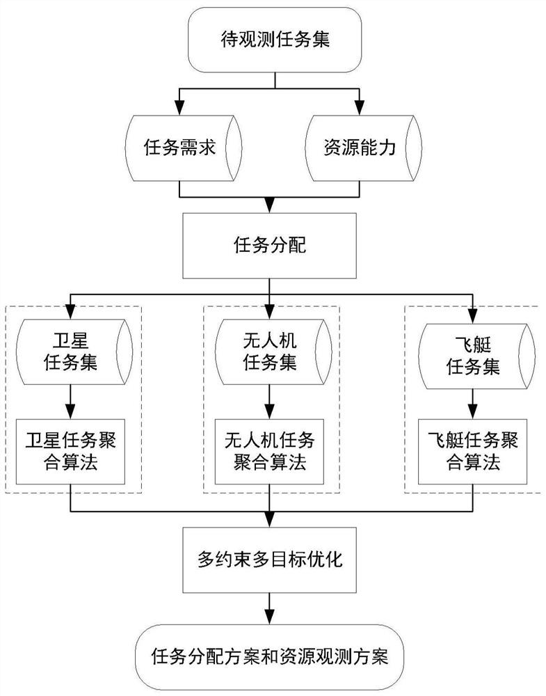
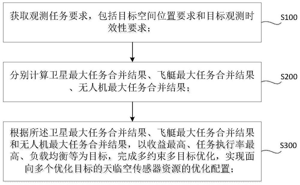
[0097] The present disclosure provides a method and device for planning collaborative missions of sky-link sensors, and performs centralized management and unified allocation of cross-domain sensor resources, so as to realize optimal configuration of the sensor resources of the sky-link sky. The method and device aim at the highest revenue, the highest task execution rate, and load balance, and complete multi-constraint and multi-objective optimization to realize the optimal allocation of sky-link sensor resources for multiple optimization objectives. Compared with traditional methods, it can Realize the optimal allocation of Tianlinkong sensor resources for multiple optimization objectives. This disclosure calculates the combined result of the largest satellite task, the combined result of the largest task of the airship, and the combined result of the largest task of the airship. It can combine multiple remote sensing observation tasks with similar observation task requiremen...
PUM
 Abstract
Description
Claims
Application Information
 - R&D
- Intellectual Property
- Life Sciences
- Materials
- Tech Scout
- Unparalleled Data Quality
- Higher Quality Content
- 60% Fewer Hallucinations
Browse by: Latest US Patents, China's latest patents, Technical Efficacy Thesaurus, Application Domain, Technology Topic, Popular Technical Reports.
© 2025 PatSnap. All rights reserved.Legal|Privacy policy|Modern Slavery Act Transparency Statement|Sitemap|About US| Contact US: help@patsnap.com


