Cable tunnel interior and ground position cooperative positioning system and method
A cable tunnel and collaborative positioning technology, applied in the direction of location information-based services, specific environment-based services, advanced technology, etc., can solve the problems of no communication signal, no GPS signal in the tunnel, and inability to excavate rescue, etc., to achieve rapid The effect of positioning rescue and preventing accidents
- Summary
- Abstract
- Description
- Claims
- Application Information
AI Technical Summary
Problems solved by technology
Method used
Image
Examples
Embodiment 1
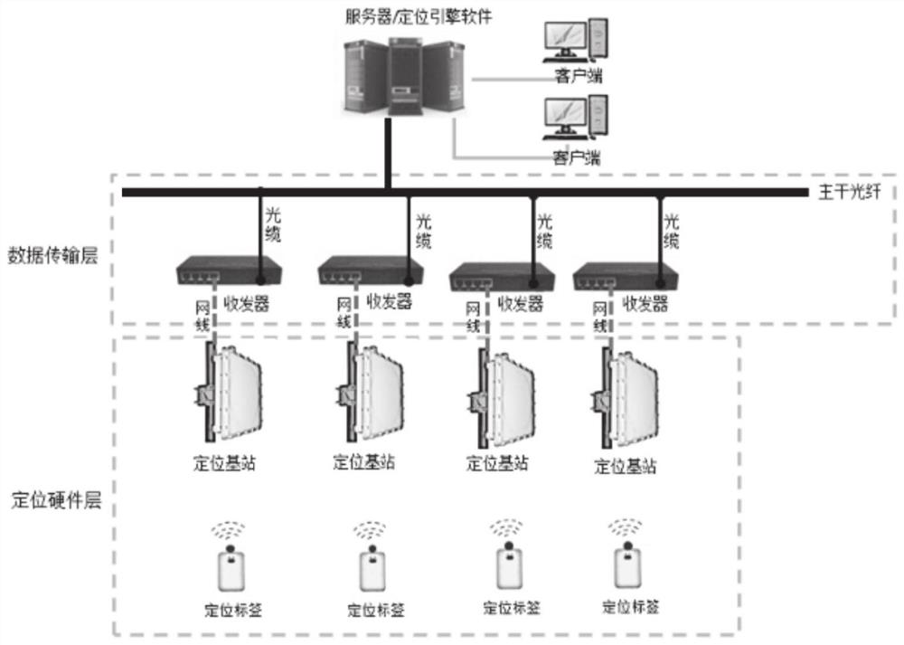
[0033] In order to locate the personnel in the cable tunnel on the ground, and obtain the latitude and longitude coordinates and latitude and longitude coordinates of the personnel, so that the personnel's positioning does not depend on the fixed attachments on the ground, and it is impossible to locate from the ground after the attachments on the ground change. Regarding the location problem of underground cable tunnels, a coordinated positioning system for the interior of the cable tunnel and the location on the ground is disclosed, including:
[0034] Positioning tags, worn on the body of the personnel in the tunnel, are used to locate the personnel in the tunnel;
[0035] Multiple sets of positioning base stations are installed in the tunnel to communicate with the positioning tags to obtain the positioning tag information and the distance information between the positioning tags and the positioning base stations;
[0036] The positioning server receives the positioning la...
Embodiment 2
[0058] In this embodiment, a working method of a cable tunnel internal and ground location co-location system disclosed in Embodiment 1 is disclosed, including:
[0059] The positioning base station and the positioning tag communicate with each other, obtain the positioning tag information inside the cable tunnel, and the distance information between the positioning base station and the positioning tag;
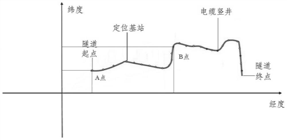
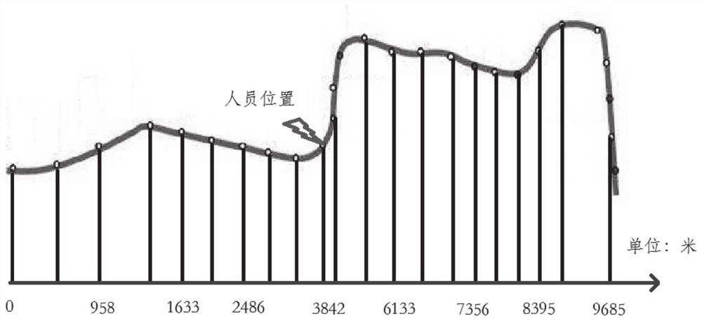
[0060] According to the distance information between the positioning base station and the positioning tag, the position information of the person in the cable tunnel is obtained, and according to the direction diagram of the cable tunnel, the deviation angle between the position of the person and the true north direction of the positioning base station is obtained, and according to the distance information Calculate the latitude and longitude offset between the personnel and the positioning base station, and obtain the latitude and longitude coordinates of the personnel in the...
PUM
 Abstract
Description
Claims
Application Information
 - R&D
- Intellectual Property
- Life Sciences
- Materials
- Tech Scout
- Unparalleled Data Quality
- Higher Quality Content
- 60% Fewer Hallucinations
Browse by: Latest US Patents, China's latest patents, Technical Efficacy Thesaurus, Application Domain, Technology Topic, Popular Technical Reports.
© 2025 PatSnap. All rights reserved.Legal|Privacy policy|Modern Slavery Act Transparency Statement|Sitemap|About US| Contact US: help@patsnap.com


