Auxiliary device for multi-point measurement by using geological radar
A technology of ground radar and auxiliary devices, which is applied in the direction of measuring devices, using re-radiation, and radio wave measurement systems, etc. It can solve the problems of poor bonding between ground radar and lining structure, deviation of measuring lines for technicians, laborious lifting of workers, etc. problems, to achieve the effect of improving fit, reducing labor intensity and improving applicability
- Summary
- Abstract
- Description
- Claims
- Application Information
AI Technical Summary
Problems solved by technology
Method used
Image
Examples
Embodiment 1
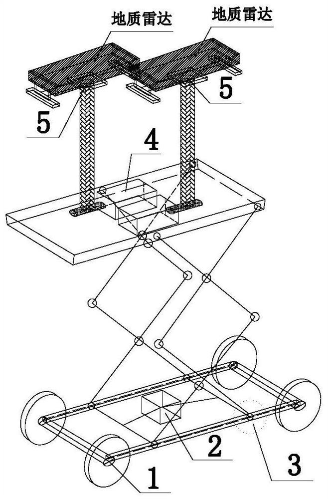
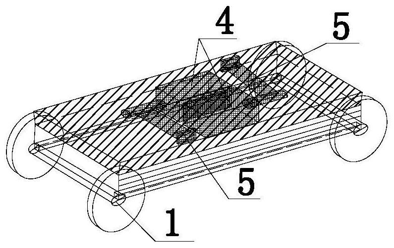
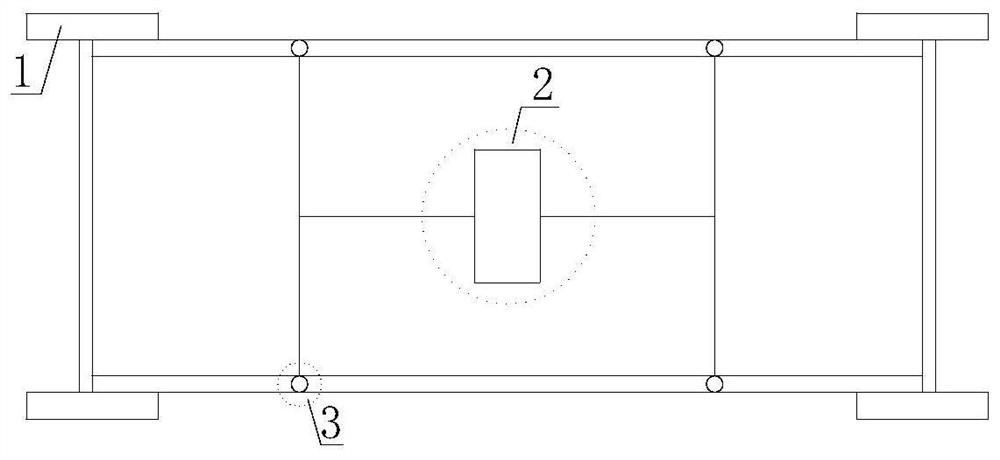
[0052] Such as figure 1 Schematic diagram for the working of the auxiliary measuring device, figure 2 Schematic diagram of the auxiliary measuring device when it is retracted, image 3 It is a top view of the lower structure of the auxiliary measuring device; the present invention provides an auxiliary device for multi-point measurement using geological radar, including: a fixing device 5, a connecting device 3 and a rolling device 1;
[0053] The geological radar is fixed on the fixing device 5, and is connected to the rolling device 1 through the connecting device 3; the connecting device 3 is a telescopic structure, and the telescopic amount is set based on the measurement environment, and then the height of the radar is adjusted ;
[0054] The fixing device 5 includes a fixed plate and a movable support rod; one end of the movable support rod is fixed on the connecting device 3, and the other end is rotatably connected to the middle of the fixed plate, and the geologica...
Embodiment 2
[0084] Based on the same inventive concept, the present invention also provides a measurement method of an auxiliary device utilizing geological radar for multi-point measurement; including:
[0085] Step 1, device adjustment, according to the design width of the cable tunnel walkway, pull the embedded shaft 103, adjust the wheelbase between the rollers 101, so that the device is stuck on both sides of the walkway;
[0086] Step 2, radar antenna installation, put the handle of the radar antenna in the concave plate 501, disturb the handle with the toothed belt 508, pass through the small hole of the back plate 502, and tighten the toothed belt 508;
[0087] Repeat the operation several times, and fix the radar antenna on the ground radar fixing device 5. When it is necessary to measure multiple survey lines at the same time, install multiple radar antennas and repeat the above steps;
[0088] Step 3, the radar antenna is in place, according to the actual needs of the site, the...
PUM
 Abstract
Description
Claims
Application Information
 - R&D
- Intellectual Property
- Life Sciences
- Materials
- Tech Scout
- Unparalleled Data Quality
- Higher Quality Content
- 60% Fewer Hallucinations
Browse by: Latest US Patents, China's latest patents, Technical Efficacy Thesaurus, Application Domain, Technology Topic, Popular Technical Reports.
© 2025 PatSnap. All rights reserved.Legal|Privacy policy|Modern Slavery Act Transparency Statement|Sitemap|About US| Contact US: help@patsnap.com


