Method and system for converting spatial data into dwg data

A technology of spatial data and data, applied in the field of data conversion, can solve the problems of area, length error, inability to convert styles, and tuple cannot convert group primitives, etc., to reduce conversion work, save money, manpower and material resources, and avoid mistakes. Effect

Pending Publication Date: 2020-09-01
洛阳鸿业迪普信息技术有限公司
View PDF0 Cites 2 Cited by
  • Summary
  • Abstract
  • Description
  • Claims
  • Application Information

AI Technical Summary

Problems solved by technology

[0003] The existing GIS to DWG conversion relies on the ArcGIS platform, and the user must install the ArcGIS software; after the spatial data is converted into a CAD primitive, the color, line type, line width, layer, etc. of the CAD are default and cannot be converted to the user's needs Style; point elements cannot be converted to CAD block primitives; there will be certain errors in the area and length of circles, arcs, elliptical arcs, and ellipses; island data cannot be converted to CAD area primitives; multigroups cannot be converted to DWG group primitive

Method used


Image

  • Method and system for converting spatial data into dwg data
  • Method and system for converting spatial data into dwg data
  • Method and system for converting spatial data into dwg data

Examples


Embodiment Construction

[0031] The present invention will be further described below in conjunction with specific examples.

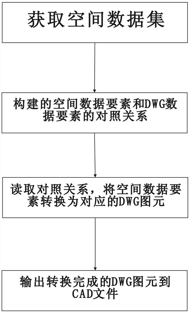
[0032] A method for converting spatial data to dwg data, the specific conversion process is as follows:

[0033] Step 1. Read the spatial data through the ArcEngine API to obtain the spatial dataset. The spatial dataset includes the data table type, spatial data elements, and data table structure.

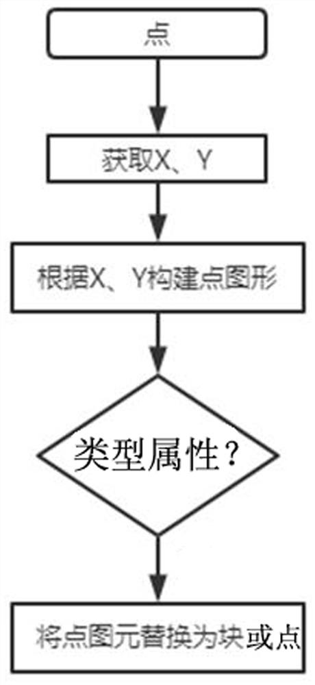
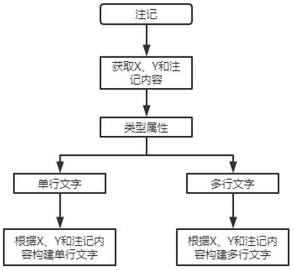
[0034] Step 2. The comparison relationship between spatial data elements and DWG data elements constructed according to the data table type. Various elements include color, layer, line type, symbol, arc, center, radius, start point, end point and other attribute comparison relationships.

[0035] Step 3: Read the comparison relationship between the spatial data element and the DWG graphic element, obtain the attribute of the spatial data element, and convert the spatial data element into the corresponding DWG graphic element through the data table structure.

[0036] Step 4. Final...


PUM


Abstract

The invention discloses a method and system for converting spatial data into dwg data, and the method specifically comprises the following steps: obtaining a spatial data set which comprises a data table type, spatial data elements, and a data table structure; constructing a contrast relationship between spatial data elements and DWG data elements according to the type of the data table; reading acontrast relationship between the spatial data elements and the DWG primitives, and converting the spatial data elements into the corresponding DWG primitives through a data table structure; and finally, outputting the converted DWG primitives to a CAD file. The problems of loss of graphic data such as circles, arcs, elliptic arcs, ellipses, islands and multituples and loss of attribute information in the conversion process from spatial data to CAD data are solved.

Description

technical field [0001] The invention relates to the technical field of data conversion, in particular to a method and system for converting spatial data to dwg data. Background technique [0002] Since the results of national land spatial planning are spatial data, editing of spatial data needs to be done in the GIS data platform. Since the editing operation of spatial data in the GIS data platform is complicated, the operation in the CAD platform will be very convenient and fast. Therefore, converting spatial data to DWG data will save designers a lot of time, energy and financial resources. This requires methods and systems involving the conversion of GIS data (spatial data) into CAD data (DWG data). [0003] The existing GIS to DWG conversion relies on the ArcGIS platform, and the user must install the ArcGIS software; after the spatial data is converted into a CAD primitive, the color, line type, line width, layer, etc. of the CAD are default and cannot be converted to...

Claims


Application Information

Patent Timeline
IPC IPC(8): G06F16/25G06F16/22
CPCG06F16/258G06F16/2282
Inventor 何旭海张华杜红涛孙国增庞玉良任洪坡郭阳阳陈小下王庆国
Owner 洛阳鸿业迪普信息技术有限公司
Why Eureka
Try Eureka