Surveying and mapping instrument for land resource management

A technology of land resources and instruments, applied in instruments, telescopes, optics, etc., can solve problems such as troublesome, difficult to control fineness, etc.

Inactive Publication Date: 2020-07-10
尹建国
View PDF0 Cites 2 Cited by
  • Summary
  • Abstract
  • Description
  • Claims
  • Application Information

AI Technical Summary

Problems solved by technology

[0002] As we all know, in the field of land resources management, the level will be widely used. The level is an instrument that establishes a horizontal line of sight to measure the height difference between two points on the ground. It measures the height difference between ground points according to the principle of leveling. and a support frame, and an adjustment plate for adjusting the level is set at the bottom of the telescope. During the use of the leve...

Method used


Image

  • Surveying and mapping instrument for land resource management
  • Surveying and mapping instrument for land resource management
  • Surveying and mapping instrument for land resource management

Examples


Embodiment Construction

[0019] The following will clearly and completely describe the technical solutions in the embodiments of the present invention with reference to the accompanying drawings in the embodiments of the present invention. Obviously, the described embodiments are only some, not all, embodiments of the present invention. Based on the embodiments of the present invention, all other embodiments obtained by persons of ordinary skill in the art without making creative efforts belong to the protection scope of the present invention.

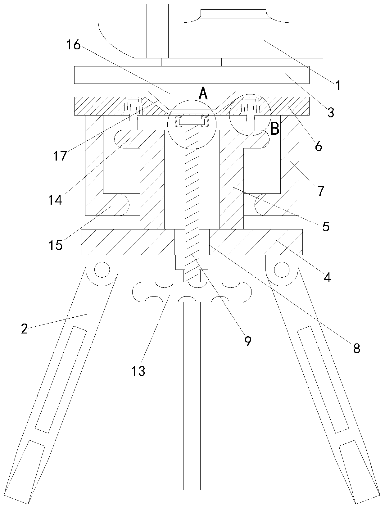
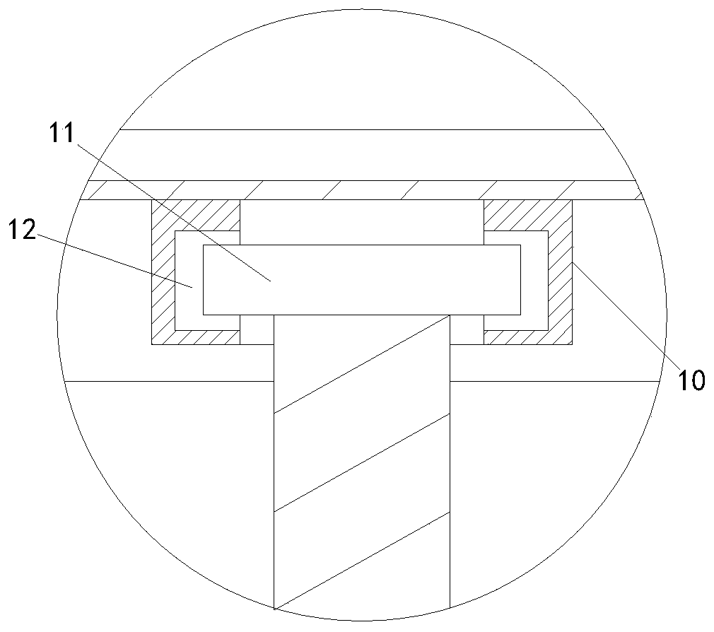
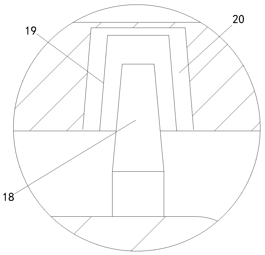
[0020] see Figure 1-3 , a surveying and mapping instrument for land resource management of the present invention comprises a telescope 1 and a support frame 2, the telescope 1 is arranged on the top of the support frame 2, the bottom of the telescope 1 is provided with a first fixing plate 3, and the support frame 2 The top of the top is provided with the second fixed plate 4 that matches with the first fixed plate 3, the top of the second fixed plate 4 is pr...


PUM

PropertyMeasurementUnit
Diameteraaaaaaaaaa

Abstract

The invention discloses a surveying and mapping instrument for land resource management. The instrument comprises a telescope and a support frame. A first fixing plate is arranged at the bottom of thetelescope; a second fixing plate is arranged at the top of the support frame; a first supporting sleeve is arranged at the top of the second fixing plate; a third fixing plate matching the first fixing plate is arranged at the top of the first supporting sleeve; a second supporting sleeve is arranged at the bottom of the third fixing plate; the second supporting sleeve is movably arranged outsidethe first supporting sleeve in a sleeving manner; a first through hole is formed in the second fixing plate; a first connecting rod is arranged in the first through hole in a communicating manner; athird supporting sleeve is arranged at the bottom of the third fixing plate; the third supporting sleeve and the first connecting rod are connected together through mutual meshing of a first fixing disc and a first groove, the first connecting rod can rotate relative to the third supporting sleeve, the first connecting rod is screwed to adjust the height of the third fixing plate conveniently, sothat the height of the telescope can be conveniently adjusted.

Description

technical field [0001] The invention relates to the technical field of land resource management, in particular to a surveying and mapping instrument for land resource management. Background technique [0002] As we all know, in the field of land resources management, the level will be widely used. The level is an instrument that establishes a horizontal line of sight to measure the height difference between two points on the ground. It measures the height difference between ground points according to the principle of leveling. and a support frame, and an adjustment plate for adjusting the level is set at the bottom of the telescope. During the use of the level, after adjusting the level of the level, if you need to adjust the height of the telescope when using the level, you can only adjust it. It is very troublesome to adjust the height of the telescope by adjusting the inclination angle of the support frame, and then readjust the level of the telescope. In addition, the he...

Claims


Application Information

Patent Timeline
IPC IPC(8): G02B23/16
CPCG02B23/16
Inventor 尹建国姜立芳王晓光
Owner 尹建国
Why Eureka
Try Eureka