Massive multi-source data fusion visualization method for urban surface monitoring

A technology of surface monitoring and multi-source data, applied in the field of geographic information system, can solve the problems of low degree of visualization, large amount of data, poor versatility, etc., and achieve the effect of high degree of visualization and strong versatility

Pending Publication Date: 2020-06-02
武汉市珞珈俊德地信科技有限公司
View PDF7 Cites 1 Cited by
  • Summary
  • Abstract
  • Description
  • Claims
  • Application Information

AI Technical Summary

Problems solved by technology

Due to the large amount of data and complex structure of BIM data, there are problems such as low degree of visualization and poor versatility when combined with GIS information.

Method used


Image

  • Massive multi-source data fusion visualization method for urban surface monitoring

Examples


Embodiment 1

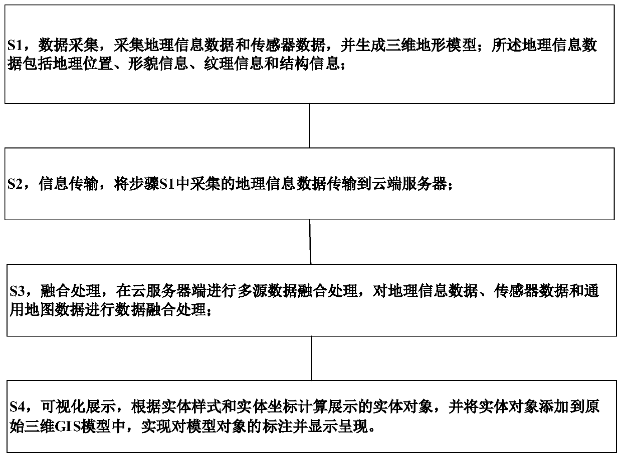
[0042] Such as figure 1 As shown, a massive multi-source data fusion visualization method for urban surface monitoring, including:

[0043] S1, data acquisition, collecting geographic information data and sensor data, and generating a three-dimensional terrain model; the geographic information data includes geographic location, shape information, texture information and structural information;

[0044] S2, information transmission, the geographic information data collected in step S1 is transmitted to the cloud server;

[0045] S3, fusion processing, performs multi-source data fusion processing on the cloud server side, and performs data fusion processing on geographic information data, sensor data and general map data;

[0046] S4, visual display, calculate and display the entity object according to the entity style and entity coordinates, and add the entity object to the original 3D GIS model, realize the labeling and display of the model object.


PUM


Abstract

The invention discloses a massive multi-source data fusion visualization method for urban surface monitoring, which comprises the steps of S1, data acquisition: acquiring geographic information data and sensor data, and generating a three-dimensional terrain model; wherein the geographic information data comprises geographic position, morphology information, texture information and structure information; S2, information transmission: transmitting the geographic information data acquired in the step S1 to a cloud server; and S3, fusion processing: performing multi-source data fusion processingat a cloud server side, and performing data fusion processing and the like on the geographic information data, the sensor data and the general map data; according to the method, the texture information and the like of each entity can be accurately described, the universality is high, the data information of each entity can be comprehensively described, and the visualization degree is high.

Description

technical field [0001] The invention relates to the technical field of geographic information systems, and more specifically, to a method for fusion and visualization of massive multi-source data for urban surface monitoring. Background technique [0002] The combination of Geographic Information System (GIS) and Building Information Modeling (BIM) is an important technical path for building a smart city. Due to the large amount of data and complex structure of BIM data, there are problems such as low degree of visualization and poor versatility when combined with GIS information. Contents of the invention [0003] The purpose of the present invention is to overcome the deficiencies of the prior art, and provide a fusion visualization method for mass multi-source data of urban surface monitoring, which can accurately describe the texture information of each entity, etc., has strong versatility, and can comprehensively describe the data of each entity Information, high deg...

Claims


Application Information

Patent Timeline
Patent Type & Authority Applications(China)
IPC IPC(8): G06F16/29G06F16/44
CPCG06F16/29G06F16/444
Inventor 方孟元许毅
Owner 武汉市珞珈俊德地信科技有限公司
Why Eureka
Try Eureka