Ground extraction method based on laser radar point cloud characteristic line and plane calibration

A technology of laser radar and extraction method, applied in the field of vehicle laser scanning, can solve the problems of large amount of data, time-consuming, error, long point cloud data level, etc., to achieve the effect of shortening time-consuming, reducing horizontal error, and improving real-time performance

Pending Publication Date: 2020-05-29
YANSHAN UNIV
View PDF5 Cites 6 Cited by
  • Summary
  • Abstract
  • Description
  • Claims
  • Application Information

AI Technical Summary

Problems solved by technology

[0005] Aiming at the two problems of the current laser radar point cloud ground segmentation algorithm, the data volume is huge and time-consuming, and the obtained point cloud data has horizontal errors in the radar coordinate system. The present invention discloses a method based on the laser radar point cloud feature line and plane A calibrated ground extraction method comprising the following steps:

Method used


Image

  • Ground extraction method based on laser radar point cloud characteristic line and plane calibration
  • Ground extraction method based on laser radar point cloud characteristic line and plane calibration
  • Ground extraction method based on laser radar point cloud characteristic line and plane calibration

Examples


Embodiment Construction

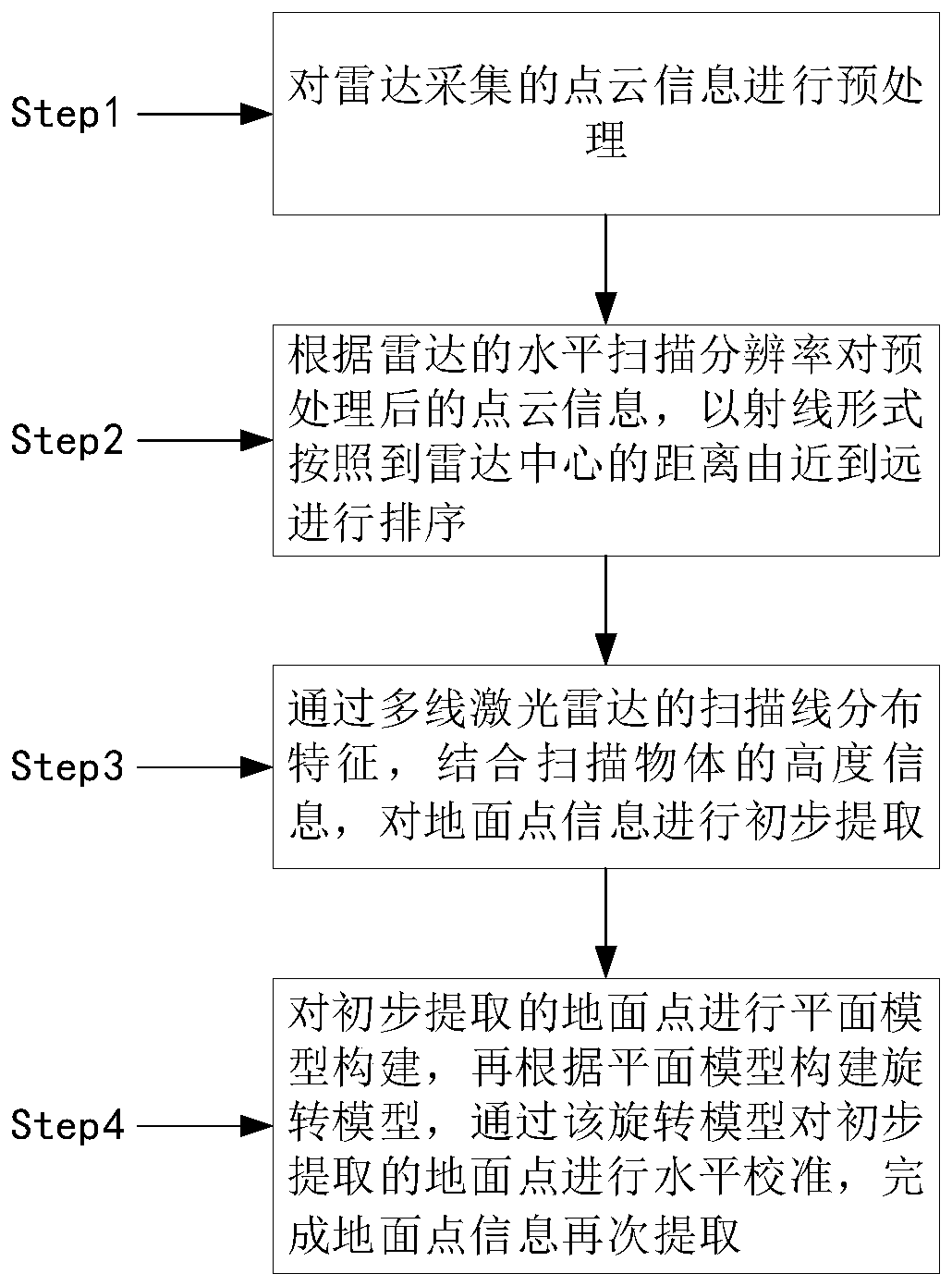
[0057] In order to make the technical solutions and advantages of the present invention more clear, the technical solutions in the embodiments of the present invention are clearly and completely described below in conjunction with the drawings in the embodiments of the present invention:

[0058] figure 1 It is a step diagram of the method of the present invention; the present invention proposes a ground extraction method based on laser radar point cloud feature lines and plane calibration, comprising the following steps:

[0059] S1: Preprocess the point cloud information collected by the radar, and use the point cloud downsampling method to compress the point cloud to reduce the calculation time and algorithm complexity;

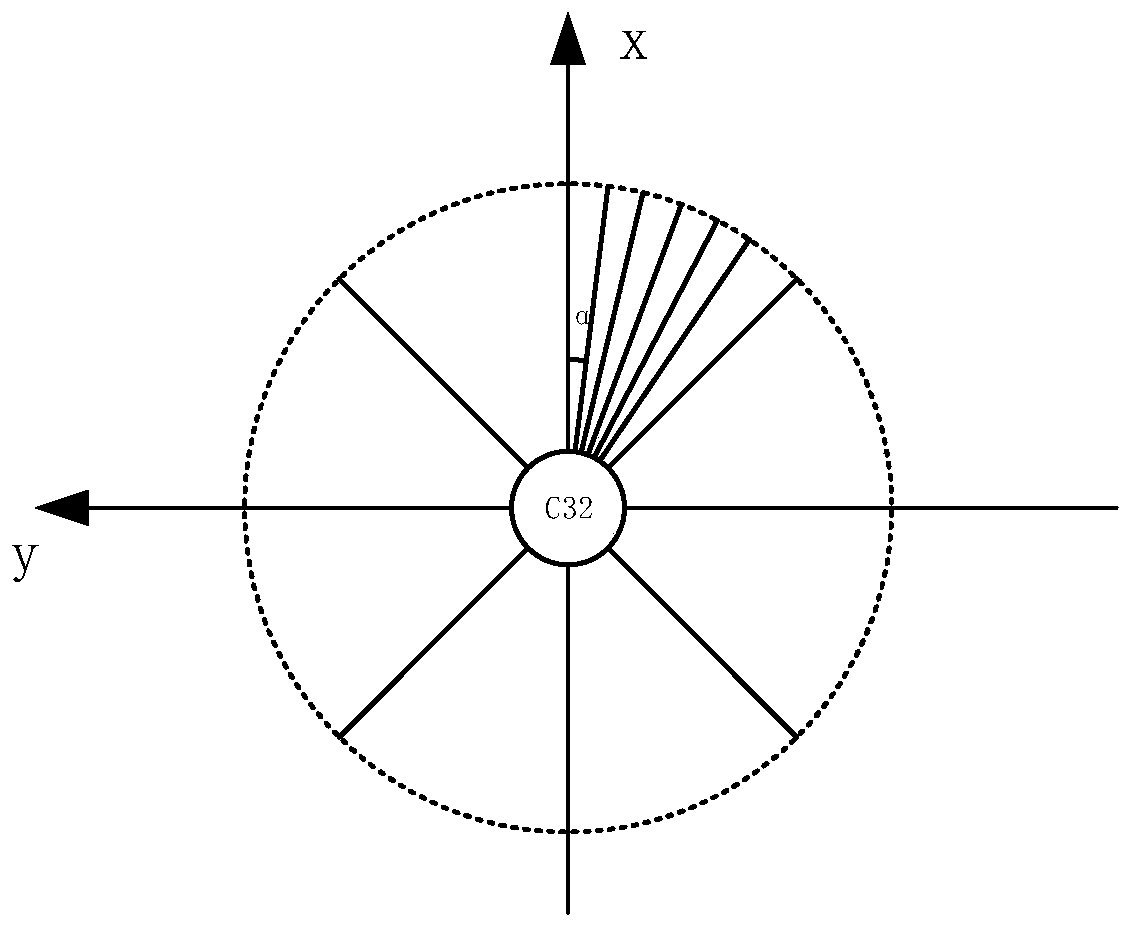
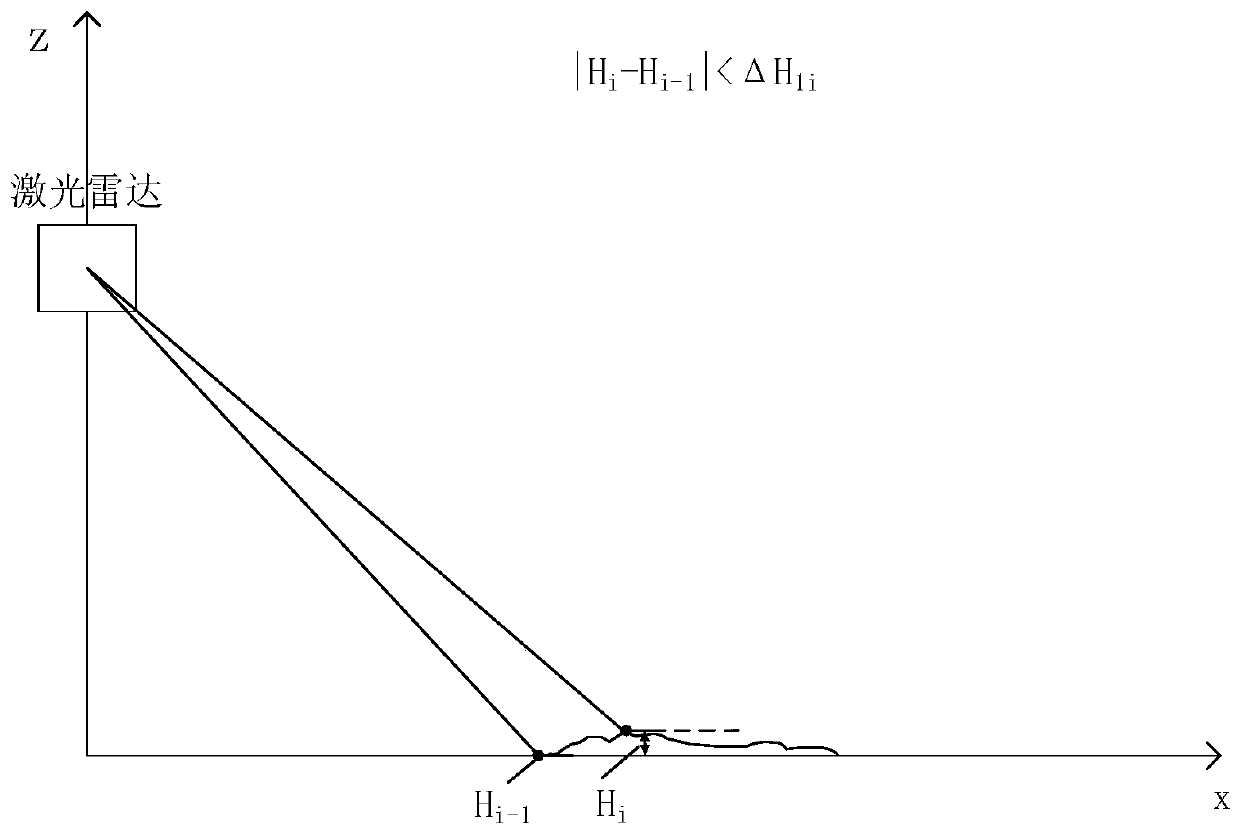
[0060] S2: According to the horizontal scan resolution of the radar, the preprocessed point cloud information is sorted according to the distance to the radar center from near to far in the form of rays, and the azimuth information is assigned to each poin...


PUM


Abstract

The invention discloses a ground extraction method based on laser radar point cloud characteristic line and plane calibration, and belongs to the technical field of vehicle-mounted laser scanning. Themethod comprises the following steps: carrying out the preprocessing of point cloud information collected by a radar; sorting the preprocessed point cloud information in a ray form from near to far from the center of the radar according to the horizontal scanning resolution of the radar; preliminarily extracting ground point information through scanning line distribution characteristics of a multi-line laser radar in combination with height information of a scanned object; carrying out plane model construction on preliminarily extracted ground points, then constructing a rotation model according to a plane model, and carrying out horizontal calibration on the preliminarily extracted ground points through the rotation model so as to complete the re-extraction of the ground point information. According to the method, ground and non-ground points can be extracted while the real-time performance is improved and the horizontal error of point cloud is corrected, the data volume of the pointcloud to be calculated is reduced by compressing the point cloud data under the condition of not changing the characteristics of the point cloud, the time consumption is reduced, and the real-time performance is improved.

Description

technical field [0001] The invention relates to the technical field of vehicle-mounted laser scanning, in particular to a ground extraction method based on laser radar point cloud feature lines and plane calibration. Background technique [0002] With its long scanning distance, 3D lidar can obtain accurate 3D information, and its advantages of good stability and robustness are gradually being applied to the construction of vehicle maps. At present, in this field, there are two deficiencies in the ground segmentation algorithm of lidar point cloud: [0003] (1) The amount of data to be processed is huge and time-consuming. At present, the multi-line radars used for terrain scanning on the market are 16 lines, 32 lines, and 64 lines. Many pairs of laser emitting and receiving devices are installed inside to perform 360-degree scanning. Panoramic scanning, the amount of data per second is at least 320,000, and the maximum is about 1.3 million. If such a large amount of data ...

Claims


Application Information

Patent Timeline
Patent Type & Authority Applications(China)
IPC IPC(8): G01S7/497G01S7/48G01S17/931G01S17/89
CPCG01S7/497G01S7/4972G01S7/48G01S17/89
Inventor 刘爽张翼飞
Owner YANSHAN UNIV
Why Eureka
Try Eureka