Remote sensing image color correction method and system based on cloud mask and MSR
A remote sensing image and color technology, which is applied in image enhancement, image analysis, image data processing, etc., can solve the problems of low contrast of color correction results and cloud color cast, etc., to reduce manual processing costs, improve universality, and improve The effect of processing efficiency
- Summary
- Abstract
- Description
- Claims
- Application Information
AI Technical Summary
Problems solved by technology
Method used
Image
Examples
Embodiment
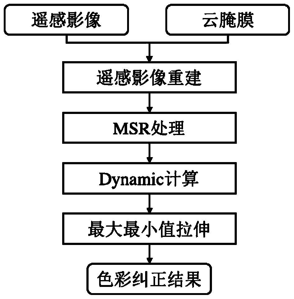
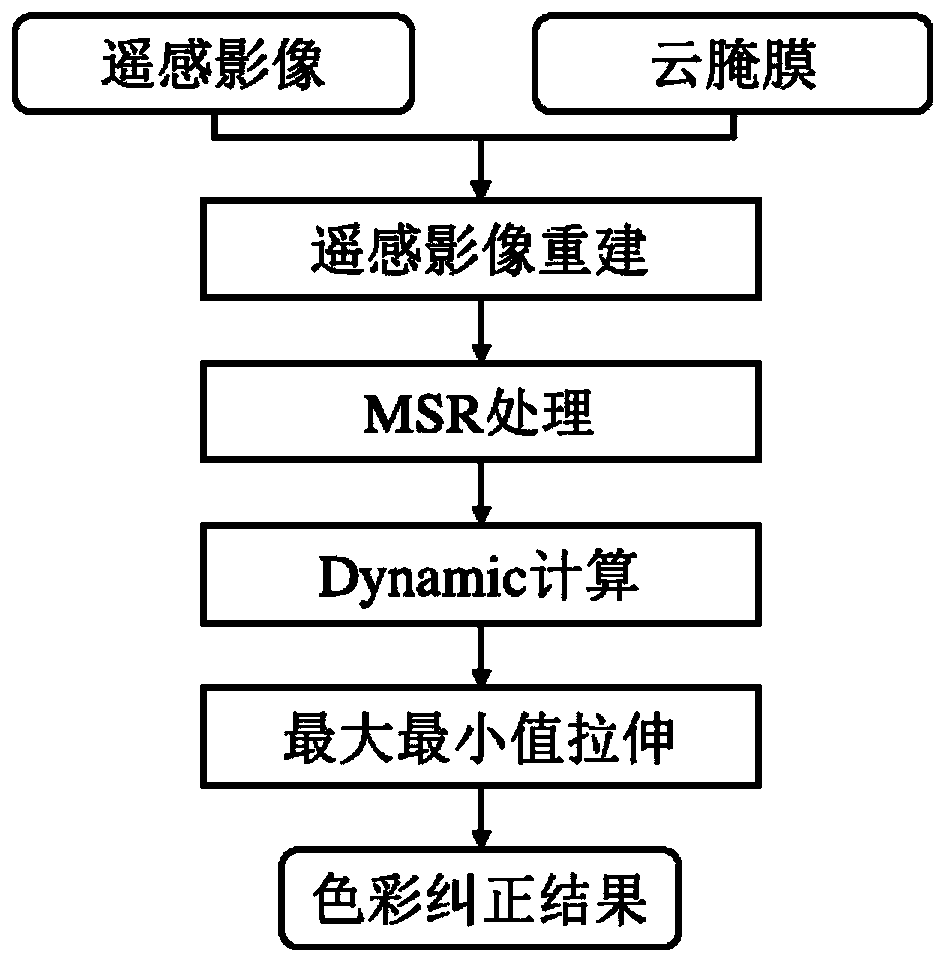
[0080] The implementation flow chart of the present invention is as figure 1 shown. The color correction method of remote sensing images based on multi-scale Retinex includes the following steps:
[0081] Step 1: Reconstruct the remote sensing image by using the cloud salt film, and generate the reconstructed remote sensing image. Specifically:
[0082] (1.1) Utilize the cloud salt film to calculate the pixel mean value of the cloud-free coverage area in sub-bands;
[0083] (1.2) Use the pixel mean value of the cloud-free coverage area in each band to replace the pixel value of the cloud coverage area in the image, complete the reconstruction of the remote sensing image, and generate the reconstructed result.
[0084] Step 2: Perform MSR processing on the reconstructed result generated in step (1) to generate a result after MSR processing. Specifically:
[0085] (2.1) The number of scales in the present invention is 3, and Gaussian blur is carried out to the remote sensin...
PUM
 Abstract
Description
Claims
Application Information
 - R&D Engineer
- R&D Manager
- IP Professional
- Industry Leading Data Capabilities
- Powerful AI technology
- Patent DNA Extraction
Browse by: Latest US Patents, China's latest patents, Technical Efficacy Thesaurus, Application Domain, Technology Topic, Popular Technical Reports.
© 2024 PatSnap. All rights reserved.Legal|Privacy policy|Modern Slavery Act Transparency Statement|Sitemap|About US| Contact US: help@patsnap.com


