Sea surface salinity inversion algorithm based on wind cloud meteorological satellite

An inversion algorithm, meteorological satellite technology, applied in neural learning methods, biological neural network models, design optimization/simulation, etc., can solve problems such as inability to accurately detect changes in sea surface salinity and dispersion of sea surface salinity.

Pending Publication Date: 2020-03-24
山西大地新亚科技有限公司
View PDF0 Cites 9 Cited by
  • Summary
  • Abstract
  • Description
  • Claims
  • Application Information

AI Technical Summary

Benefits of technology

This patented technology uses advanced techniques from machine learning methods such as convolutional neural networks or support vector regression analysis to improve oceanographic saltiness detection capabilities over time without being limited by gamma rays emitted through space due to their influence upon marine environments.

Problems solved by technology

This patented technical problem addressed in this patents relates to developing a new way to measure sea surface saltiness without being limited temporally or spatially due to limitations associated with current methods like airborne radar measurements and ground boron measurement tools.

Method used


Image

  • Sea surface salinity inversion algorithm based on wind cloud meteorological satellite
  • Sea surface salinity inversion algorithm based on wind cloud meteorological satellite
  • Sea surface salinity inversion algorithm based on wind cloud meteorological satellite

Examples


Embodiment Construction

[0040] The following will clearly and completely describe the technical solutions in the embodiments of the present invention with reference to the accompanying drawings in the embodiments of the present invention. Obviously, the described embodiments are only some, not all, embodiments of the present invention. Based on the embodiments of the present invention, all other embodiments obtained by persons of ordinary skill in the art without making creative efforts belong to the protection scope of the present invention.

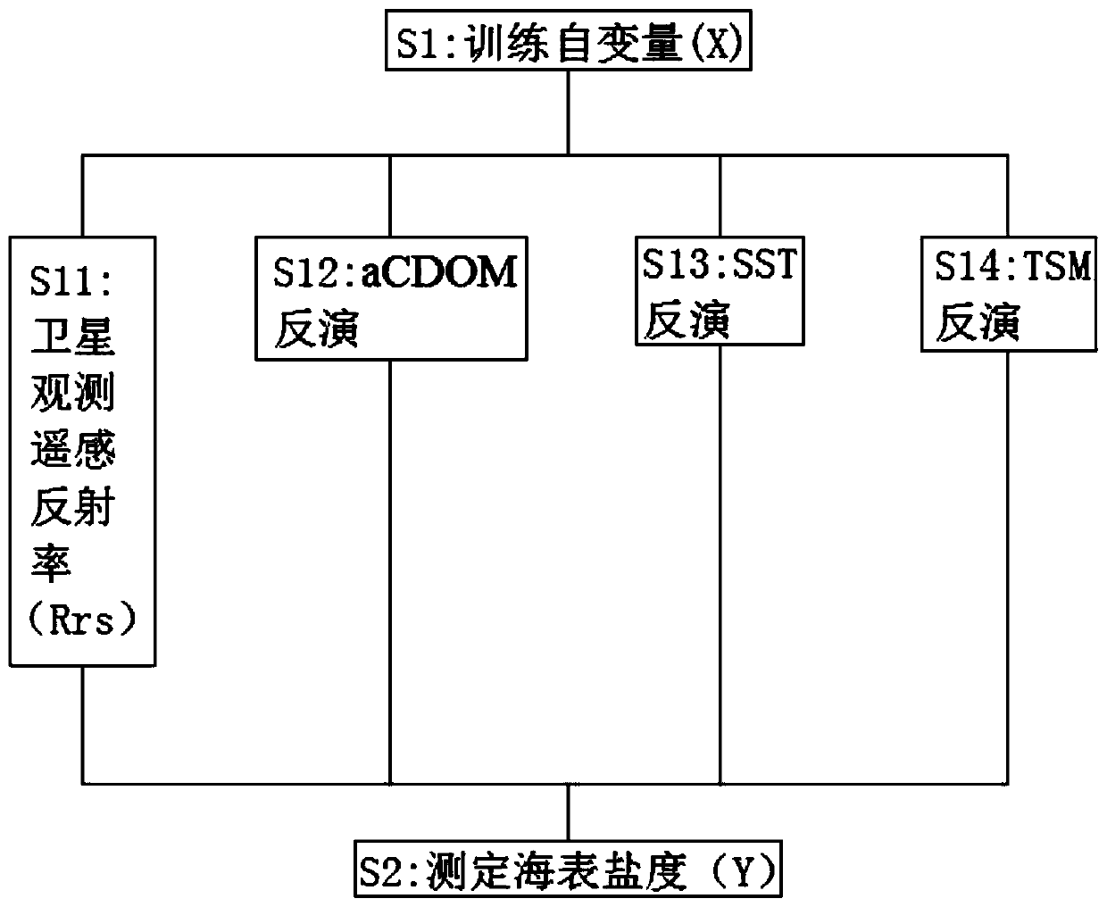
[0041] see Figure 1-6 , the present invention provides a technical solution: a sea surface salinity retrieval algorithm based on Fengyun Meteorological Satellite, comprising the following steps:

[0042] S1: Training independent variable (X): According to the need to increase the number of hidden layers according to the regression task, a deep neural network is used to carry out sea surface salinity satellite inversion algorithm model, which is 4-band satellite...


PUM


Abstract

The invention discloses a sea surface salinity inversion algorithm based on a wind cloud meteorological satellite. The method comprises the following steps: S1, training independent variables (X): increasing the number of hidden layers according to the need of a regression task, building a sea surface salinity satellite inversion algorithm model for a deep neural network, and setting up four independent variables including the four-waveband satellite observation remote sensing reflectance (Rrs), aCDOM, the sea surface temperature (SST) and the suspended matter concentration (TSM); and S2, measuring the sea surface salinity (Y): establishing a relationship between aCDOM, SST and TSM and the sea surface salinity through a deep learning model, and realizing the observation of the global seasurface salinity by utilizing the FY-3D/MERSI global observation capability. According to the invention, a sea surface salinity inversion algorithm of a domestic wind cloud meteorological satellite (FY-3D/MERSI) is established based on a deep learning method; observation of high spatial-temporal resolution of sea surface salinity is achieved, and the problems that due to the limitation of low spatial-temporal resolution, data quality and the like of SMOS and Aquarius/SAC-D satellites, the sea surface salinity data coverage rate is low, and the sea surface salinity cannot be observed with the high spatial-temporal resolution are solved.

Description


Claims


Application Information

Patent Timeline
Owner 山西大地新亚科技有限公司
Why Eureka
Try Eureka