
Spatial autocorrelation machine learning satellite precipitation data downscaling method and system

A technology of spatial autocorrelation and machine learning, applied in machine learning, image data processing, nonlinear system models, etc. poor starting performance

Active Publication Date: 2020-01-31
GUANGZHOU INST OF GEOGRAPHY GUANGDONG ACAD OF SCI +1
View PDF14 Cites 15 Cited by
  • Summary
  • Abstract
  • Description
  • Claims
  • Application Information

AI Technical Summary

Problems solved by technology

[0006] (1) This method only establishes the regression model between precipitation data and independent variables, without considering the nonlinear relationship between precipitation data and independent variables, and does not consider the spatial autocorrelation information of satellite remote sensing precipitation data itself, ignoring the geographical process. The inherent spatial autocorrelation of precipitation data;
[0007] (2) This method only uses the traditional interpolation method to correct the precipitation residual, and does not take into account the difference in scale before and after downscaling and the inherent spatial correlation of the data, which will bring a certain loss of accuracy to the downscaling results
[0009] (1) This method only establishes a regression downscaling model between monthly precipitation data and independent variables, does not consider the spatial autocorrelation information of satellite remote sensing precipitation data itself, and ignores the inherent spatial autocorrelation characteristics of precipitation data in geographical processes;
[0010] (2) This method does not correct the residual error of the regression downscaling model, which will bring a certain loss of accuracy to the downscaling result, especially when the fitting degree of the regression model between the precipitation data and the independent variable is low, the regression model's The residual is relatively large, and the residual of the regression model is even larger
[0011] (3) This method only considers the influence of NDVI and terrain factors, ignoring the influence of daytime / nighttime surface temperature and day-night surface temperature difference
[0013] (1) This method only considers the correlation between satellite remote sensing precipitation data and daytime surface temperature, nighttime surface temperature, day-night surface temperature difference, digital elevation model and vegetation index, and does not consider the spatial autocorrelation information of satellite remote sensing precipitation data itself. The inherent spatial autocorrelation properties of precipitation data in geographic processes;
[0014] (2) This method only uses the traditional spline interpolation method to correct the regression residuals, and does not consider the difference in scale before and after downscaling and the inherent spatial correlation of the data, which will bring a certain loss of accuracy to the downscaling results;
[0015] (3) The initial performance of the random forest model used in this method is poor, especially when there is only one basic learner, as the number of learners increases, the random forest usually converges to a lower generalization error, and in the noisy environment Overfitting on classification or regression problems
[0016] In summary, the prior art still does not solve the above-mentioned deficiencies in the two aspects, and there is no description or report of the similar technology of the present invention and similar materials at home and abroad.

Method used


Image

  • Spatial autocorrelation machine learning satellite precipitation data downscaling method and system
  • Spatial autocorrelation machine learning satellite precipitation data downscaling method and system
  • Spatial autocorrelation machine learning satellite precipitation data downscaling method and system

Examples


Embodiment Construction

[0087] The following is a detailed description of the embodiments of the present invention: this embodiment is implemented on the premise of the technical solution of the present invention, and provides detailed implementation methods and specific operation processes. It should be noted that those skilled in the art can make several modifications and improvements without departing from the concept of the present invention, and these all belong to the protection scope of the present invention.

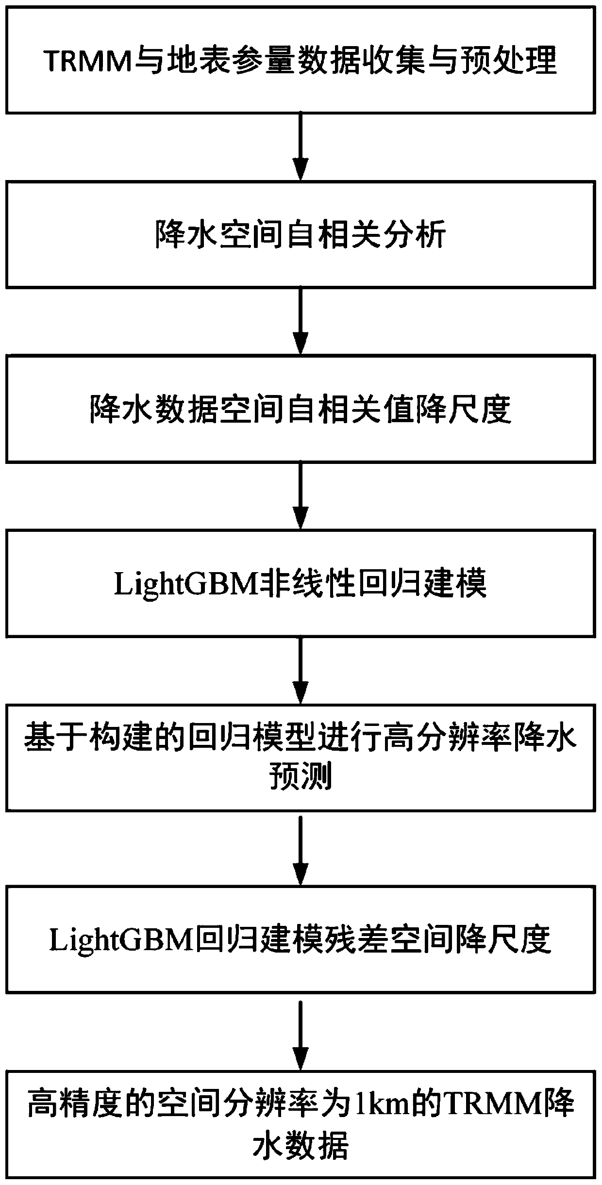
[0088] The embodiment of the present invention provides a machine learning downscaling method for satellite remote sensing precipitation data considering spatial autocorrelation. First, perform spatial autocorrelation analysis on 25km TRMM monthly precipitation data, calculate the spatial autocorrelation value, and use surface-to-point Kerry The gold interpolation method is interpolated to obtain the spatial autocorrelation value of 1km precipitation data; the 1km NDVI, DEM, daytime surf...


PUM


Abstract

The invention provides a spatial autocorrelation machine learning satellite precipitation data downscaling method. The method comprises the steps of acquiring TRMM precipitation data and surface parameter data; preprocessing the earth surface parameter data to obtain DEM data with spatial resolutions of 1km and 25km, daytime earth surface temperature, night earth surface temperature, day and nightearth surface temperature difference and NDVI data; performing spatial autocorrelation analysis on the TRMM precipitation data to obtain an estimated precipitation data spatial autocorrelation valuewith the spatial resolution of 25km; downscaling the spatial autocorrelation value of the precipitation data with the spatial resolution of 25km until the spatial resolution is 1km; establishing a nonlinear regression model; and obtaining rainfall downscaling data with the spatial resolution of 1km based on the nonlinear regression model. The invention further provides a system and a terminal. Thedownscaling result is superior to the downscaling result based on a conventional regression model, and the method has important theoretical and practical significance and popularization and application value.

Description

technical field [0001] The present invention relates to a downscaling method for satellite remote sensing precipitation data, in particular to a downscaling method, system and terminal for machine learning satellite precipitation data considering spatial autocorrelation. Background technique [0002] Precipitation is a key parameter reflecting the state of the surface environment and the global water cycle, an important part of the water cycle and energy exchange in the climate system, and an important indicator of climate change. have a significant impact on life. High temporal and spatial resolution and high precision precipitation data are of great significance for hydrological simulation, urban flood disaster monitoring and water resources management. Satellite precipitation data has gradually become an important data source in hydrological research because of its wide spatial coverage and high temporal and spatial resolution. However, due to the low original resolutio...

Claims


Application Information

Patent Timeline
Patent Type & Authority Applications(China)
IPC IPC(8): G06K9/62G06F17/18G06N20/00
CPCG06F17/18G06N20/00G06F18/213G01W1/10G06F17/17G06T3/4053G06N7/08G01W1/14G06N7/00G06T3/4007
Inventor 许剑辉阮惠华杨骥胡泓达钟凯文周成虎
Owner GUANGZHOU INST OF GEOGRAPHY GUANGDONG ACAD OF SCI
Learn More