Abnormal remote sensing information extraction method and device based on spatial data set analysis
A technology of abnormal information and spatial data, applied in the field of geological exploration, it can solve the problems of difficult remote sensing anomaly extraction, many false anomalies, and untargeted prospecting.
- Summary
- Abstract
- Description
- Claims
- Application Information
AI Technical Summary
Problems solved by technology
Method used
Image
Examples
Embodiment Construction
[0038] The present invention will be described below in conjunction with the accompanying drawings.
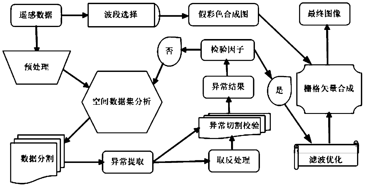
[0039] The invention relates to a method for extracting abnormal remote sensing information based on spatial data set analysis, comprising: a first step of calculating feature vectors and features of acquired remote sensing image data by means of spatial data set analysis according to the characteristics of electronic anomalies and group anomalies value, and segment the data according to the calculated eigenvalues and eigenvectors; in the second step, use the principal component analysis method to extract abnormal information from the segmented data, and use the normal distribution and multiple linear regression methods to respectively extract the abnormal information. In the third step, the data after cutting and verification is combined with the false color image synthesized by the remote sensing image data through band selection, and the grid and vector are superimposed by...
PUM
 Abstract
Description
Claims
Application Information
 - R&D
- Intellectual Property
- Life Sciences
- Materials
- Tech Scout
- Unparalleled Data Quality
- Higher Quality Content
- 60% Fewer Hallucinations
Browse by: Latest US Patents, China's latest patents, Technical Efficacy Thesaurus, Application Domain, Technology Topic, Popular Technical Reports.
© 2025 PatSnap. All rights reserved.Legal|Privacy policy|Modern Slavery Act Transparency Statement|Sitemap|About US| Contact US: help@patsnap.com


