An unmanned vehicle localization method based on multi-sensor data fusion
A data fusion, multi-sensor technology, used in satellite radio beacon positioning systems, instruments, radio wave measurement systems, etc. problems such as poor real-time performance, to achieve the effect of reliable high-precision positioning data
- Summary
- Abstract
- Description
- Claims
- Application Information
AI Technical Summary
Problems solved by technology
Method used
Image
Examples
Embodiment Construction
[0035] The present invention will be further described below in conjunction with the accompanying drawings.
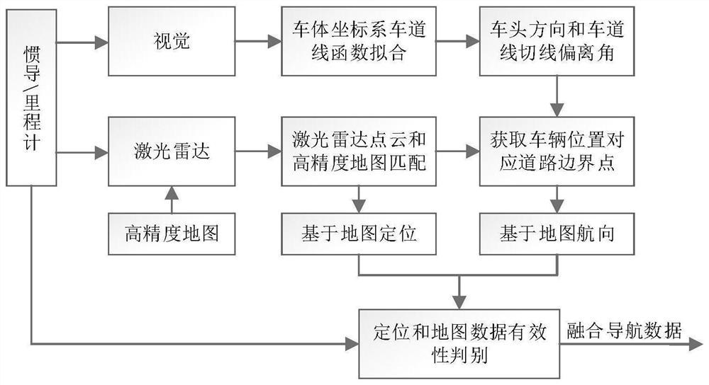
[0036] A method for positioning an unmanned vehicle based on multi-sensor data fusion, comprising the steps of:
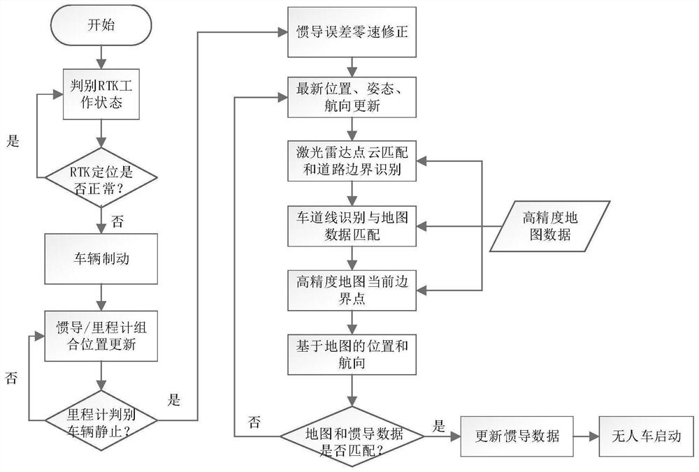
[0037] (1) Through the positioning data output by the satellite navigation receiver, the validity of the data is monitored in real time. When either of the two situations of PDOP>5 and the number of visible stars is less than or equal to 4, it is judged that the availability of satellite positioning data has decreased;
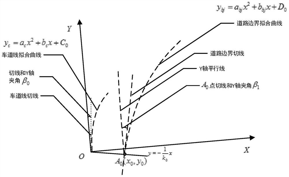
[0038] (2) When the availability of satellite positioning data declines, the unmanned vehicle brakes. During the braking process, the positioning position is updated through the fusion of the odometer and inertial navigation data. After the vehicle is stationary, the pitch angle error of the inertial navigation equipment, Roll angle error, heading angle error, accelerometer and gyroscope constant value error are corrected, the specific proc...
PUM
 Abstract
Description
Claims
Application Information
 - R&D
- Intellectual Property
- Life Sciences
- Materials
- Tech Scout
- Unparalleled Data Quality
- Higher Quality Content
- 60% Fewer Hallucinations
Browse by: Latest US Patents, China's latest patents, Technical Efficacy Thesaurus, Application Domain, Technology Topic, Popular Technical Reports.
© 2025 PatSnap. All rights reserved.Legal|Privacy policy|Modern Slavery Act Transparency Statement|Sitemap|About US| Contact US: help@patsnap.com


